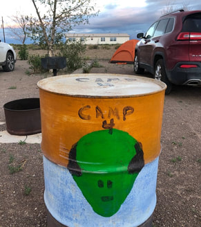
When we planned out a girls trip to Willow Lakes and Challenger Point, I noticed on the map how close the Watchtower is to the trailhead, and I suggested we meet up there the first night. You can read more from our entire trip to Crestone, Colorado, including our summit hike up to Challenger Point in the separate blog post HERE! I was a little nervous that the girls might not have been into the idea of martians and UFOs potentially invading our campsite, but fortunately, everyone was stoked to check it out! We all drove in from different parts of Colorado and met at the campground around 9 p.m. on a Thursday night in July.
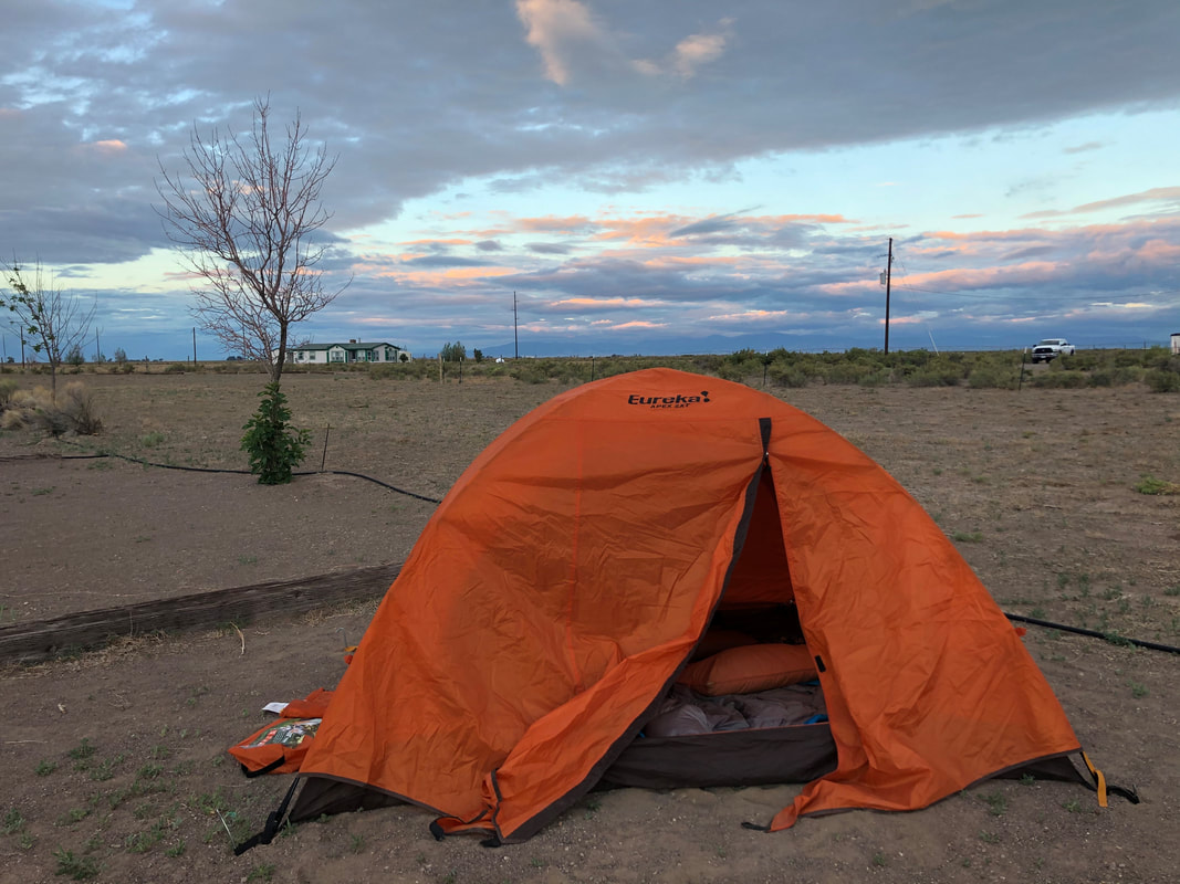
Since it was so early when we got up, we had plenty of time to walk around the Watchtower before anyone else even woke up!
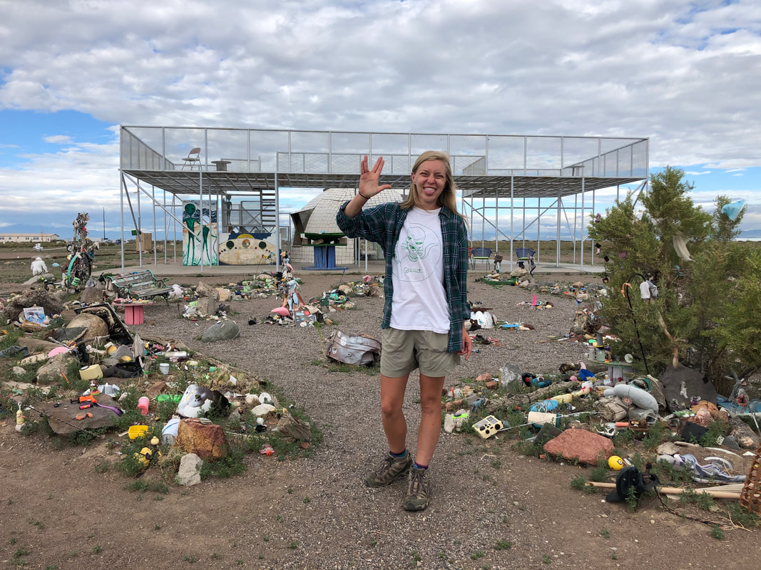
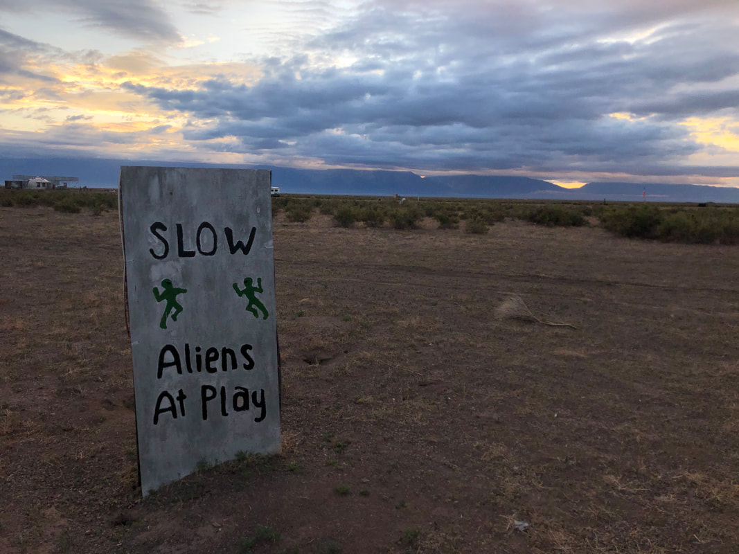
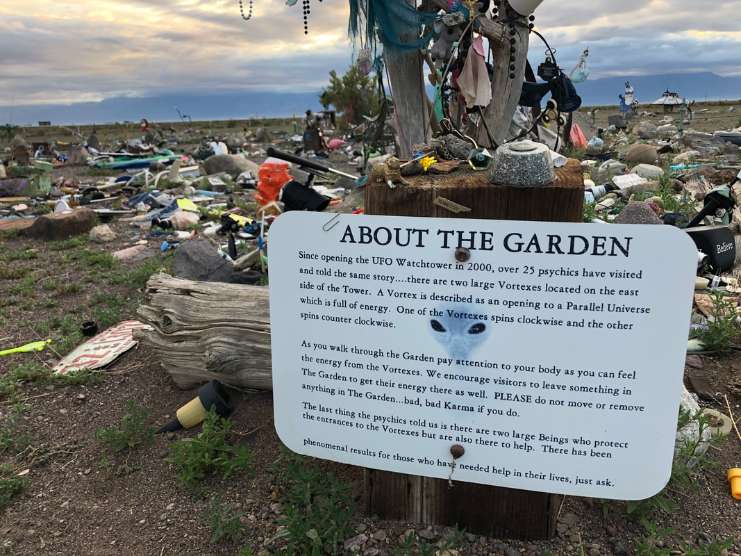
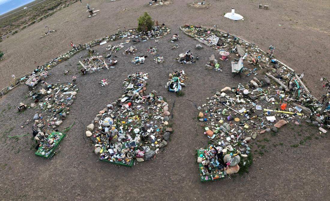
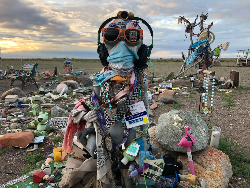
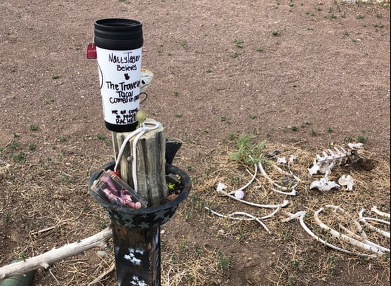
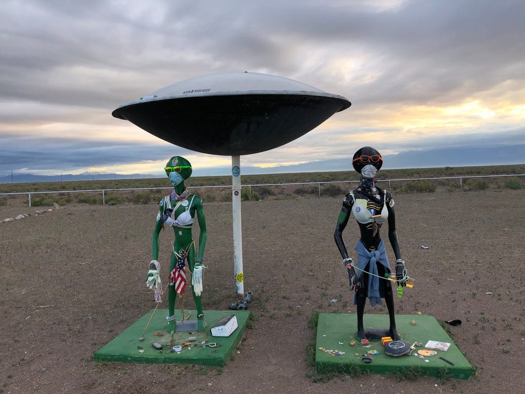
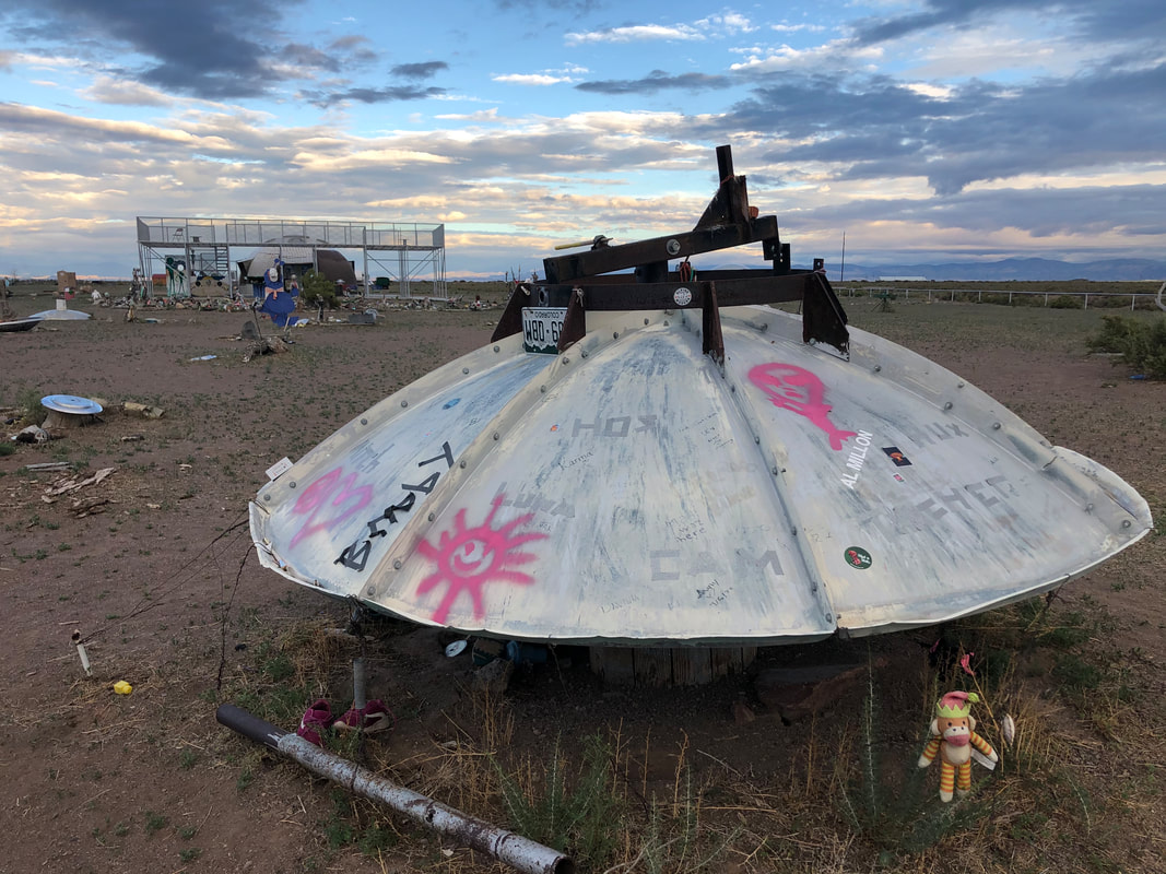
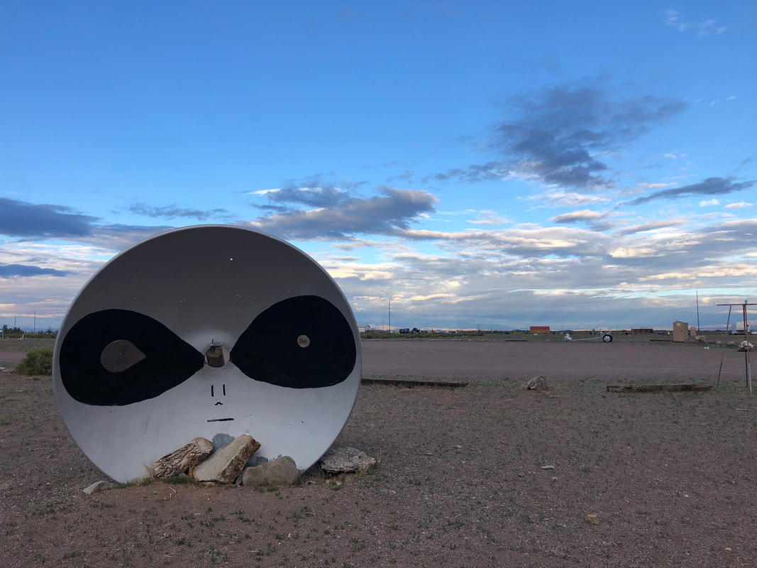
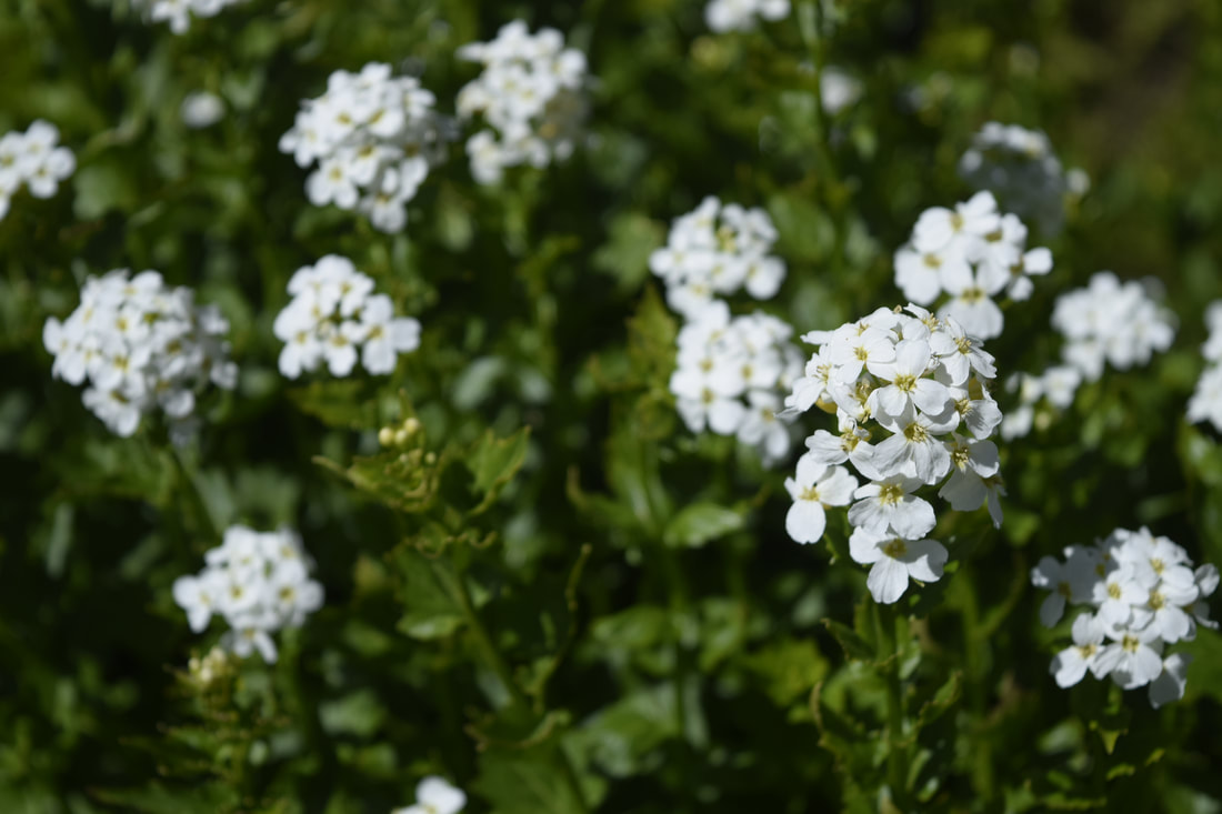
The Watchtower is a site for people to leave offerings to these beings, and to look down on the believed vortexes. 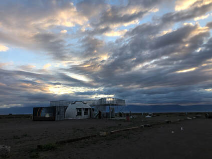 Sunrise at the Watchtower. We first walked up the watchtower to look down onto the garden area. It gave us a great perspective of how many people had come over the years believing in some mystical help from these extraterrestrial beings.
We walked around the entire garden looking closely at but never touching the items. When we had taken in as much as our minds could contemplate, we went back to our campground and packed up.
If you would like to see more from our entire girls weekend trip please enjoy the video below or visit my separate blog post here!
1 Comment
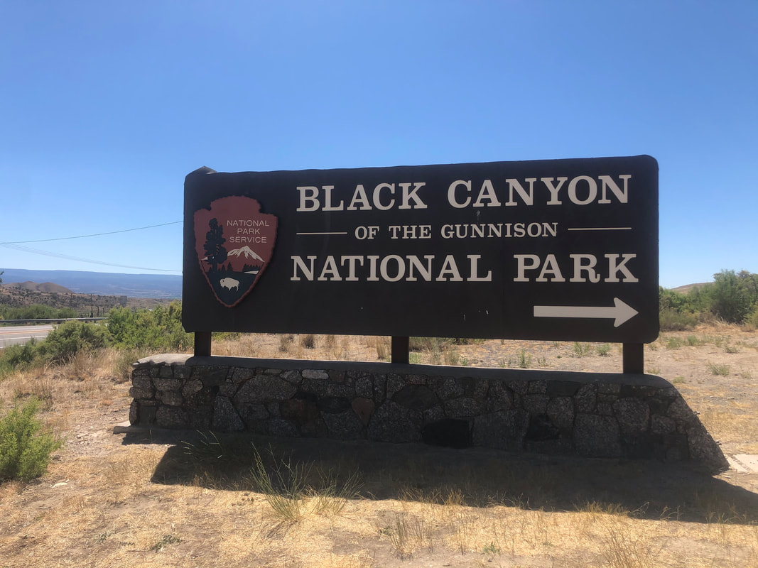
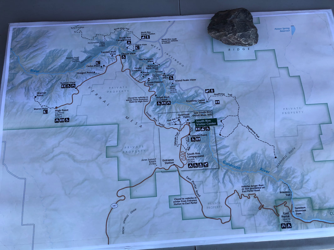
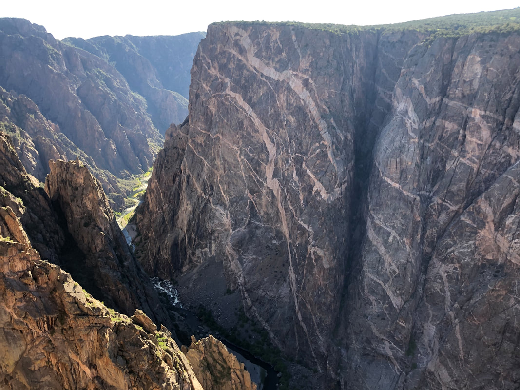
If you would like to read more from our entire week in the San Juan Mountains please check out our separate blog post HERE! Before heading to the park, I did some research on trails down into the canyon. I found that the Tomichi Trail is the shortest way to the Gunnison River via the south rim. Since we were going after work, our time was limited, so the Tomichi Trail seemed like our best option. Once we closed our work laptops, we hopped in the car and headed for the park!
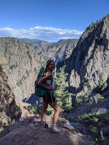
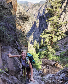
It didn't take us long to discover that we needed a permit to hike all the way to the bottom. We were forced to turn back around, but our dog, Maria, was happy to get off the steep, rocky trail. Sadly, our goal to get to the Gunnison River would have to wait for another trip.
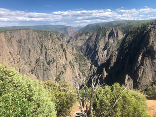
Once we got back in the car, we chose to drive down the South Rim Road and pull off at every viewpoint we saw. If we weren't going to be able to walk to the bottom, we were determined to see it from every available angle!
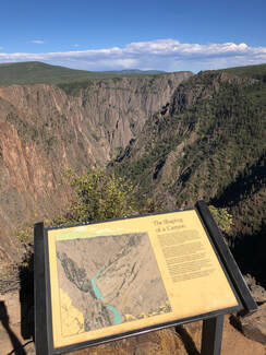
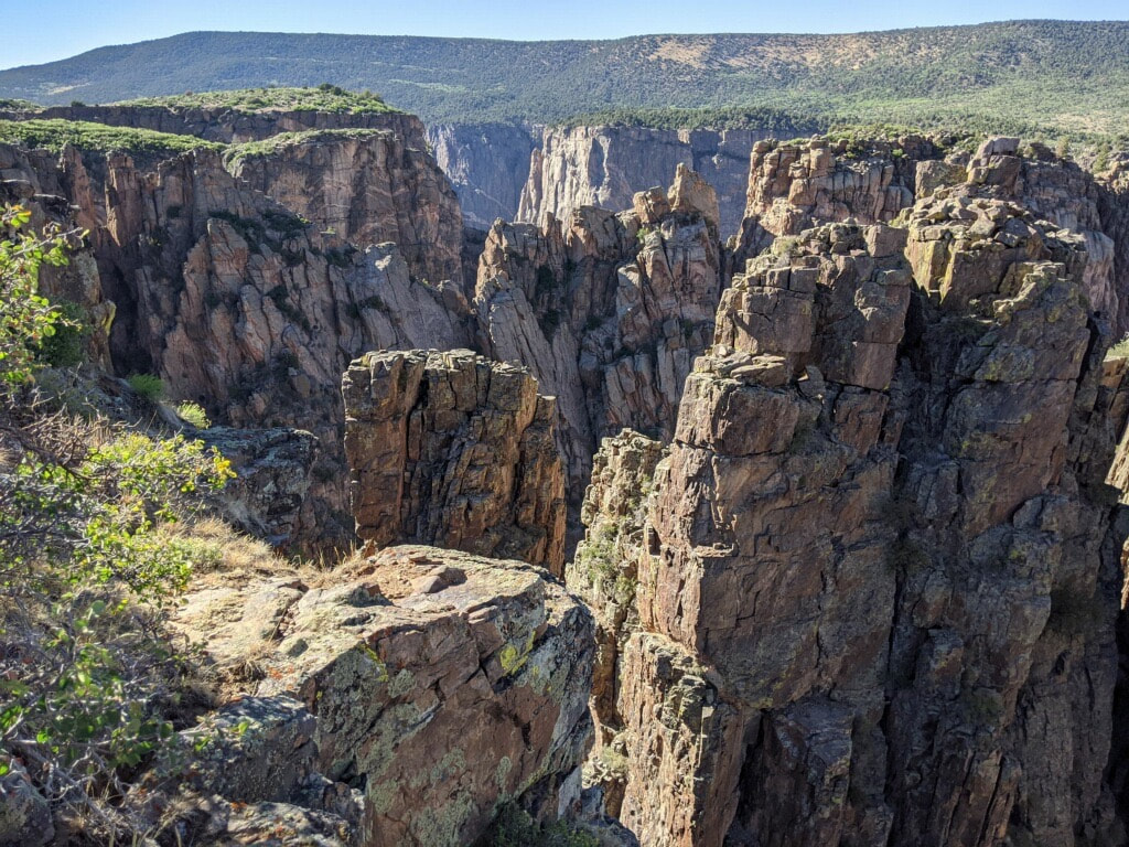
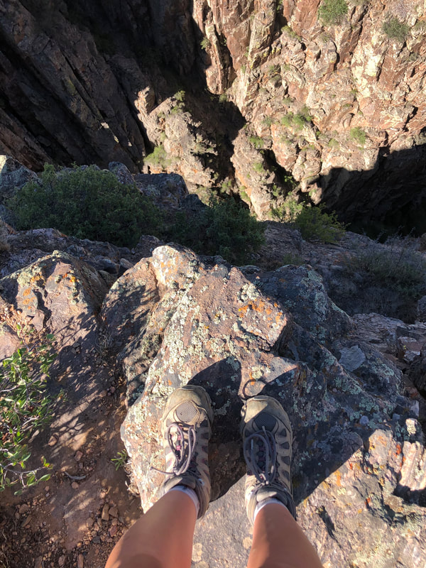
The next few stops were Rock Point, Devils Lookout, and Chasm View. Each stop has its own unique set of short and rocky trails surrounded by scruffy bushes and short, gnarly trees. Our dog, Maria, enjoyed trying to chase ground squirrels and other unseen critters through the brush, and Taylor and I enjoyed seeing the canyon from all different perspectives. Once we’d visited each of these points, we came to the most popular stop on the South Rim Road, The Painted Wall.
The Painted Wall was our last stop for the day, and as we were gazing at the natural wonder, I remembered that the visitors center was offering a guided geology hiking tour the next day, so I decided I had to come back to learn more!
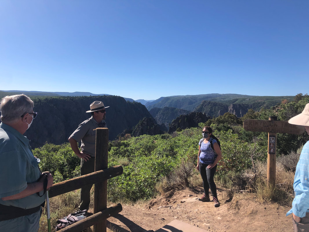
It was the most educational and fun hour I had spent with a group inside a national park. Not only was our guide really entertaining, he was super knowledgeable. I only asked one question that stumped him, and it was about the flowers not the rocks! He spent the hour explaining to us how the canyon was formed, pointing out all the different types of rocks, and describing how the canyon might look millions of years from now. I had never taken one of the National Parks’ offered ranger experiences, but after how much I learned from this one, I will always try to make time for one when I’m inside a park from now on. When the tour ended and we were back at the visitors center, I was sad to be leaving. I still had so many questions and there was so much more to see, but I had to leave and meet back up with John who had to work instead of joining me on the tour. All I could think about while I was leaving was how this is truly a place I cannot wait to come back and explore more. If you want to see more from inside the National Park please watch my video below!
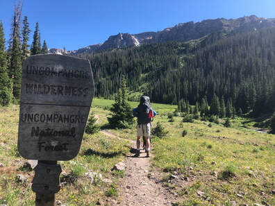
I had never heard of the Uncompahgre National Forest, so I decided to trust him. I chose not to look at pictures of the destinations to keep my excitement up and my expectations down. Topographic maps and trail guides were the only things I looked at for the area we were visiting in Uncompahgre.
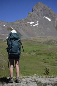
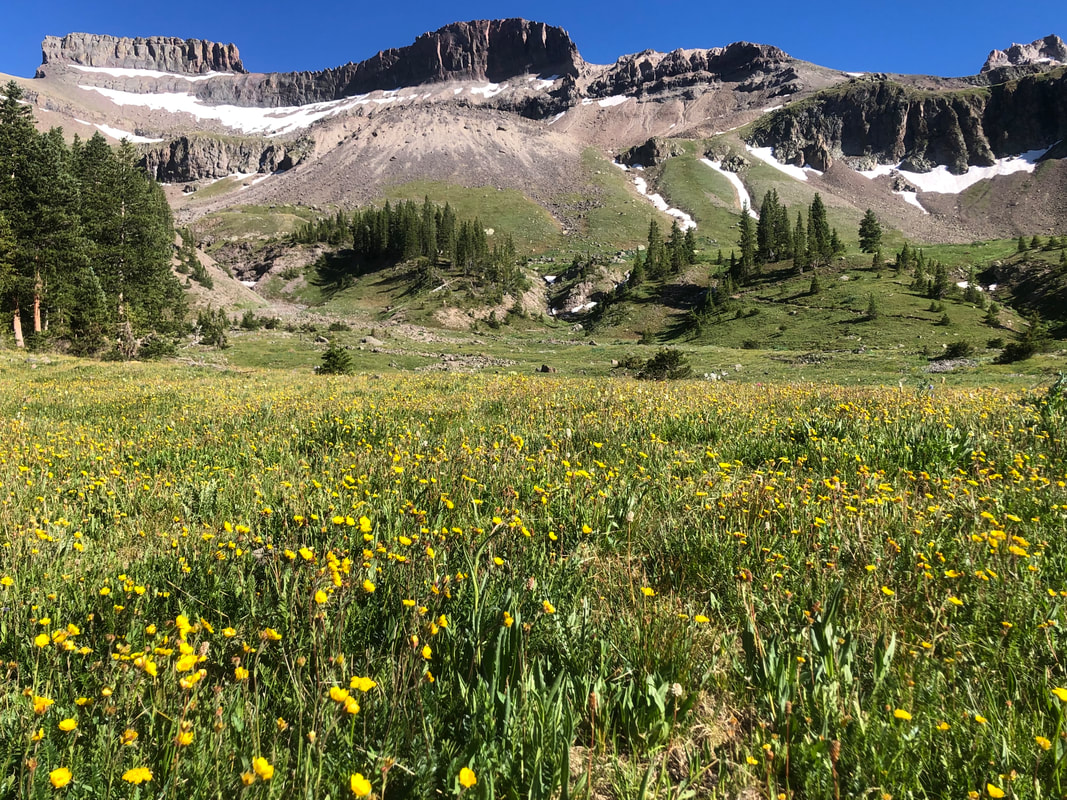
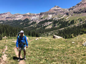
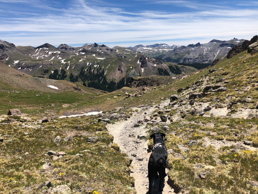
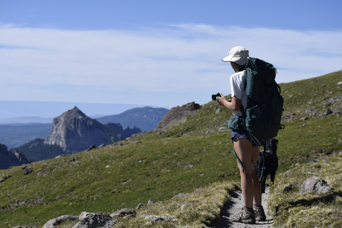
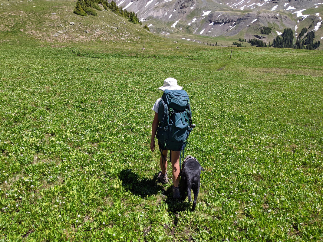
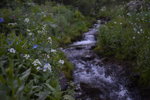
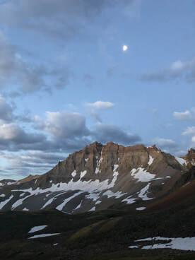
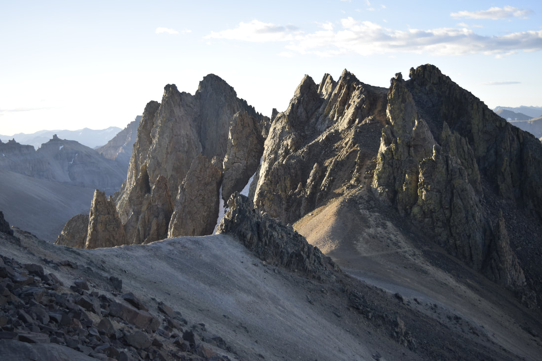
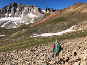
We hit the trail hoping to make it as far as we could before the sun set and before we were exhausted. Earlier that morning, we had climbed the difficult Mount Sneffels, (Read about it here!!) so we were already a bit tired. From where we parked our car, it was about 3 miles to the top of our first mountain pass, and our goal was to reach it. You can see more from our weekend in the Uncompahgre National Forest watch our YouTube video below! We were somewhat dreading the late start, but we quickly found encouragement. Every person we passed on the way up, “oohed”, “ahed”, and raved about what we were heading toward and that kept us pushing further and further up the pass. One couple called it the most beautiful trail they had ever been on and exclaimed that the Wetterhorn Basin surpassed their experience in the Canadian Rockies. The trail starts surrounded by a forest of thick pines and follows the West Fork Cimarron River to its small, creek headwaters. Once we were out of the forest and above the treeline, we entered into one of the most scenic valleys I have ever seen.
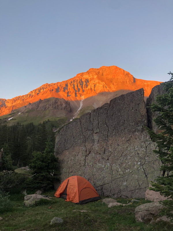
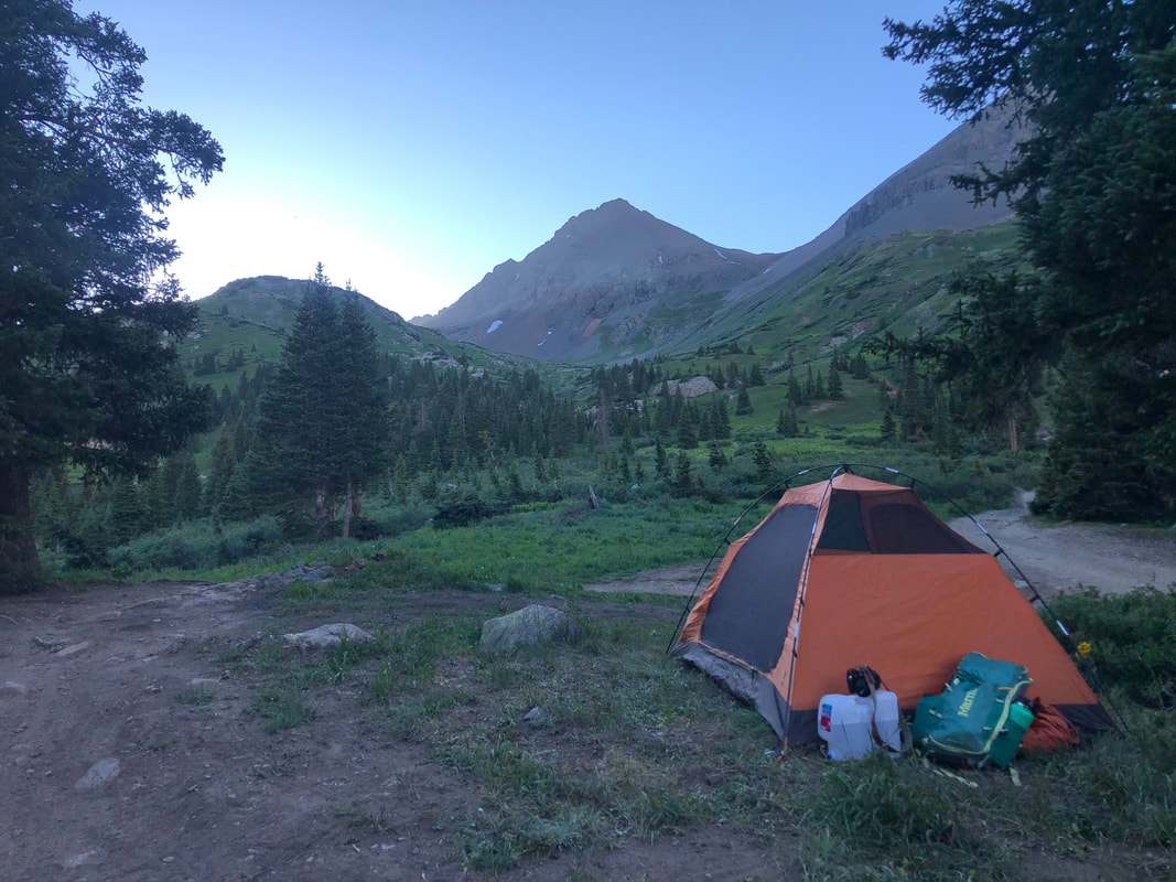
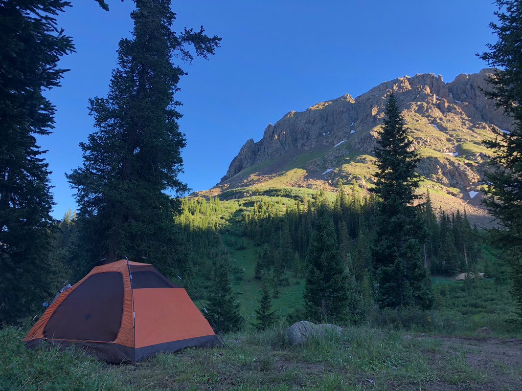
It was around 9 p.m. when the darkness hit our tent, and we decided it was time to go to bed. We put all our food in our LokSak Bear Bags and hung them down wind before crawling into our sleeping bags. 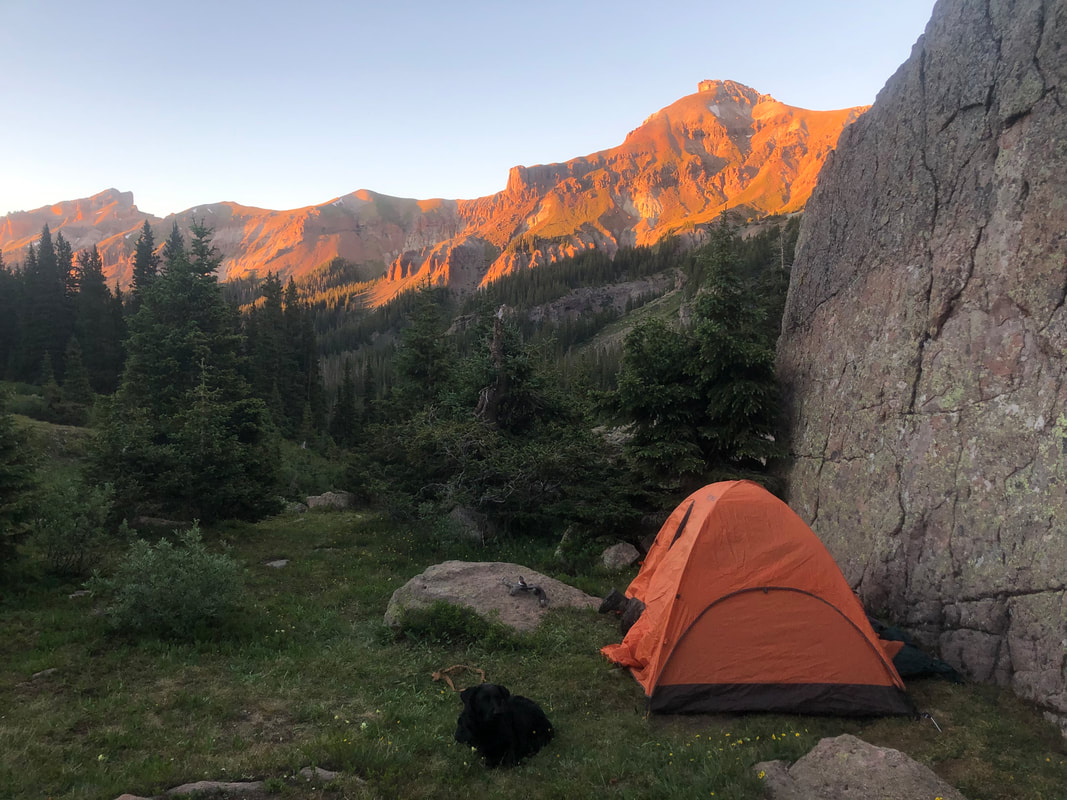 Enjoying the sunset from our campsite. 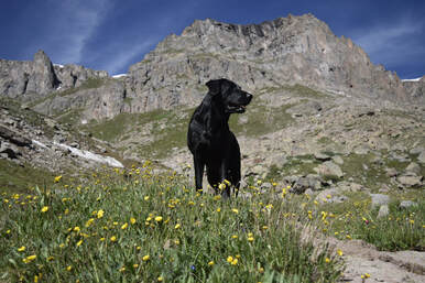 Maria standing on the trail watching us get our bear bag down. Maria standing on the trail watching us get our bear bag down. We managed to sleep in much later than we had anticipated. The day before’s strenuous hikes really wore us out, and we stayed in our tent until almost 9:30 a.m. We enjoyed our morning, took our time getting up, and decided to explore around camp to let our dog, Maria, rest her paws longer. 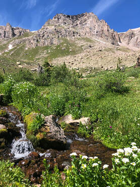 The waterfall where we filled our water filters and brushed our teeth! The waterfall where we filled our water filters and brushed our teeth! We filtered some creek water with our LifeStraw Water Filtration System from nearby and boiled it single propane burner to cook another Mountain House Meal. We also filled up our water bottles for the day while we planned out our hiking path. While eating our Southwestern Breakfast Scramble, we looked over the map and decided climbing the nearby mountains might be a little more difficult than we initially thought. With our packs and a pretty sore pup, climbing over rock scrambles and gaining thousands of feet of elevation didn’t sound like what we wanted.
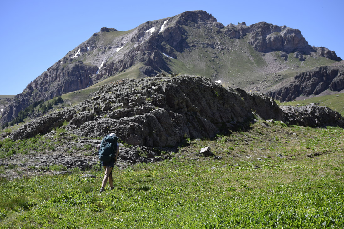
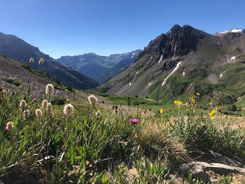
We knew we were hiking in the hottest part of the day, but there would be plenty of water for our dog, and we thought that we would eventually hike down into the tree line on the other side of the pass. What we really didn't know, though, was just how absolutely spectacular Wetterhorn Basin and the trail leading to it would be. 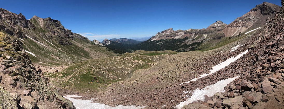 Making it over West Fork Pass and looking down toward our campsite.
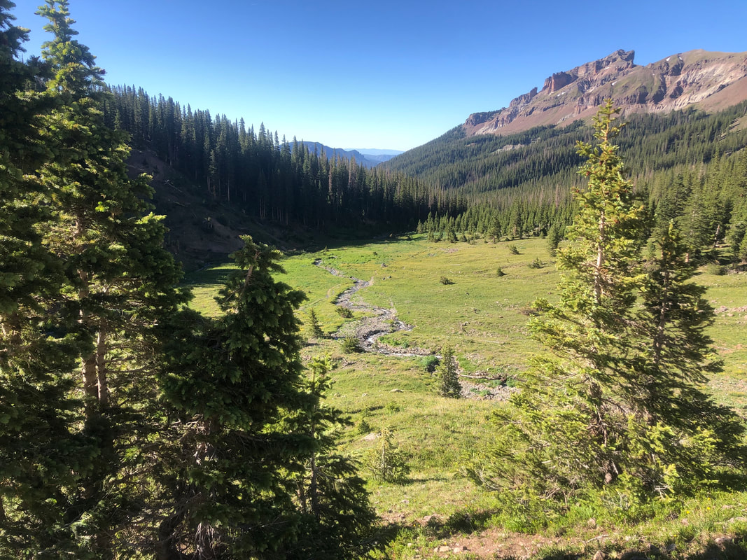
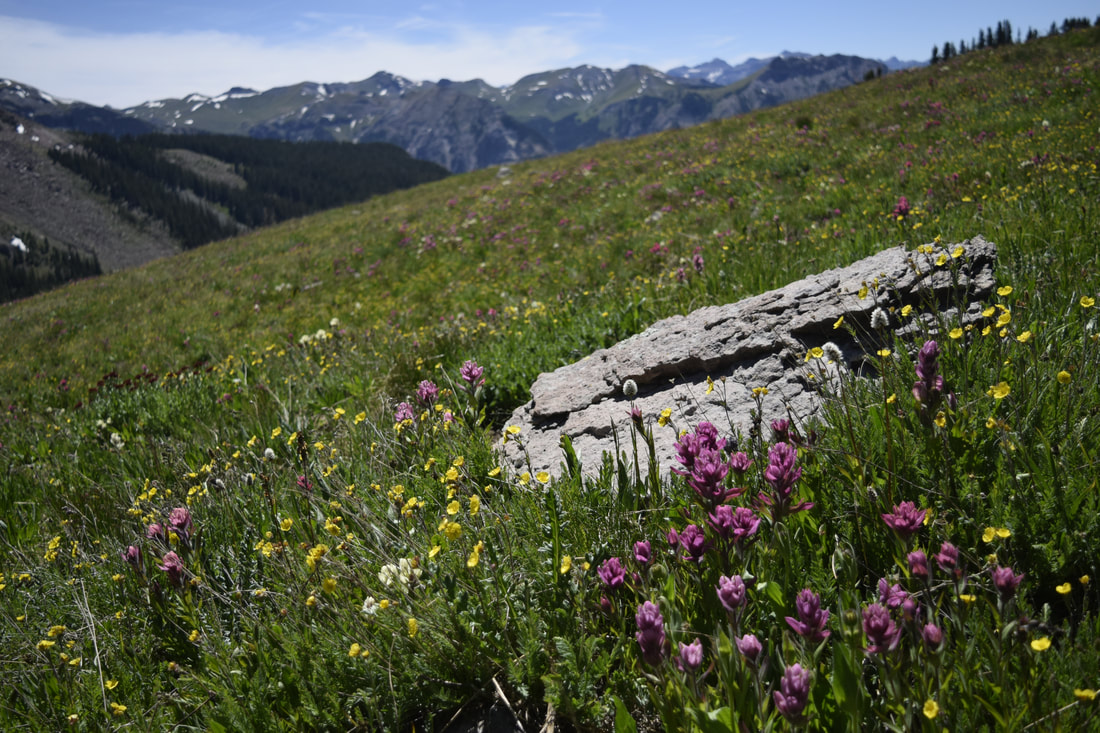
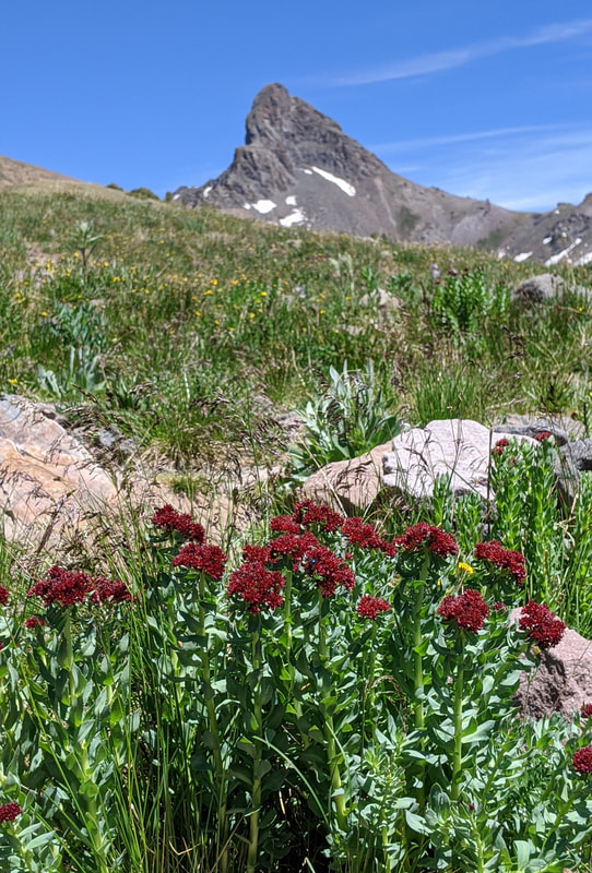
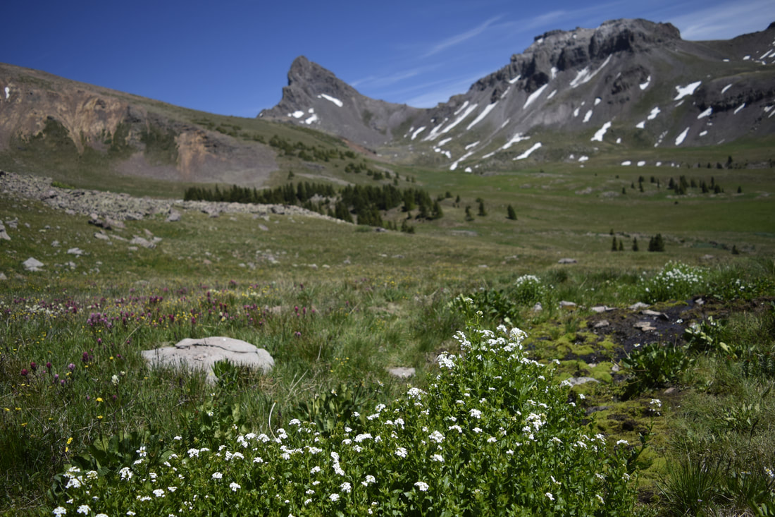
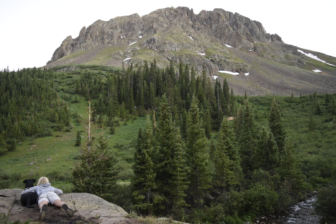
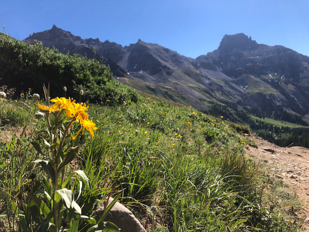
We were blown away by the scenery and the persistent wind on this side of the mountain pass. We spent all afternoon wandering down into Wetterhorn Basin looking at all the flowers, trekking through the water, and trying to take in all the wonders we had found.
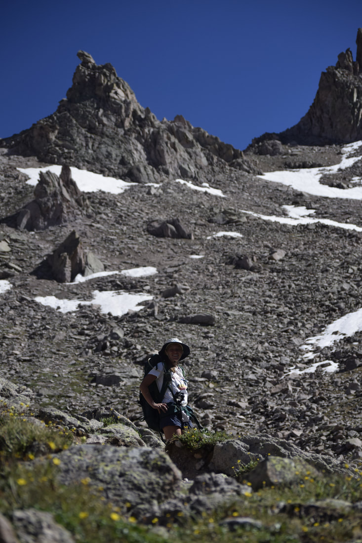
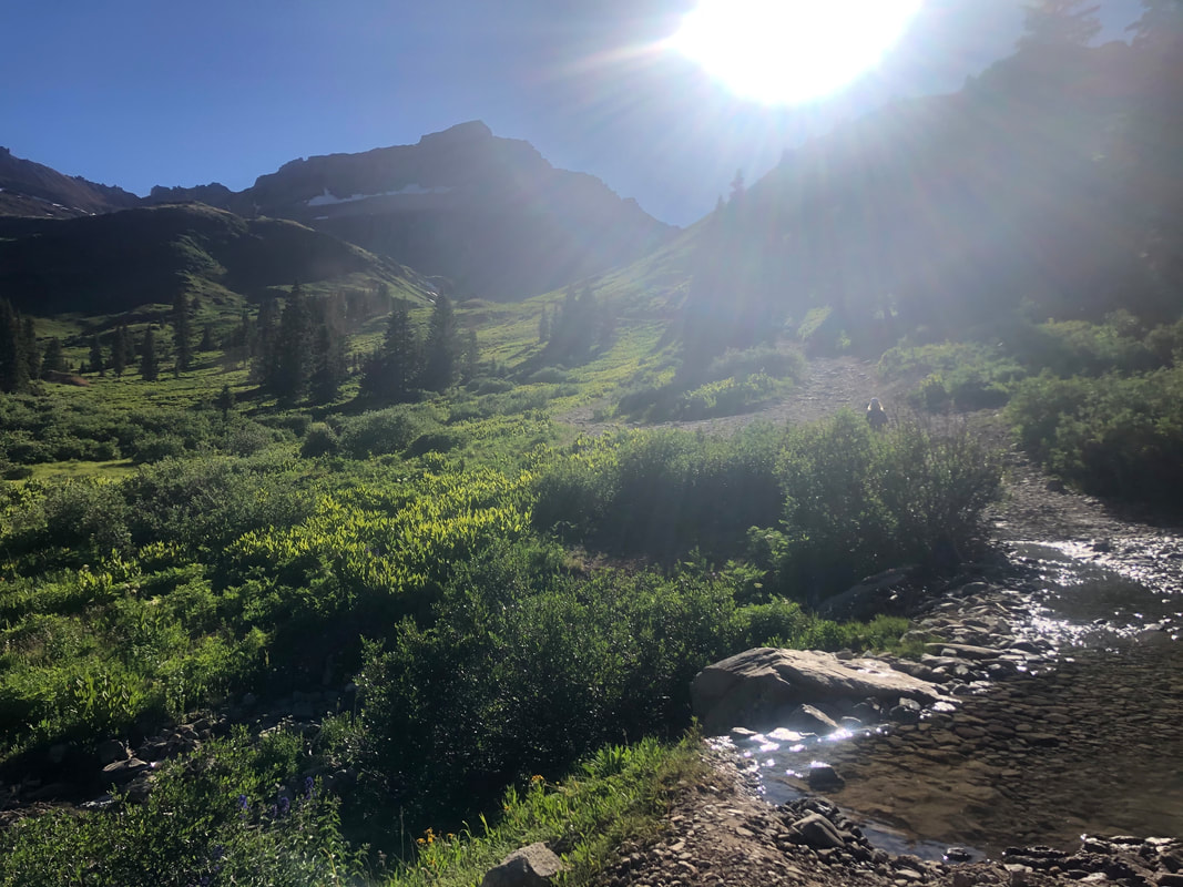
Eventually, after hours in the sun, we decided to make our way back up toward the pass and our campsite. It took us roughly an hour or so to get from our overlook of Wetterhorn Creek, over the pass, and down to our spot.
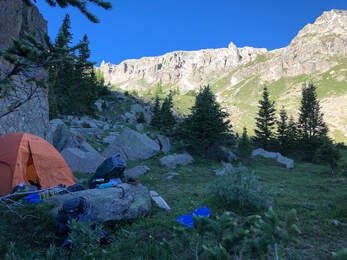 Another view of our campsite. Another view of our campsite. We caught another stunning sunset from our campsite and made a nice picnic of cheese and crackers while we watched it. We put away our food bags again before crawling into the tent happy as a clam and tired as a dog (maybe not as tired as our dog). The next morning, we were awake fairly as the sun hit our tent. The night before’s early bedtime had let us both rest well, so we decided to use our energy to hike out and head home. Before we knew it, we were packing up all of our gear and breaking down the tent. We were sad to be leaving such a serene place but happy to be home after three weeks away.
It was a bittersweet feeling to be leaving the wilderness, but we had seen and done so much in the previous few days that we were perfectly content heading home. We both agreed this had been our favorite place in Colorado thus far. The wildflowers framed with the magnificent mountain backdrops made the picture perfect place even more beautiful. 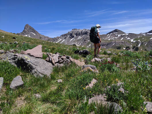
After two years of waiting and developing my backpacking and mountaineering skills, John decided that he would plan an entire week long adventure for us through the San Juan Mountain Range in southern Colorado, including a stop at Mount Sneffels! You can read about our entire adventurous week in the Sneffels and Uncompahgre Wildernesses in this separate blog post here!
We called it a night as soon as the sunset so that we could get an early start in the morning. We hoped we could get on the trail and get to the summit of Mount Sneffels by sunrise, so we set our alarms for 2 a.m. and said goodnight before 9 p.m. Surprisingly, the early morning wake up call wasn't as difficult as we thought. By 2:30 we were up and moving around our tent. We put on warm clothes, laced up our shoes, and managed to be on the trail at precisely 3:26 a.m.
It took us exactly two hours to reach the trailhead. You can see, in the video below, that it was exactly 5:26 a.m when we arrived at the trailhead and signed our names in the log book!
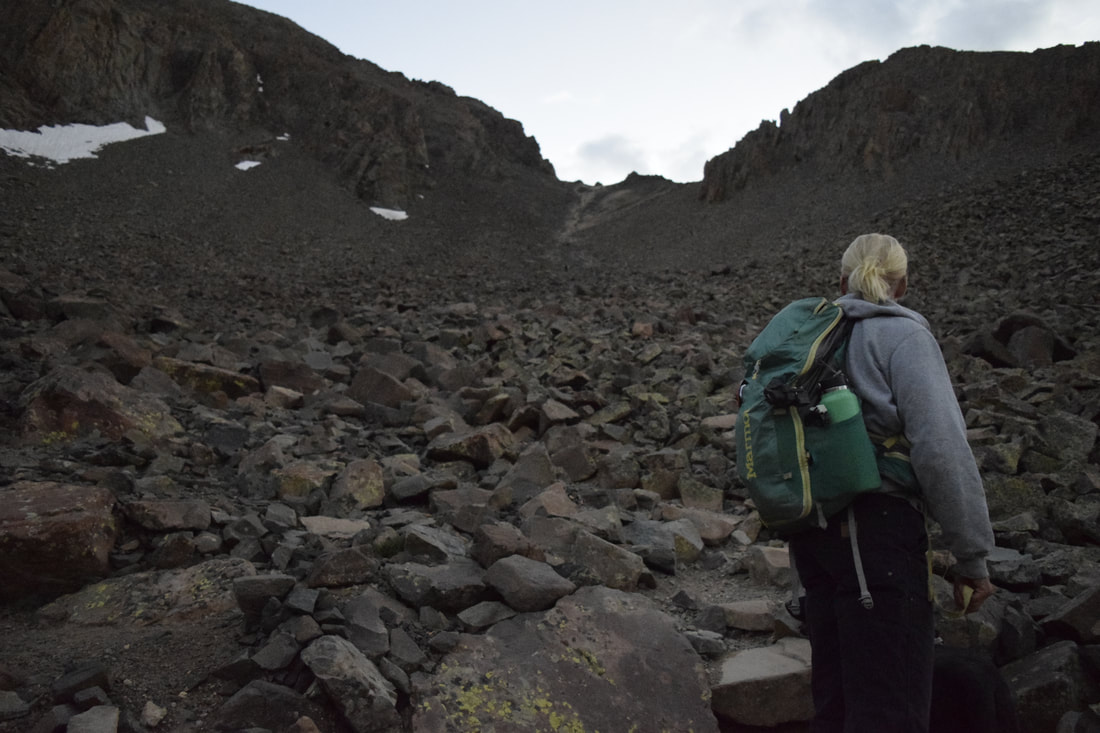
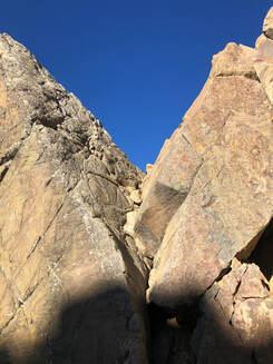
We had our dog, Maria, with us, and even though there were warnings about potential risks for dogs, we thought she could handle it because of her previous mountain climbing experiences. Once the trail turned into rocks though, we got a bit nervous about how she would handle the steep grade. The trail quickly went from a gradual incline to a nearly straight up rock climb in less than a mile. For a while, we were the only people on the trail, so we could stop and take breaks without anyone passing by, but eventually, another group of two and their dogs passed us. Not long after they did, we started to have to climb the rocks. 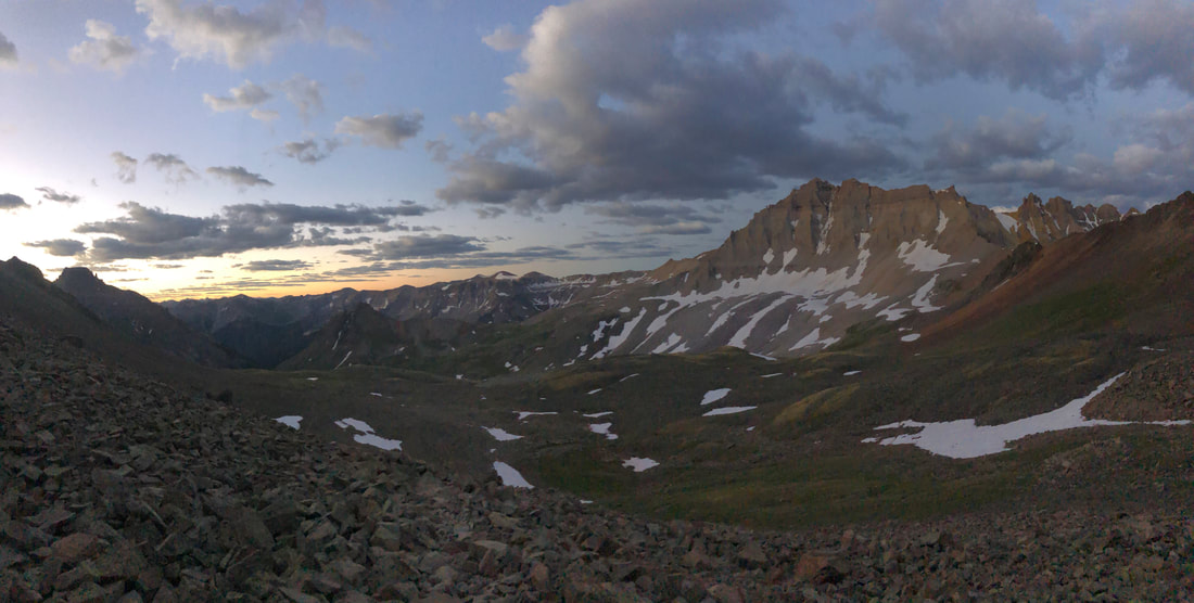 Looking down on the trail we had come up in the dark. Still a mile or two from the summit. This part got a little scary not only because we were grabbing at rocks on our hands and knees on a steep mountain, but mainly because the group in front of us knocked a decently sized rock loose and sent it whirling straight toward us. If they hadn’t yelled a warning as loud as they did and given me the two and a half seconds to move out of the way, I would have been knocked off the mountain side.
John graciously offered to stop where we were, hold on to the dog, and let me summit first. According to our map we only had about .2 miles left, so we figured we would just trade off. We were lucky to have stopped when we did, because the last ascent was the hardest to climb.
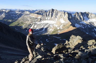
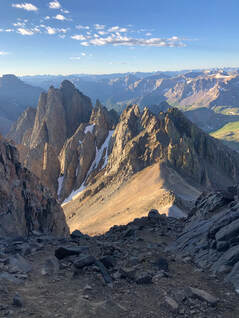
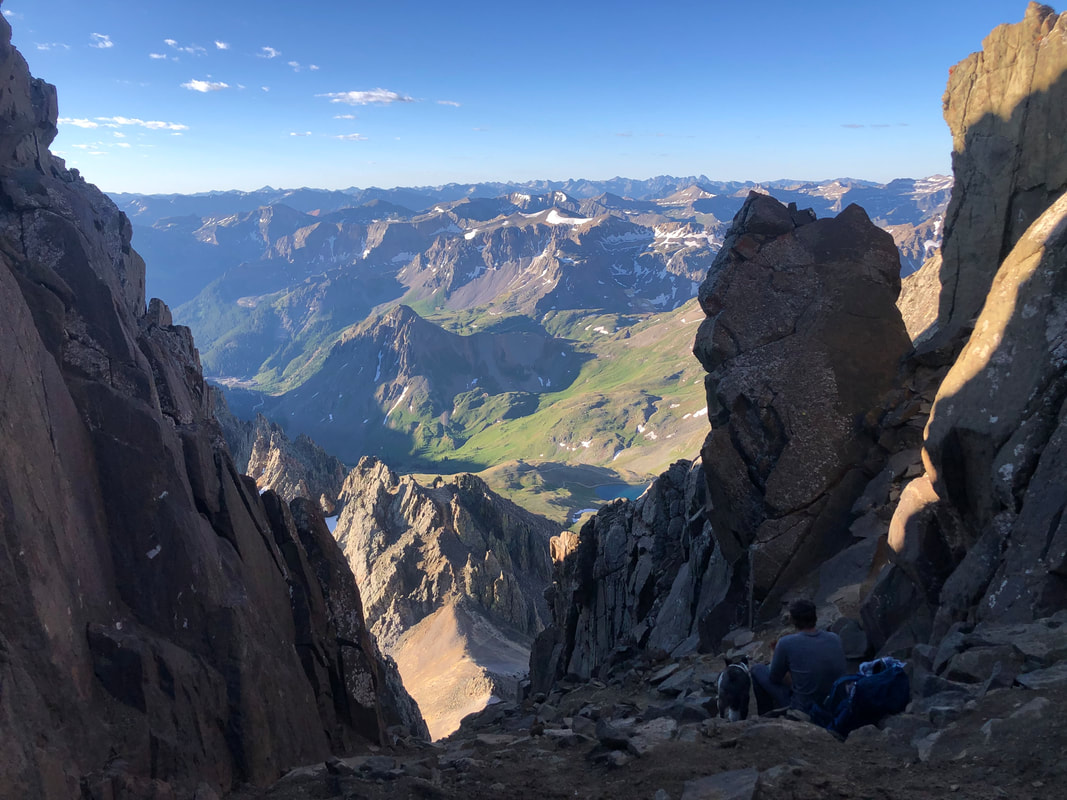
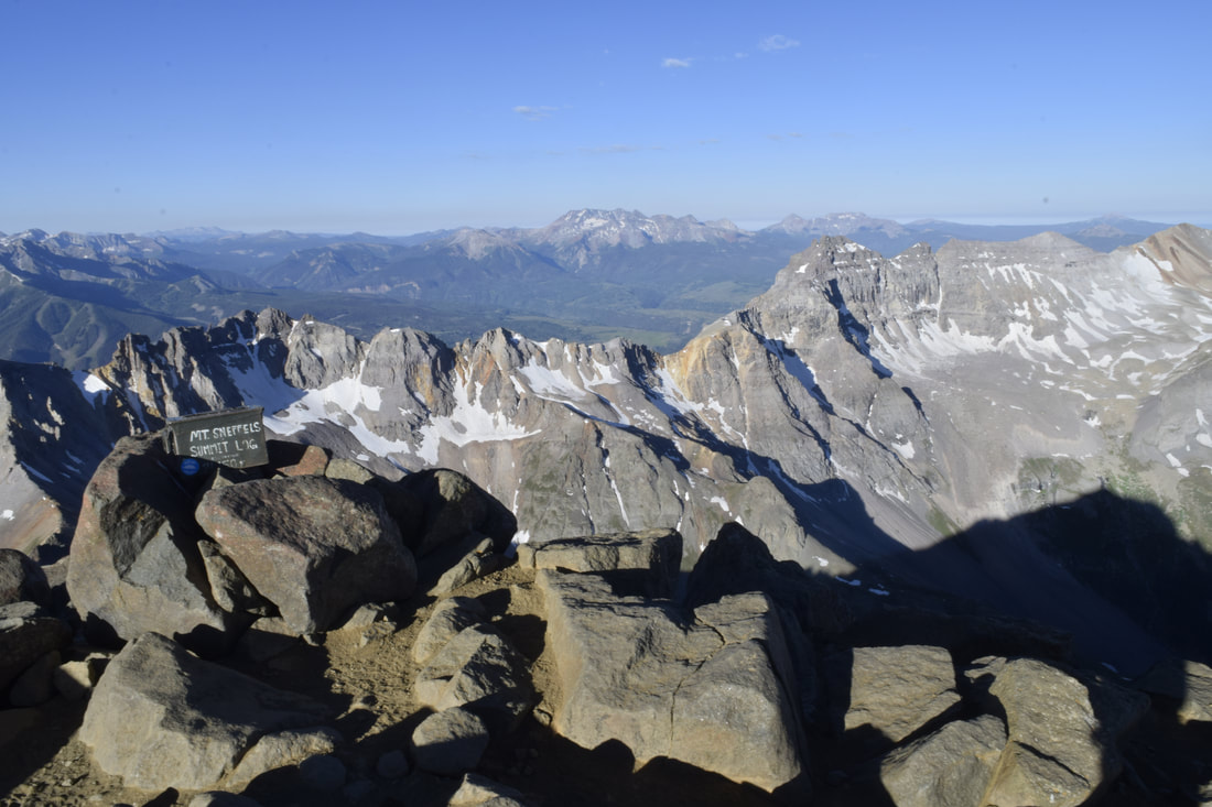
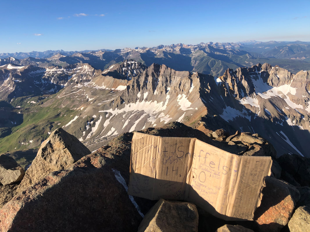
The last few minutes of the climb were the coolest of all. I was able to turn around and look back on the entire climb I had just made, and it felt so rewarding to see how far I had come especially with the incredible mountain views surrounding me. It didn’t take long until I had pulled myself up to the tippy top of the mountain. 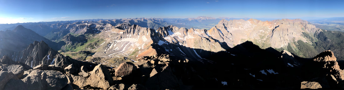 The view from the summit of Mount Sneffels! 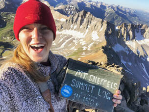 Summit selfie on Mount Sneffels. Summit selfie on Mount Sneffels. Standing 14,150 feet above sea level and looking down on the entire San Juan Mountain Range all by myself was a feeling I will never be able to explain. The hard hike, the early morning, the training hikes, and other 14ers led me to this point. I felt so strong and so proud of myself. I didn't stay up at the top long, because it was super windy and John still wanted to make his way up. I signed the summit log book, snapped my pictures, took some videos, and started my descent.
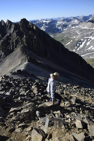 Making our way down. Making our way down. The walk down was much scarier than the climb up simply because of the downward view, but it took only about half the time to get down. It took me and John each almost an hour to get from where our dog was, up to the summit, and back down. While John went up, I hung out and took in all the views and took some more pictures. Eventually, we made our way back down the trail. It was around 8 a.m. and the trail was starting to get busy. Where we had been the only ones on the trail in the morning, there were now about 10-15 groups of people. It made the climb down a little more treacherous since we didn’t want to send any boulders flying down toward them.
If you want to see more from our entire week-long trip in Southern Colorado check out our YouTube video below! |
Talkin' 'bout Tacos:
I'm Taylor, aka Tacos! I am sharing my journeys and experiences from across the world, hoping to inspire travel and adventure in all who read! Archives
July 2024
|