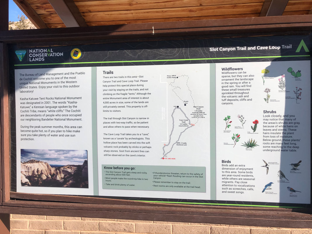
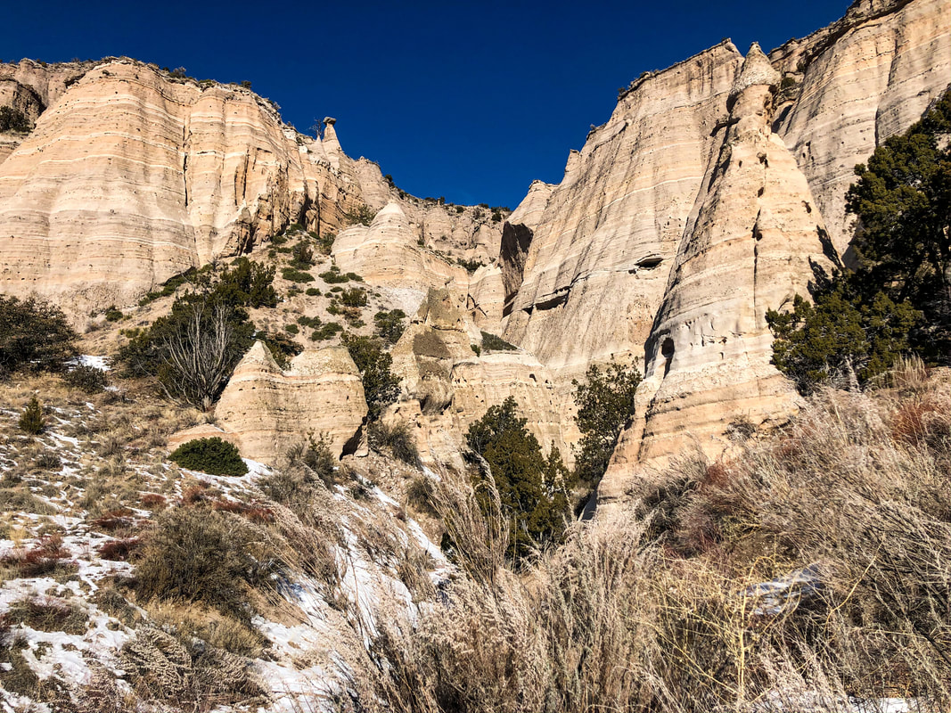
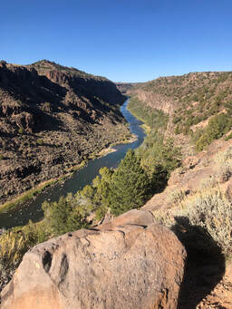
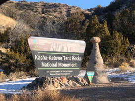
 The entrance to Kasha-Katuwe Tent Rocks National Monument. The entrance to Kasha-Katuwe Tent Rocks National Monument. As part of our Martin Luther King Jr. extended weekend road trip across northern New Mexico, my friend Natalie and I woke up early Sunday morning to explore The Kasha-Katuwe Tent Rocks National Monument. We passed through the entrance toll booth with my national parks pass around 9 a.m. without waiting in line to our surprise. We were admitted and proceeded down the road to the parking lot. After a quick bite of breakfast from the back of my car at the trailhead, we were on the path into the canyon.
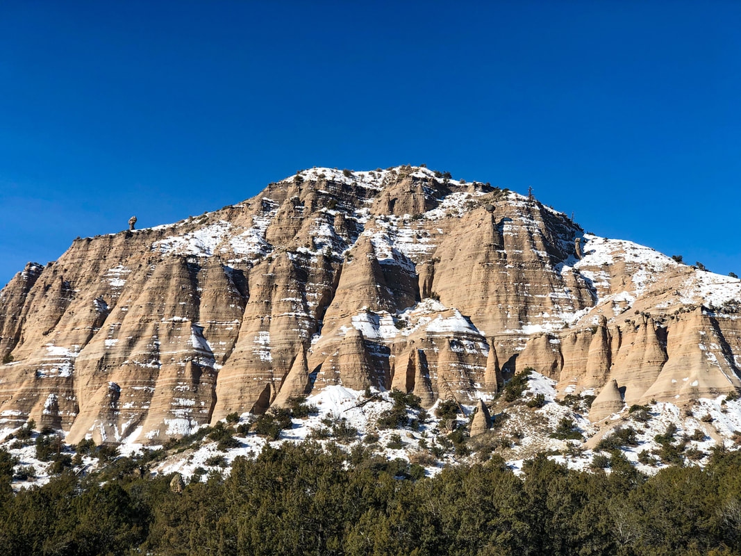
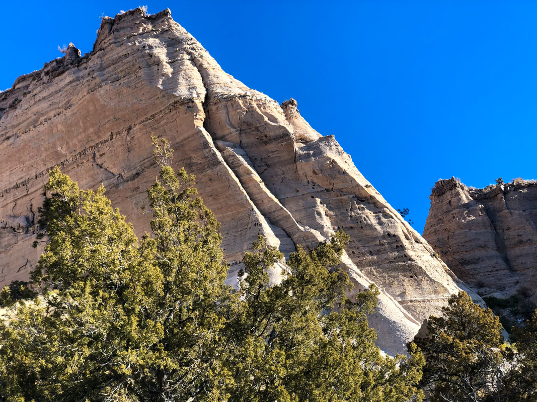
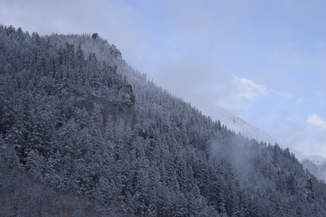
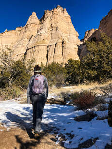 Our view from the beginning of the trail. Our view from the beginning of the trail. John and I had tried to visit the tent rocks during our trip to Albuquerque for the International Hot Air Balloon Festival, but we were deterred by a 45 minute wait at the entrance gate. Natalie and I did very little research into what this area would be like, and we were blown away by what we saw. The Tent Rocks were by far the most unique rock formations we saw all weekend for many reasons. To start, they are volcanic remnants layered by lava flows from nearby volcanic explosions. We let our imaginations wander around the thought of what it would have been like to see the landscape burning, bubbling, and forming.
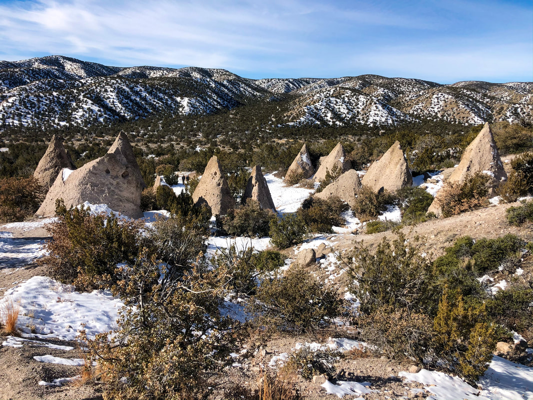
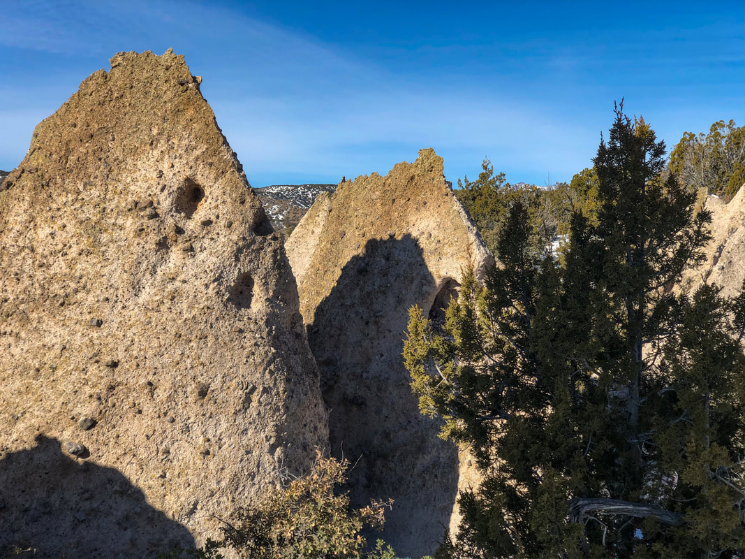
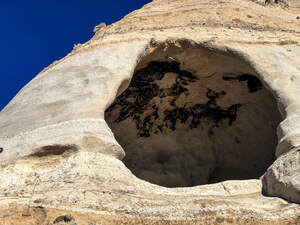 The manmade cave carved over 5,000 years ago. The manmade cave carved over 5,000 years ago. We then started to think more about the years of erosion that created the landscape we stood among. It is a landscape ripped and worn by wind and water. We wandered through the resulting space between each tent rock. The trail then took us past a cave believed to have been carved out by human hands thousands of years before, and now, we were more curious than ever about the place we were exploring. We were only able to take the Cave Loop trail, because the Slot Canyon trail had been closed due to snowy and icy conditions. Even though we didn't get to see the entire preservation, what we saw was more than enough to stoke our curiosity.
 The sunrising over the Tent Rocks. The sunrising over the Tent Rocks. We spent about two hours walking, stopping, taking pictures, and questioning the history of this mesmerizing area before we completed the loop and were back at the car. It was one of the coolest ways to start the day, and we were so glad we had woken up early enough to avoid the crowds and see the sunrise. The early morning start left us with the perfect amount of time to explore our next stop: Meow Wolf! One thing that never ceased to amaze us during our four days in New Mexico were the landscapes. Everywhere we went was uniquely different than the last. We went from mountains to valleys to near desert-like terrains within a couple hundred miles, and of all that diversity, the Tent Rocks was the most unique place we saw. 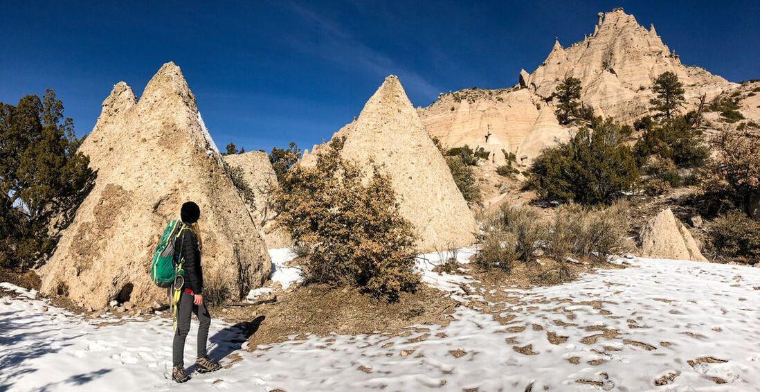
0 Comments
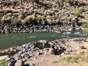
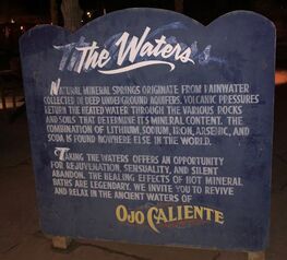 Ojo Caliente's healing waters. Ojo Caliente's healing waters. After a long day of exploring Taos and its Ski Valley area, a late night soak at Ojo Caliente Spa and Hot Spring was the perfect nightcap for the first full day of our extended weekend road trip. We had spent the morning snowshoeing, the afternoon visiting temples, and the evening enjoying drinks, food, and live music. You can read more about our entire trip in my New Mexico Road Trip post! 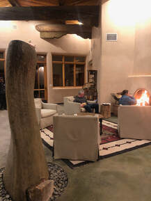 The lobby and front desk area of Ojo Caliente Spa and Hot Springs. The lobby and front desk area of Ojo Caliente Spa and Hot Springs. We arrived at the front desk of Ojo Caliente around 7:30 p.m., paid our entrance fees totaling $40.78, listened to the safety run down, and were given directions to everything. We had until 10 p.m. to enjoy the facilities, and we intended to take full advantage of our time. We found the women’s locker room to change and lock up our items. In just a few short minutes we would be briskly walking across the stone-floored patio toward our first pool.  The Iron Pool's mineral benefits. The Iron Pool's mineral benefits. The Iron Pool was the closest pool to our locker room, and we thought it would have some of the best views because of its awesome rock feature. It turns out that the pool has some of the best mineral features too. A plaque outside the pool tells of an Indian legend claiming that the rock guards the place where ancient people of the mesa collected food and water during a famine and explains how the iron in the water is beneficial to the blood, immune system, and skin. 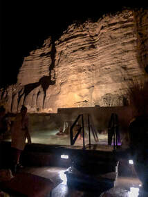 View of the Iron Pool and nearby Terrace Pool. View of the Iron Pool and nearby Terrace Pool. We sat in the water for a nice, long time taking in the big, red rock standing guard with shimmering stars behind it. Eventually, we decided it was time to move on to the next pool and see if we could find something hotter. We walked up a stairwell next to the pool we were leaving and discovered the hottest pool in the spa, The New Terrace Pool. At night, its awning covers the stars, and we debated how long we wanted to stay. We knew we wouldn't find heat like this again, but we wanted a better view. 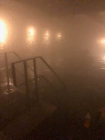 The inside of the Soda Pool. The inside of the Soda Pool. Our search took us to the indoor Soda Pool where we didn't even get in, because the pool that was supposed to be a silent reflection pool was loud and overcrowded instead. We found The Lithia and Cliffside Pool next and discovered that both are pumped full of waters formulated to combat depression and aid in digestion. Both pools were just warm, so we didn't stay long in either. 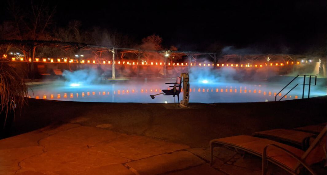 One of the outdoor pools. 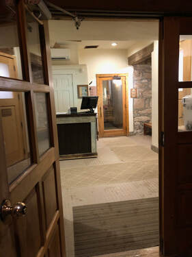 The Ojo Caliente Spa steam rooms. The Ojo Caliente Spa steam rooms. Finally, we hustled across the chilly patio, jumped into the Arsenic Spring, and settled in for a long soak. This pool had all the qualities we had been searching for: it was hot, it wasn’t crowded, and it featured a wide open view of the sky and the stars above. We enjoyed the company of an older couple and a few more visitors who were in and out during our invigorating time in the spring. We eventually learned that we only had about 45 minutes left in our spa access and decided to finish the night with a sauna session.
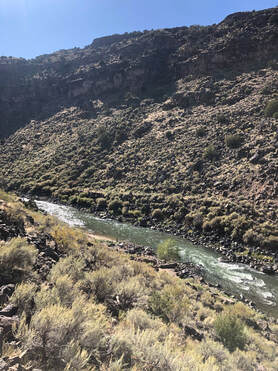
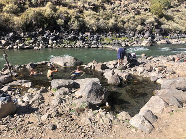
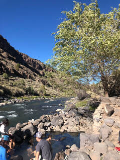
 Manby Hot Spring is a relaxing oasis on the side of the Rio Grande River, just outside of Taos, New Mexico. On our way home from the Albuquerque International Hot Air Balloon Festival we took the rutted and rough roads down to enjoy a nice long soak. Three pools with varying temperatures, good people, and mysterious structural remains made this stop and short hike more enjoyable than Taylor and I could have expected.
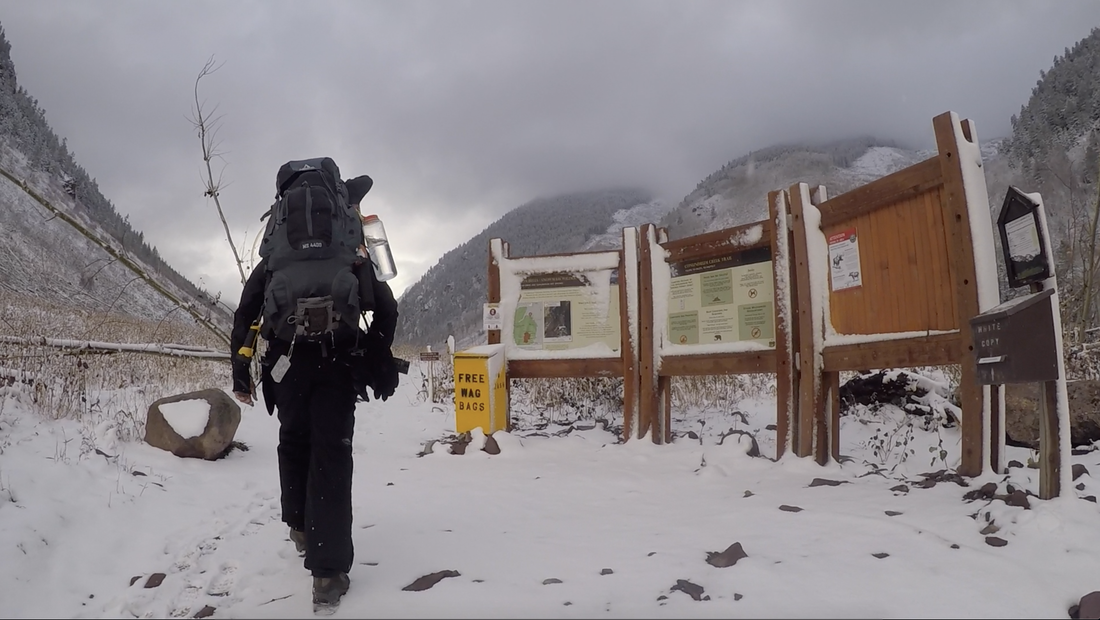
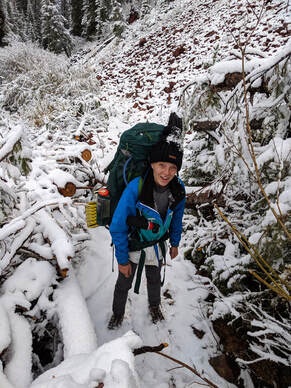
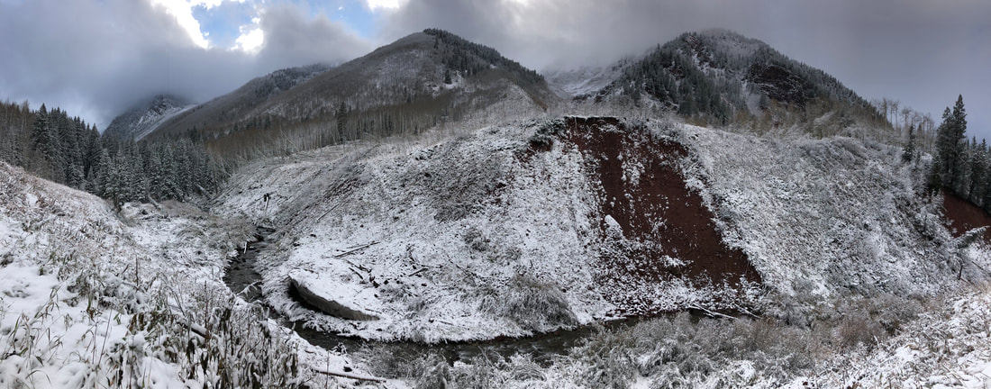
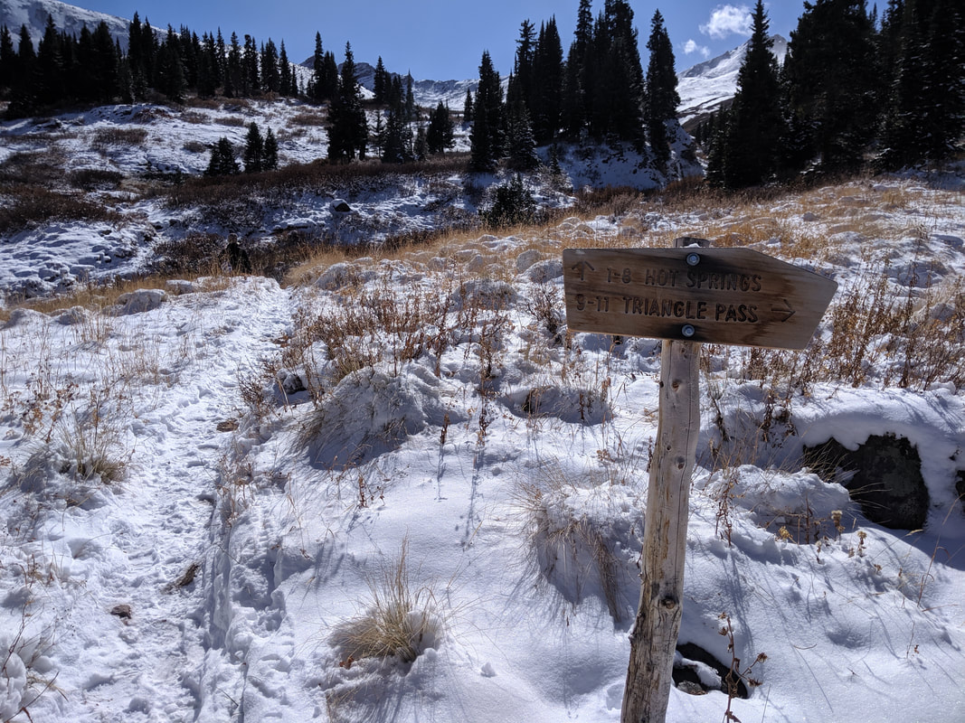
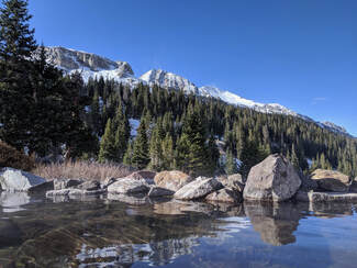
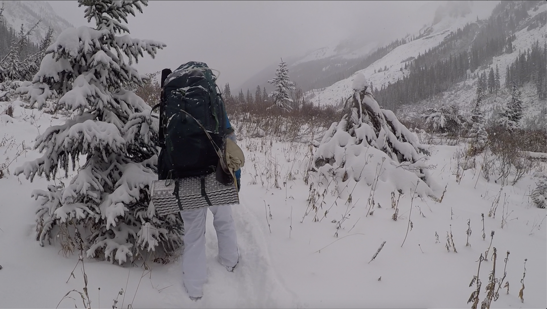
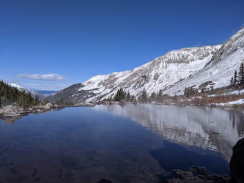
The one mile hike up to Taylor’s car seemed to fly by as we strolled along the path. This nice short detour to Manby Hot Spring relaxed our tired bodies and left us feeling euphoric and was the perfect cap to our weekend at Albuquerque’s International Balloon Festival. 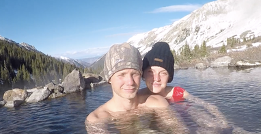 One of the highest hot springs in North America is near Aspen, Colorado. It flows from over 11,000 feet above sea level and maintains an average temperature of 100 degrees Fahrenheit. It is picturesquely nestled between Castle Peak and Hilliard Peak of the White River National Forest. Taylor and I spent a snowy weekend in October hiking up to and enjoying the hot, crystal clear pool. You can watch our YouTube video to see exactly how beautiful this weekend was! www.youtube.com/watch?v=02itHxSIWjQ&t=2s 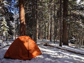 Months before our visit to the high hot tub, Taylor secured a group camping permit through the recreation.gov website. Permits become available in waves, and she booked our October 18th date on June 15th. Later on in August, I supplemented our reservation with a two-person permit for that Saturday the 19th. From here, we began to prepare for our weekend in the Maroon Bells and Snowmass Wilderness. When booking, we didn’t realize that winter would come so early in the year, but we learned in the weeks leading up to our trip that we would be trekking through inches of fresh powder. With seventeen total miles to hike and two nights of camping to survive, keeping warm and dry became our utmost concern. 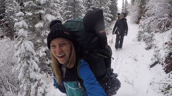 Base layer thermal wears, multiple warm shirts, waterproof hiking boots, gloves, and ski gear were all essential along with the dehydrated food, cooking gear, tent, and sleeping bags in our packs. Once we were packed and ready, we left Denver to start our journey into the woods. After a slow, icy drive into Aspen, Taylor and I grabbed lunch downtown and waited for the snow to let up. Eventually, we drove Castle Creek Road to Conundrum Creek Road and set out on the Conundrum Creek Trail around 4:00 PM. We had no idea how long it would take us to tackle the eight and a half mile trail, but we would soon be well aware.
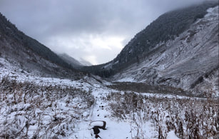
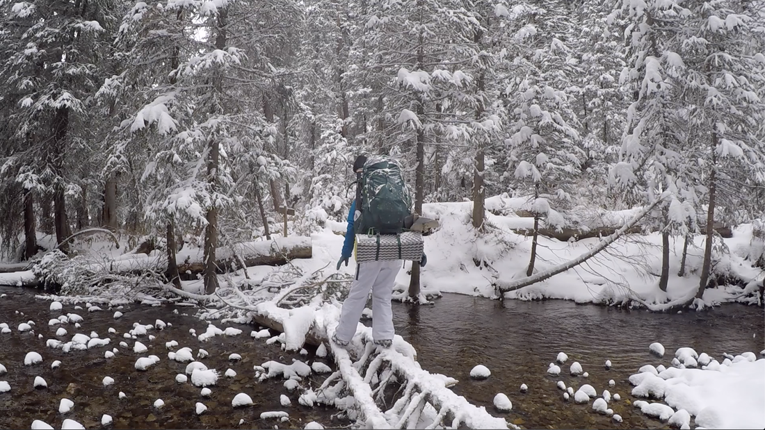
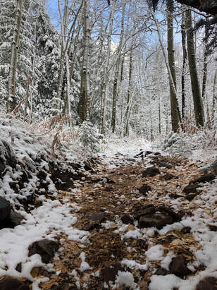 The trail started much like our multi-day hike on the Thorofare Trail in Yellowstone National Park a timber debris littered valley. Many of the large trunks had been cut to unblock the trail, but broken branches and limbs were ever-present and had been covered with several inches of snow. We watched our steps and continued down the trail. After topping several small hills, crossing open plains, and making our way through glistening pine and aspen groves, we noticed that the precious sunlight was becoming more and more faint.
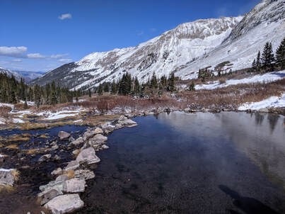
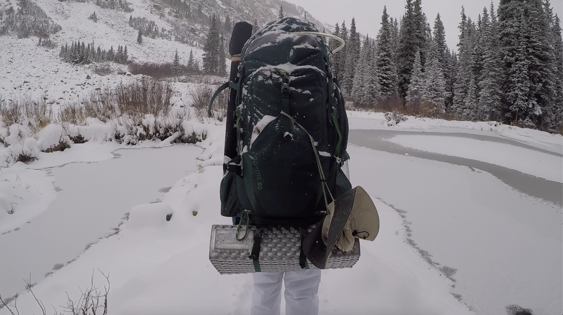
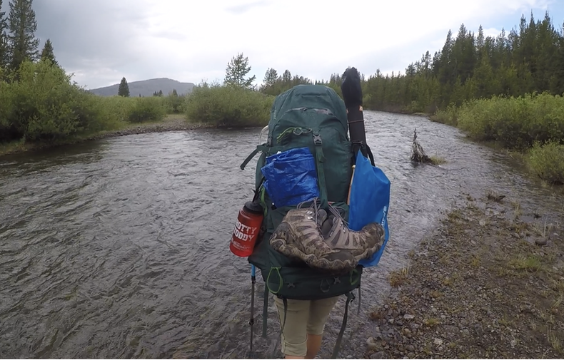
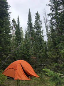
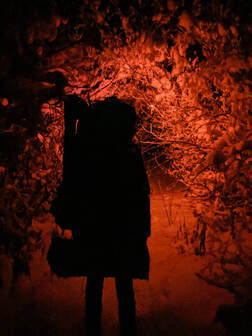 Four hours into our hike and after a few, “Good luck,” wishes from those returning to their cars, the valley was engulfed in darkness. During an impromptu star-gazing session, we realized that we were only halfway to our site and had a long night ahead of us. I followed Taylor’s red headlight as we both did our best to maintain our footing on the trail. Icy rocks hidden under snow, large fields of avalanche debris, and narrow footbridges over flowing water were all part of our risky nighttime march up the valley. 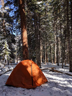 Just after midnight, we spotted a sign for campsites 17 - 20 and used nearly all of our remaining energy in celebration. Everything we had left was used when we set up our tent at the snowy campsite and bundled up for some shut eye. Taylor and I knew that keeping warm while sleeping would be most difficult, but we managed to improvise and get by without losing too much sleep in temperatures that dropped as low as ten degrees. 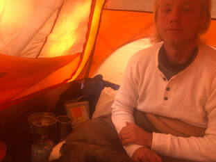 Most of Saturday morning was spent snoozing, but once we’d crawled out of our sleeping bags, we didn’t waste any more time. After organizing our gear, we boiled water to rehydrate oatmeal and made two cups of hot chocolate. Our insides were warmer than our outsides, but the hot spring would change that before too long. The hot spring is a short, uphill walk from the group campsites. Taylor and I were sore from the day before, but it felt great to be moving without 30 pounds of gear on our backs. 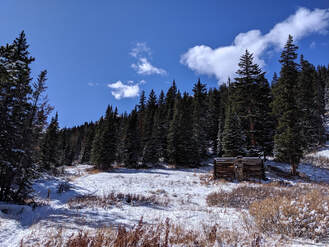 As we climbed, we stopped to peer into the small canyon carved by the rushing creek. An old cabin with a collapsed roof stood along the trail and before we could float too many ideas about who built it, I spotted a tiny bit of steam rising from a stream. Taylor felt the water, excitedly confirmed that it was warm, and wasted no time continuing up the trail. The steep landscape made it difficult to see what was up ahead, but rolling steam clouds soon exposed the hot spring’s location.
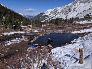 Before we could say anything, Taylor and I were stripping off layers of warm clothing to hop into the hot water. The water is, on average, 100 degrees Fahrenheit and could not have been more relaxing. After gaining nearly 2,800 feet of elevation over eight and a half miles, our joints and muscles relished in the hot bath.
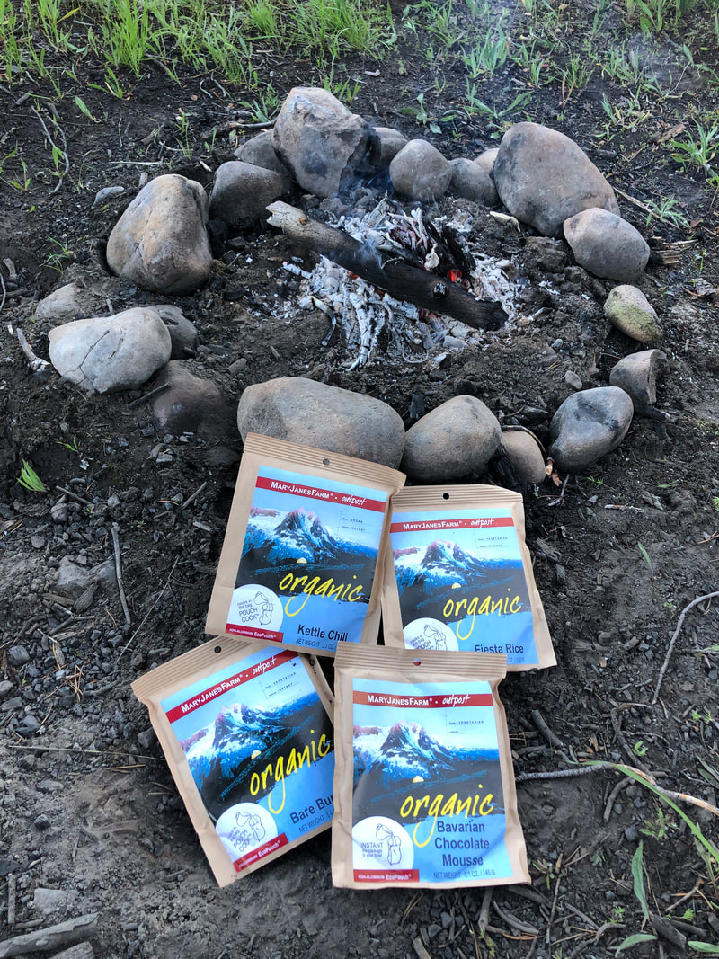
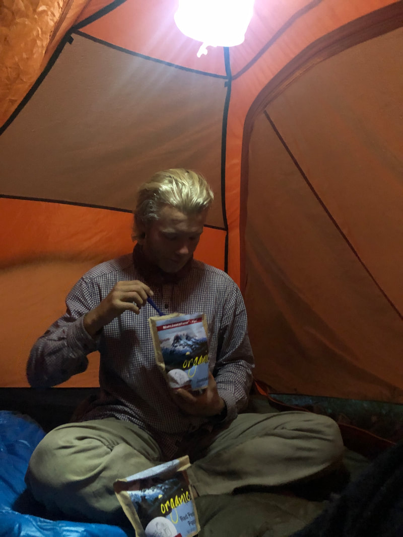
The large infinity-style pool has a hot spot in the middle that produces a constant stream of bubbles. Taylor and I had the pool to ourselves for several hours, and we relaxed in this hottest part for most of that time. We hesitated when we decided to exit the fountain of heat, because we knew it would be the last time of the day that we’d be perfectly warm. 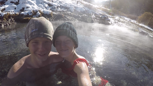 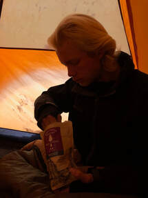 Leaving the hot spring wasn’t as bad as we’d expected so long as the wind didn’t pick up. We ended up leaving at the perfect time, because another couple was on their way up while we were toweling off. Once fully dressed and dry, Taylor and I made our way back to the tent before the sun set behind the mountains. While Taylor began to prepare our dehydrated dinners, I walked through soft, crunchy snow to fill our LifeStraw water bladder with fresh creek water. While we scarfed down our Good To Go Chicken Gumbo and Mary Jane's Farm Bavarian Chocolate Mousse, the dark night and a hard freeze set in. Bundled up in our warm clothes and sleeping bags, Taylor and I went to bed early to prepare for the task that lay ahead of us. 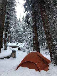 Sunday morning, we woke to four inches of fresh snow with more coming down. A quick oatmeal breakfast helped us warm up while we gradually packed our gear. Soon, we were pulling stakes, folding the tent, and complaining about the retreating feeling in our fingers and toes. When 9:30 rolled around, we shouldered our packs and began the journey back to civilization and centralized heating. 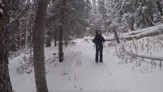 A couple of hunters and hikers had made the trek before us that morning, and we were thankful for their presence. The once-beaten trail had been covered by the continual snowfall, and their footprints were easy to follow most of the way. Hiking down from Conundrum Hot Springs was easier than the climb up, but it took Taylor and me nearly the same eight hours to complete.
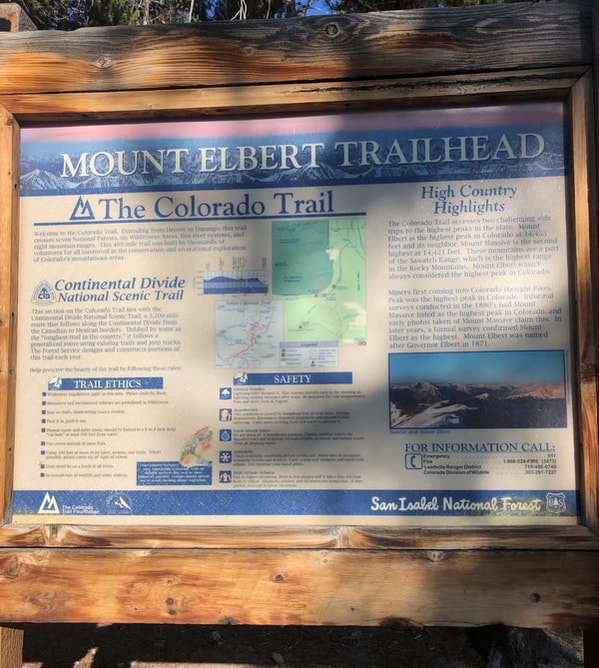
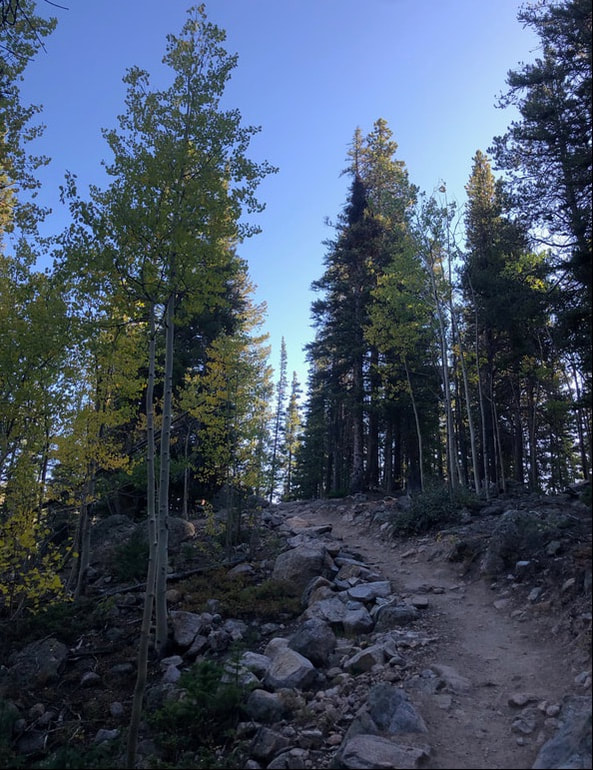
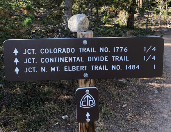
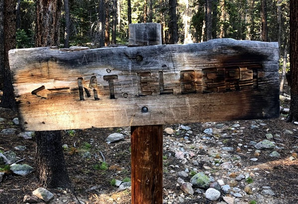
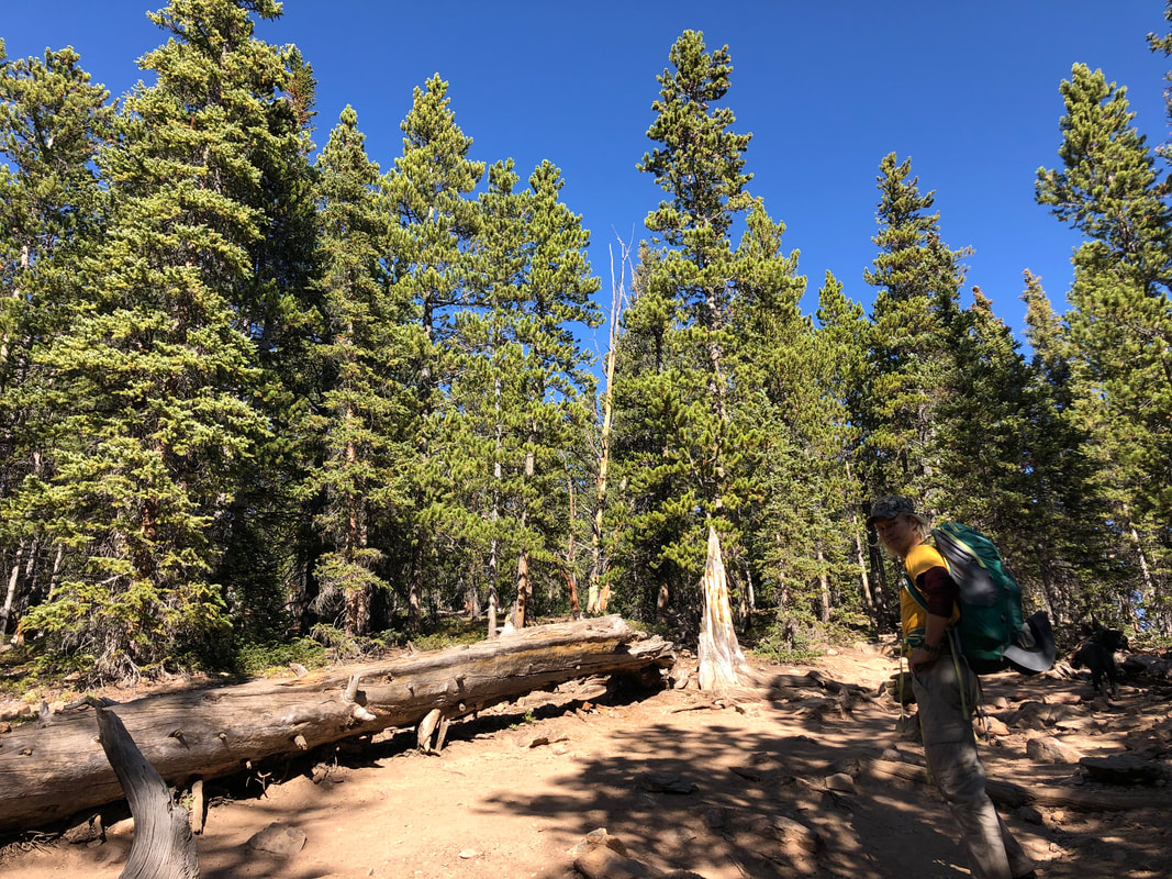
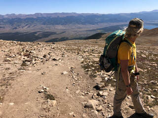
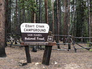
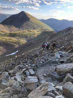
 Long, cold, and treacherous, the Conundrum Creek Trail was a task fitting for its reward. The few hours spent in the 100 degree spring was worth every step, slip, and flake of snow. Once in the car, with the seat warmers and heat all pumping, Taylor and I agree that a summer return is absolutely necessary.  Leadville, Colorado, is a historic mining town nestled in the valley between the Mosquito and Sawatch mountain ranges. This bowl of mountains is home to three peaks over 14,000 feet including Colorado’s tallest peak and the second tallest mountain in the contiguous United States, Mount Elbert.  During the third weekend in September, John and I set out to summit this behemoth. We arrived in town Friday night after leaving Denver around 6 p.m. Luckily, we managed to snag the last spot at the Elbert Creek Campground which happened to be the campground closest to the trailhead too. By 10 p.m., we were in our sleeping bags and ready to get a good night’s sleep.  We woke the next morning around 6 a.m. freezing cold and quite hungry. John cooked breakfast while I struggled to leave my warm cocoon. Eventually, we ate our delicious Mary Jane’s Farm Hot & Creamy Cereal and packed up our gear for the day. (We love our MJ meals, and if you want to read about how we chose this dehydrated brand, you can see our comparisons here!) We were at the trailhead right after 8:30 and ready to head deep into the woods to start our hike. Thick, tall pine trees surrounded us over the course of the first few miles of our hike. We crossed over a small, rushing creek at the beginning of the hike before the trail became a red dirt path surrounded by trees and a steady climb up.
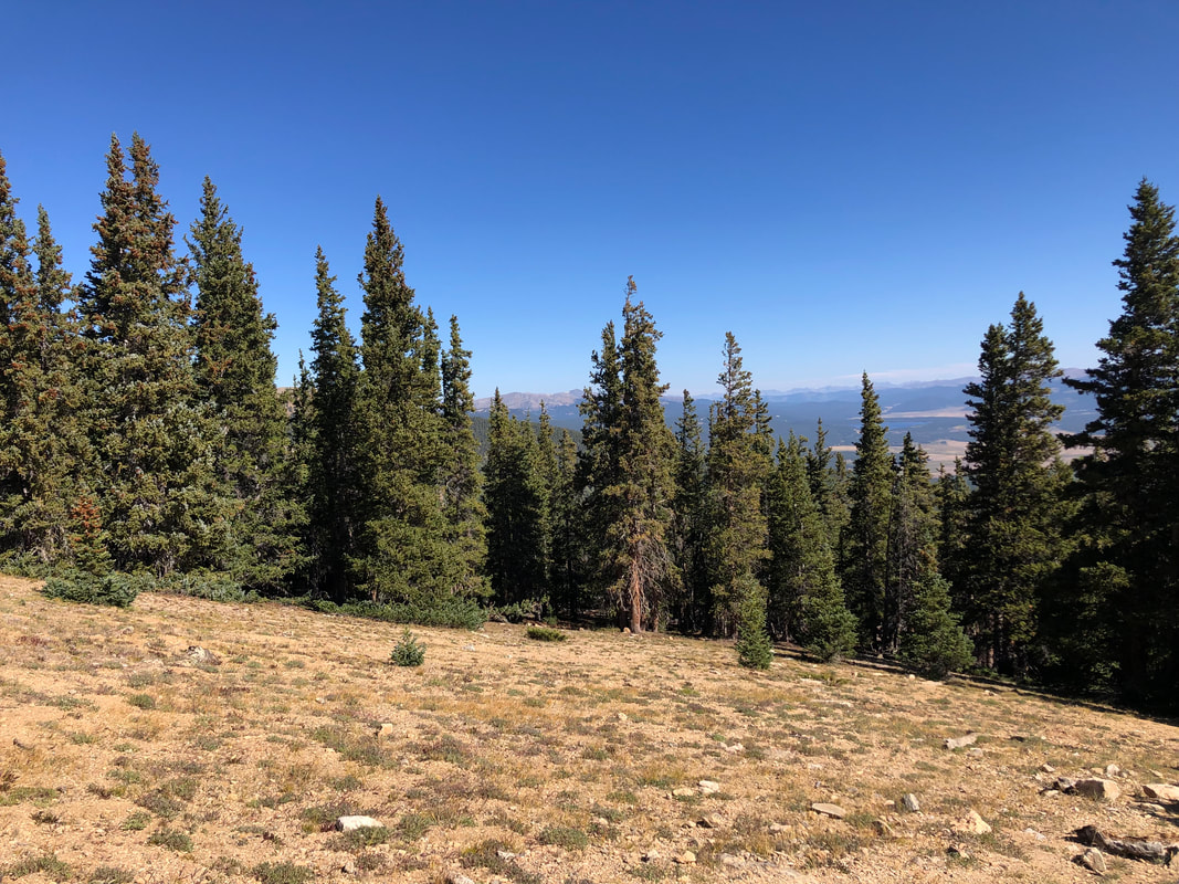
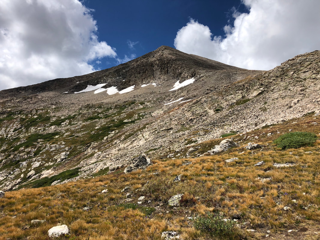
It took us roughly two hours to breach the tree line which was nearly three miles into the trail and almost 2,000 feet higher than the trailhead. From here, we were finally able to see the peak we were trying to reach.
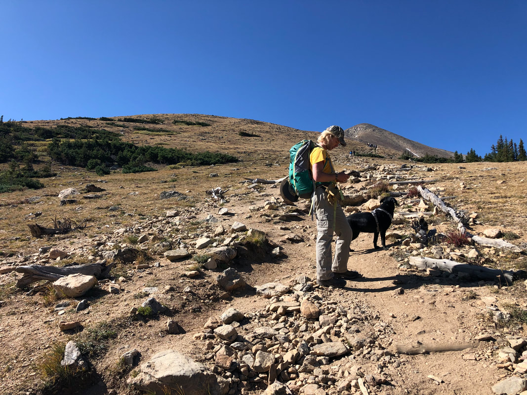
 Going up the mountain was a tad bit daunting, but when we turned around, the views were worth all of it. We were able to see not only the wilderness we had just emerged from but also the surrounding mountain ranges just emerging over the tops of the trees. For the next mile or so, we walked with this incredible view at our backs as we followed the steep trail up the mountain. The trail had changed drastically since we left the pines. We went from a red clay trail and warm but shady, wooded area to a wide open, windy, and scree-filled climb. This was one of the most difficult parts of the trail. There were no switchbacks or even places to stop and catch our breath. Instead, for almost 1,000 feet of elevation gain, we had to push through and keep our heads up.
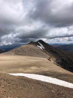
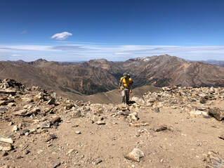 When we arrived at the top of the hill we’d been hiking toward, which sadly turned out not to be the summit, we were greeted with unbelievable views. We were able to look back on all of the ground we had covered and now could see a new mountain range that had been hidden from sight. We were finally surrounded by mountains -- beautiful mountains, I might add. This is one of my favorite feelings in the world. There is nothing like being able to spin all the way around and see nothing but rolling mountains for miles and miles on the horizon. 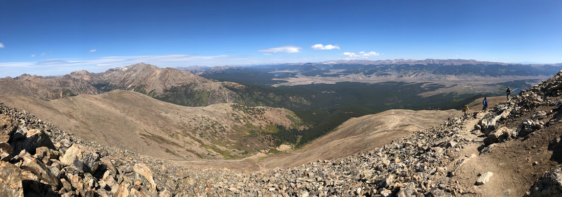 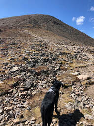 The trail, from here, winds through a large boulder field and climbs the northern face of the mountain. It led us to one more false summit with a nice, open spot and directional cairn before the final ascent. From this cairn, there were only about 15 minutes left in our journey. We could finally see the real summit, and we couldn’t wait to get there.
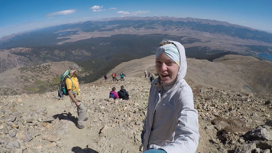
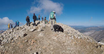
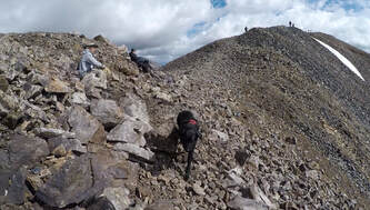
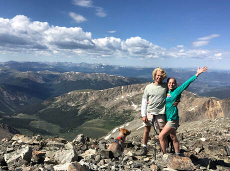
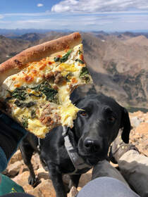 It was around 1:30 p.m. when we arrived at the summit. After the over-four-hour long trip up, we were starving and a bit tired. There were a group of bikers hanging out, but they left within a few minutes of our arrival. We found a rocky spot that shielded some of the wind and sat down to enjoy the views and some pizza for a long while. For almost the entire 30-minutes we were snuggled up in the rocks with the peak to ourselves. When others started to show up and we got chilly, we took our summit photos and headed back down. 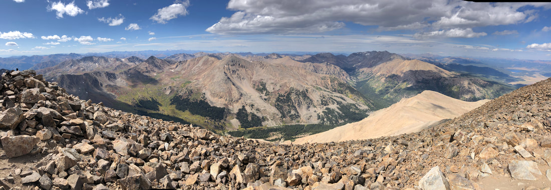 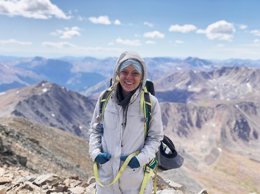 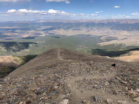 The upper trail’s lack of switchbacks made the trip down very rough on our knees. Eventually, we entered back into the wooded area for the last two or three miles. This part felt much longer than our trip through it earlier that morning, but it eventually led us to the end of the trail.
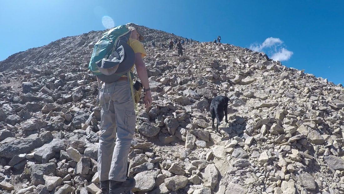
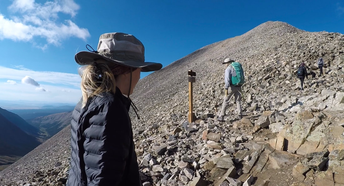
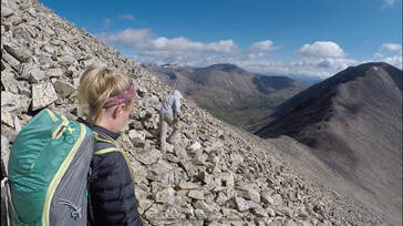
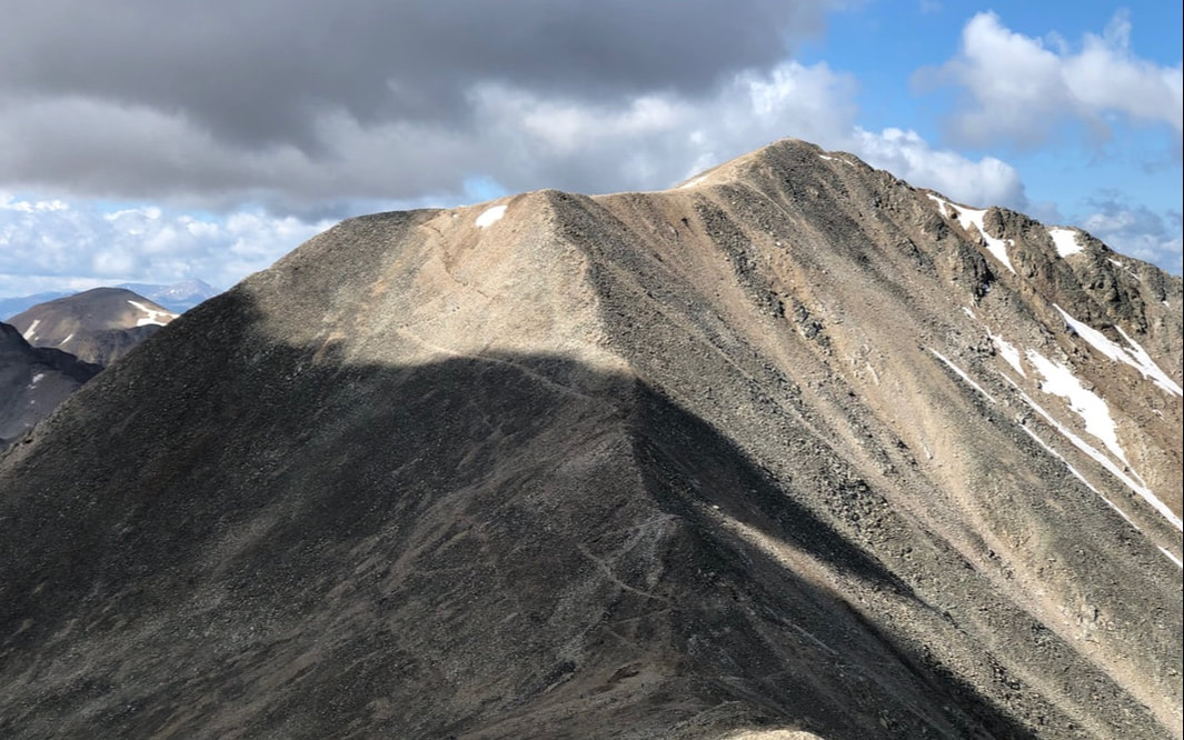
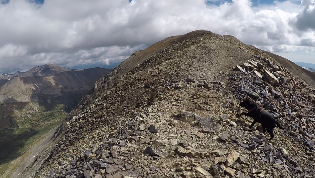
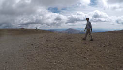
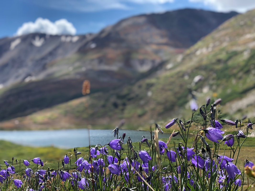
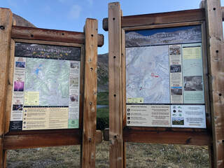
 The hike back down wasn’t as difficult as the hike up, but somehow, without any stops, it took us the same amount of time to get back to the trailhead. We arrived back at the trailhead, and our campsite, around 5:45 p.m. After over 9 hours of hiking, we were exhausted yet proud of what we had accomplished. We had just climbed Colorado’s tallest peak and marked 14’er #7 off our 2019 list! 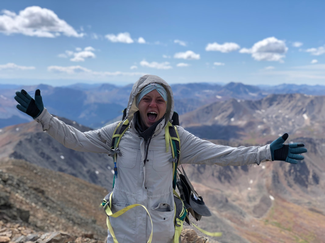 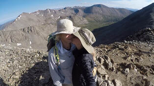 14’ers are starting to become routine for John and I. Almost every weekend, we pack up and head out to climb another one of Colorado’s mountains. The first weekend in September, we set out to hike the DeCaLiBron loop which summits Mount Democrat, Mount Lincoln, Mount Cameron, and Mount Bross. 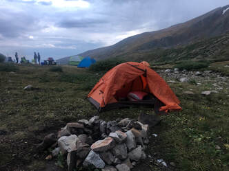 We left Denver around 4 p.m. Friday afternoon and arrived at the Kit Lake Campground around 7. We had just enough time to set up our tent and get settled in for the night, before an evening thunderstorm rolled in. We sat in our tent and ate some snacks while the rain whipped our polyester shelter. When we were full and certain the rain wouldn’t let up, we called it an early night and got into our sleeping bags. The rain continued into the night, and when our alarm went off at 4 a.m., it was still coming down. We decided to pack up our things inside the tent and prepare for the day with hopes that it would stop shortly. When it didn’t, we went back to sleep until 6:30. 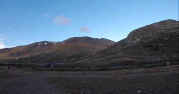 We woke up to the sun rising over the horizon, so we knew it was clear enough for us to get started. Even though the sun was out, it didn’t crest over the mountains until after 7:45, and it made the beginning of our trek just a tad chillier. By that time we had left our tent where it was, grabbed our pack, and been on the trail for 30 minutes. 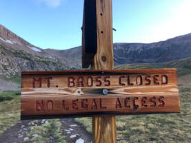 We decided to go clockwise and summit Mount Democrat first. We had heard that Mount Bross has a lot of loose scree that makes the hike more difficult, so we figured that, with our late start, we should go with the easier route. Plus, there were signs saying Bross’s peak was closed, and we didn’t have time to take any risks. The Democrat trail starts on the east side of Kite Lake and heads north cutting a path through a lush valley. For the first mile or so, the trail makes a steady but subtle incline. The valley was full of blooming bluebells, but the mountainside grass was starting to show some of its orange, fall colors. Once we’d left the lake, we followed a small and swiftly flowing stream.
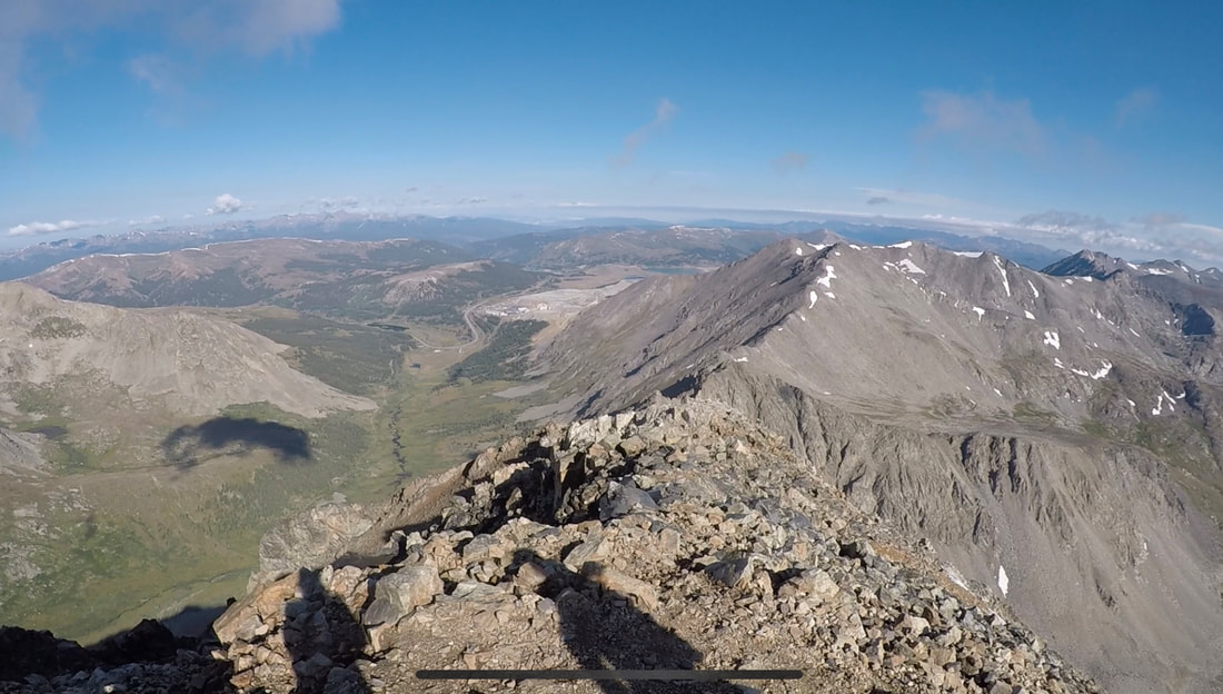
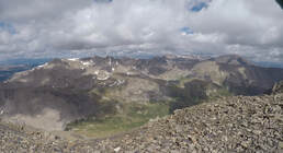
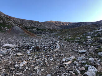 The valley quickly turned into a steep, rocky boulder field. Until we reached the saddle, the trail was intertwined with large rock scrambles and sharp switchbacks. Sometimes, we had to climb over feet-tall rocks, and other times, the trail was large enough for us to walk side by side. Either way, the trail was always easy to find thanks to rock cairns and other people climbing up. When we made it up to the saddle, we were blown away by the view and nearly by the wind. The whole hour climb up, we had no idea what had been waiting for us on the other side of the mountains. The view opened up, and we looked down on The Pike National Forest’s Clinton, McNamee and Traver Peaks inside a vast mountain range. From here, we took a left and began out summit of Mount Democrat. 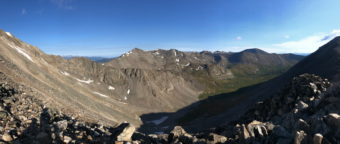 The trail goes back to the south side of the ridge line, where we could look over the terrain we had just traversed. It was around a mile and a half to the summit, and it took us roughly an hour to make it to the top.
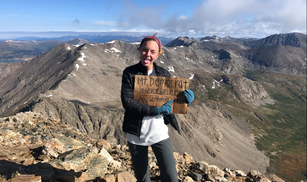
 Once at the summit of Mount Democrat, we were greeted by roughly a dozen hikers and some strong winds. We found a spot to sit and gazed out over the vast view of rolling hills and mountains. The sunshine felt great between gusts of wind, but we didn’t stay long after we thought about the other peaks we wanted to climb. 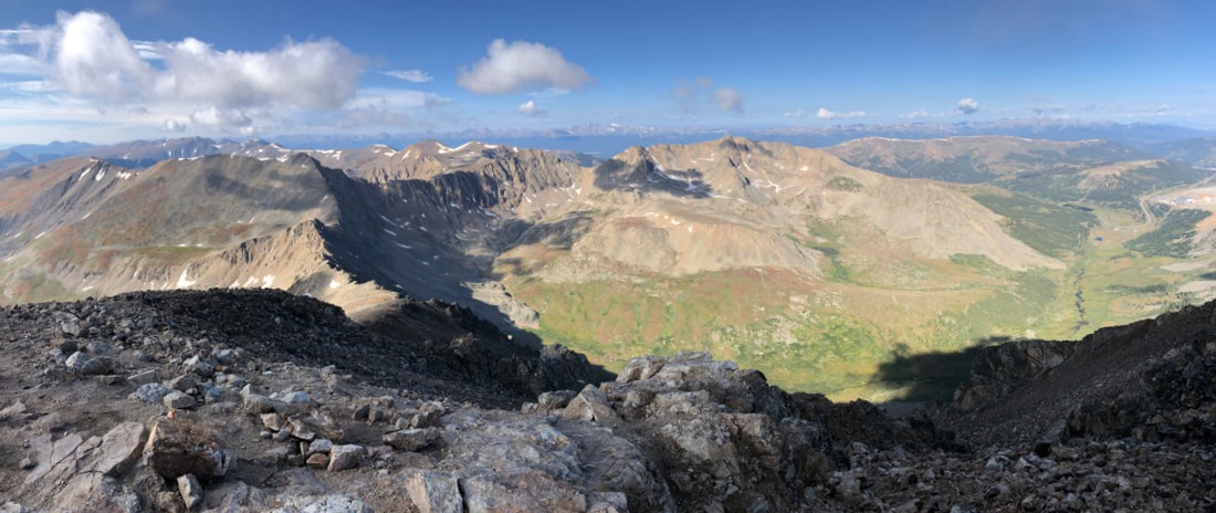
We took some pictures and videos before making our descent, then we headed down the same route we had come. Once back in the saddle, we started up Mount Cameron.
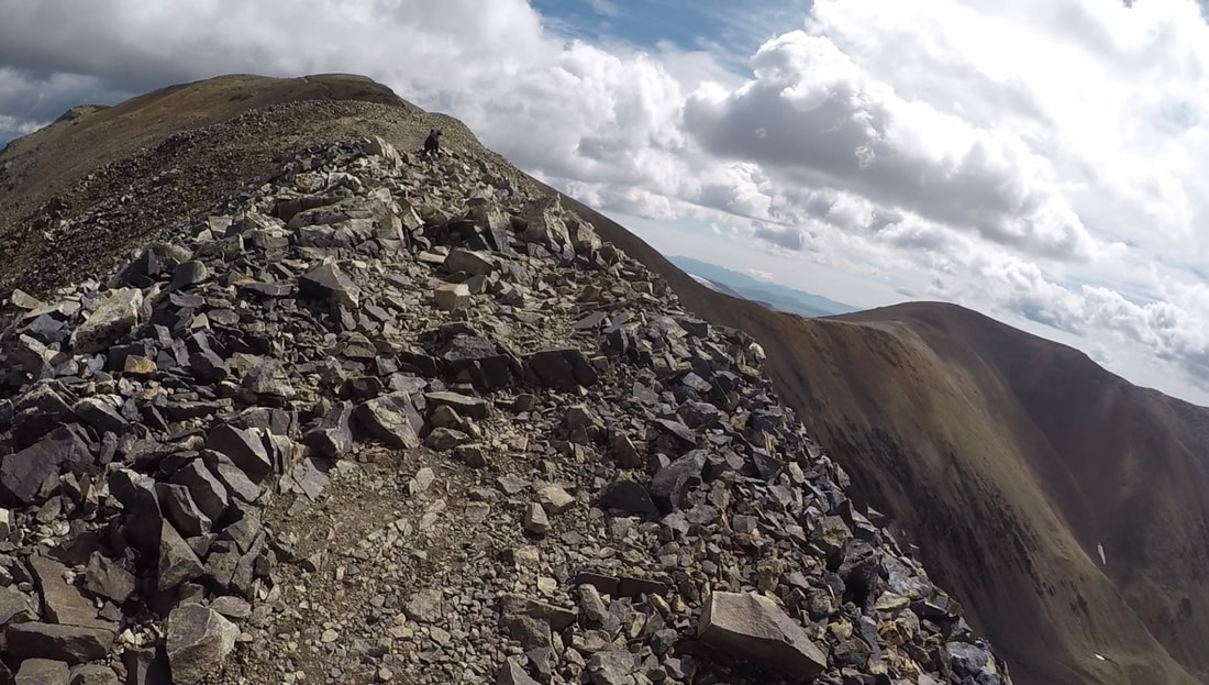
 The climb toward Mount Cameron was very similar to the route up Mount Democrat. It was scattered with scree and made for rough climbing in places, but the trail was still well defined and easy to follow. The main difference between the two paths was what lay on the other side of the first hill. Democrats’s trail remained similar after reaching the false summit, while Cameron’s crested a ridge and opened up to a windy, open trail with 360 degree views of the mountains. It was unbelievable how much more windy the trail became from here. We were warned by every passing hiker that it didn’t get easier, and they were right. Each also said the peaks were worth it, and again, they were right.
As windy as it was, this part of the trail was arguably some of our favorite. It felt unreal to be walking such a narrow path in the middle of a circle of mountains. Sadly, though, this trail led to a disappointing summit peak. Mount Cameron was nothing more than a big, open rock field. There was no special view or anything special about it, but that couldn’t stop us from enjoying a spectacular hike. We didn’t stop and kept pushing toward Mount Lincoln as the wind blew at our backs.
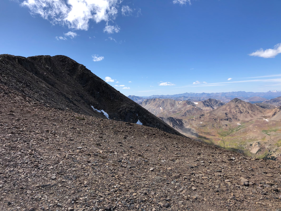
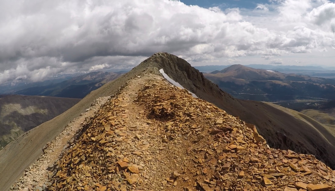
 Our very favorite part of the trail was ascending Mount Lincoln. The views didn’t change much, because we only went about a half mile, and we were already on the knife’s edge, but we were approaching an actual pin-point peak, and it gave us the jitters. Of course, there were more than one of these peaks, because 14’ers almost always have false summits. Lincoln’s false summit has been our favorite. The trail wraps around the south edge of the peak before revealing Lincoln’s actual summit.
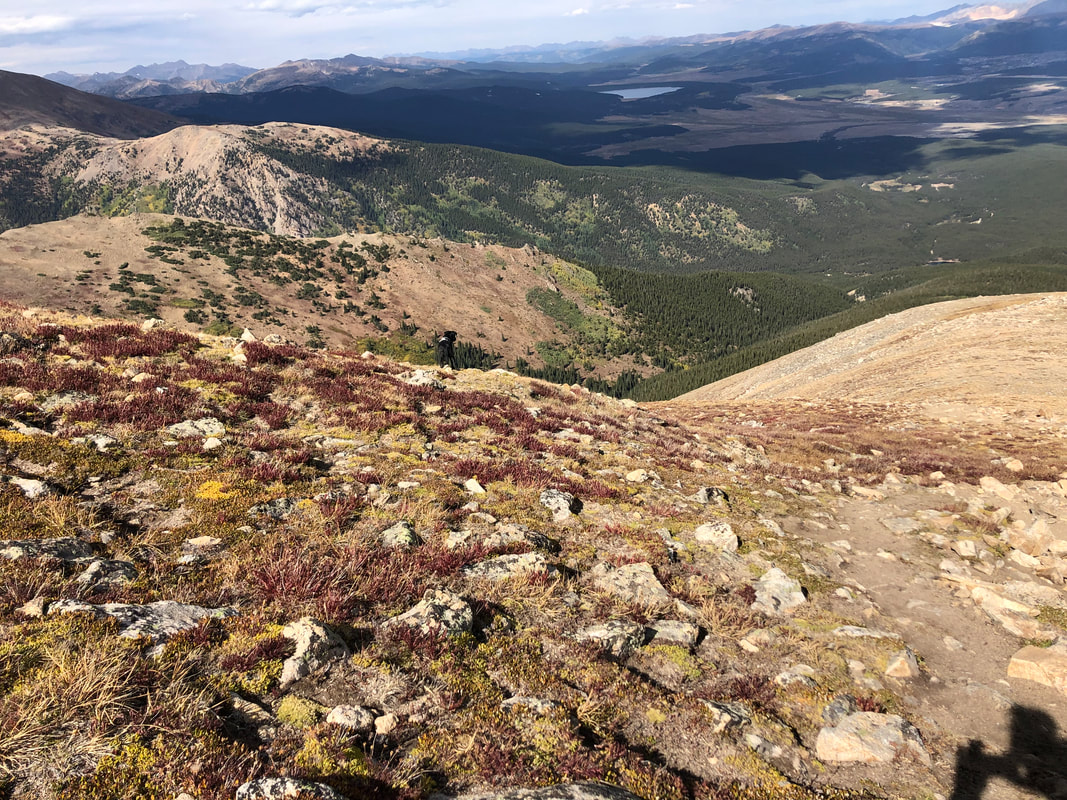
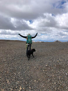
We had been alone on the trail, for the most part, since we reached the saddle between Mount Cameron and Mount Lincoln. We had only seen a few others hiking out, and when we reached the summit, of Lincoln we had complete solitude. The views partnered with silence couldn’t have been more serene. 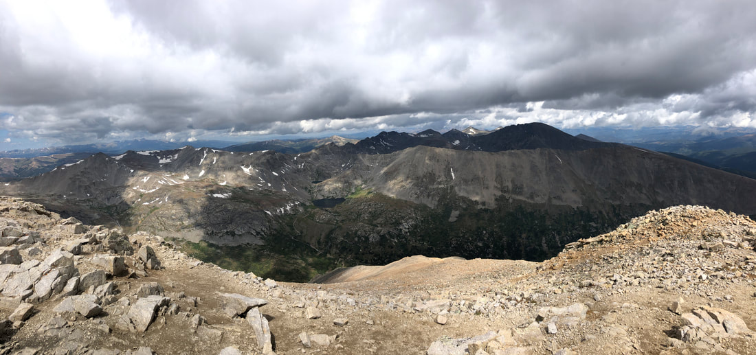 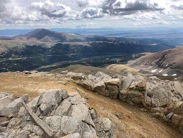 We found a bit of shelter from the wind in a rocky cove facing the south, where we sat and enjoyed lunch wraps, dehydrated apples, and beef jerky. It didn’t take long for company to arrive from a different side of the mountain than we had climbed. Once we had gotten chilly from the wind, we packed up our picnic and were taking a few pictures when we noticed unwelcoming clouds rolling in from the north. 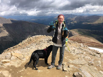 We started to discuss whether summiting Bross would be feasible, safe, and worth it. After some thought, we decided to opt out, because it was after noon and we had evening obligations in Denver. We took our summit pictures and began down the same trail we had come up. Going down is always easier, but we still had to make a minor climb back up to Mount Cameron. In only about 20 minutes, we went from one 14’er to another. 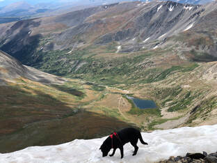 After we left Cameron’s peak, the wind died down and our descent was steady for the next two miles down. We stopped a whole bunch to take pictures of Maria playing in the snow and the stunning wildflowers that we had missed during our dark hike earlier in the morning. The flowers surrounded Kite Lake and the valley surrounding it. We were amazed by the colors we had missed while the sun was hiding. It took us two hours to go from the summit of Mount Lincoln to the trailhead, and sadly back to our car to make our return trip to Denver.
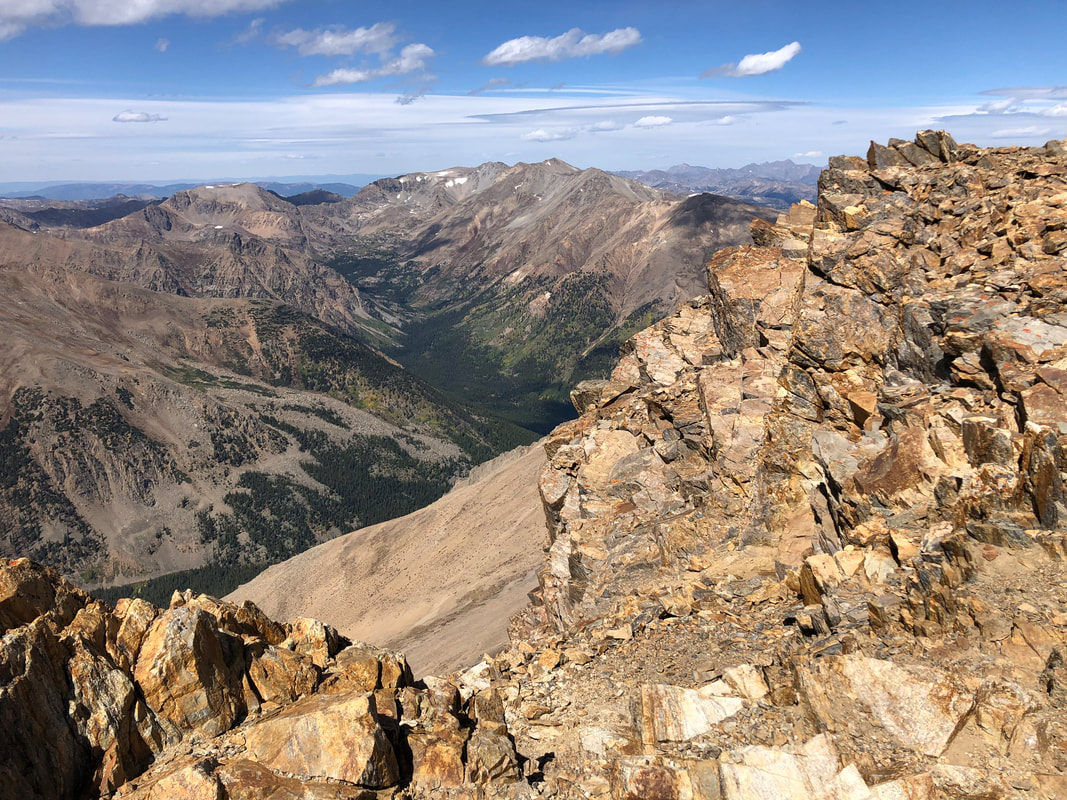
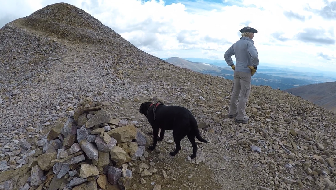
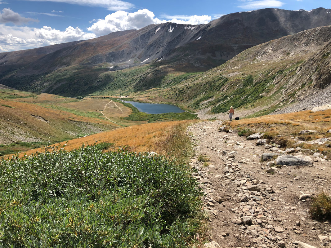
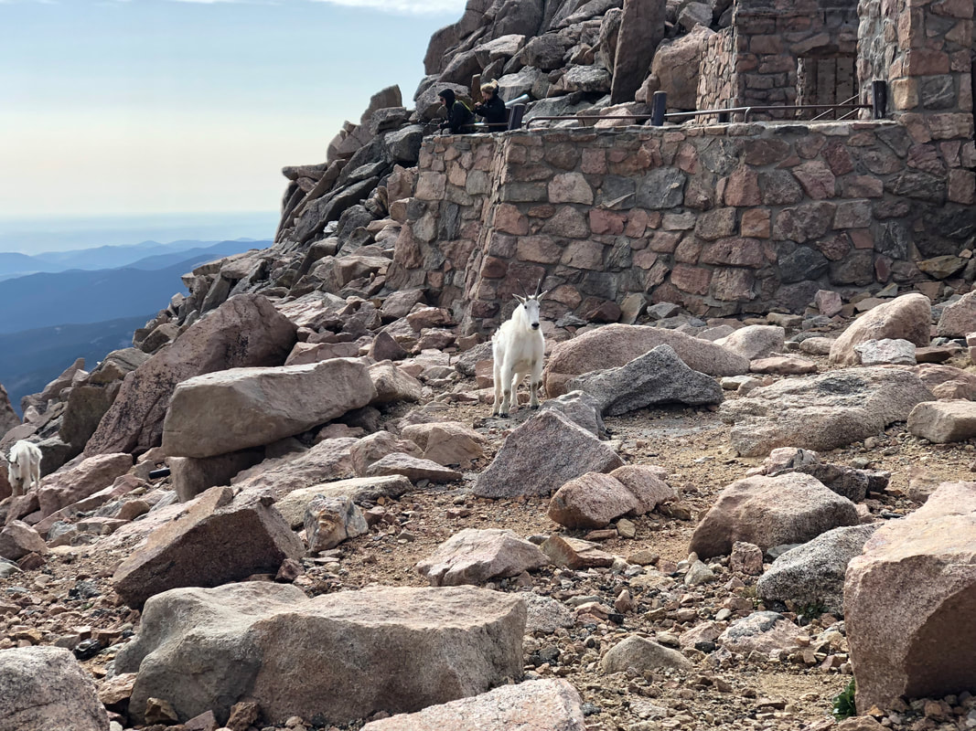
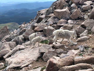
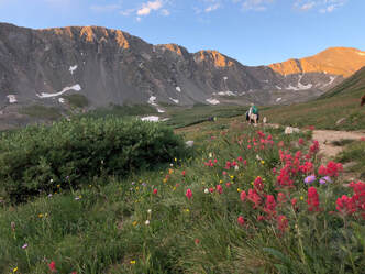
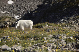
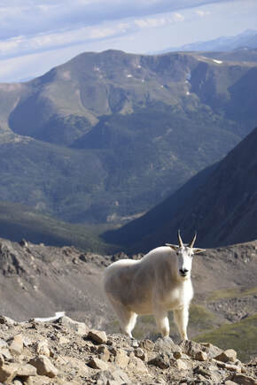
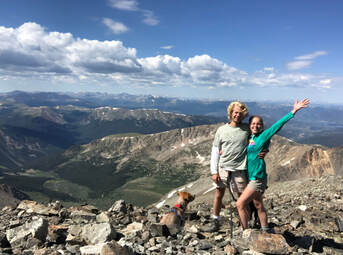
 In just a little under seven hours we were able to summit three different 14,000 foot peaks. Even though we didn't finish the loop and make it to Mount Bross, we were still proud of the ground we had covered and the heights we had been able to climb. Maybe next time we will start with Bross and get to add it to our list, but until then we are leaving these peaks in our rearview mirror while we check out some of the other 50 or so that are out there. 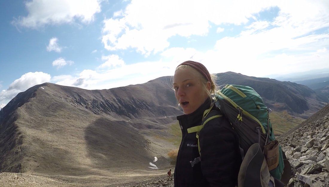 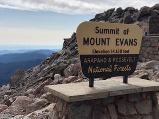 Mount Evans can be seen for miles along the Rocky Mountain foothills and is one of the most accessible 14’ers from Denver. This looming mass has had its sides eaten away by erosion leaving deep cirques—or valleys—that hold crystal lakes and creeks. It was the perfect candidate for Taylor and I’s third 14’er of the summer. The morning of August 24th, we drove I-70 West from Denver just like we had done the weekend before for Gray’s and Torrey’s Peaks. We picked up a friend of ours at 4:15am and arrived at the Evans/Summit Lake Trailhead just over an hour later. 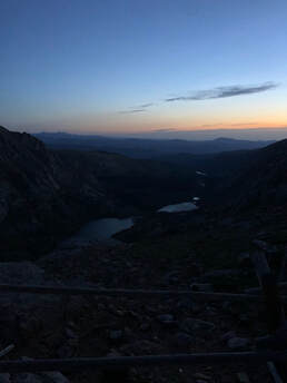 View of Chicago Lakes. View of Chicago Lakes. The mountains and surrounding valleys were cloaked in darkness as we began our ascent. It was nearly dark enough to make our black, mountain-climbing dog, Maria, invisible. The trail started as a relatively wide dirt path, crossed through a grass pasture, and gradually climbed up the northeast side of Summit Lake. Even in the last few minutes of darkness, the trail was easy for us to follow without headlamps or flashlights. Climbing around Summit Lake’s northern point was enough to make us winded only a mile into the trip. We stopped along the eastern ridgeline and looked down on the Chicago Lake Basin to watch the sun rise. We quickly realized it would be behind Mt. Warren for a while longer, so we decided to keep moving after having some water and snacks. 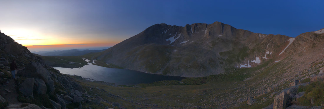 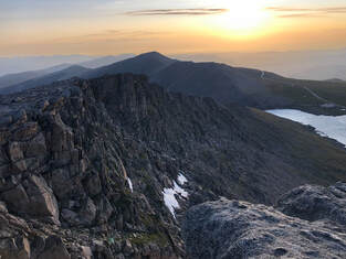 Through steep, stone littered fields, we continued our approached to Mount Spalding during the sunrise. This preliminary summit felt like a shrine. A natural slab encircled by rock walls and towers sits atop the 13,000 foot destination. A short break and a few photos of the early morning landscape later, we were descending into the short, flat saddle between Mt. Evans and Mt. Spalding. 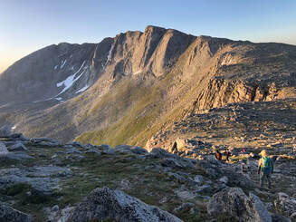 View of the saddle to Mount Evans from Mount Spalding. View of the saddle to Mount Evans from Mount Spalding. Upon ascent from the saddle, the Mount Evans trail continues to the Southern slopes of the mountain. Blustering winds welcomed us, and from here on out, the winds were constant, cutting, and cold. Large boulders did not provide cover from the wind, but climbing up them was entertaining enough to temporarily take our minds off it. For a little under two miles, we maneuvered through the boulder-crowded mountainside. We stopped, at times, for descending hikers attempting to scramble down as we scrambled up. Every time we stopped, the aforementioned winds motivated us to keep moving even. The terrain made it difficult to keep track of the trail, but the occasional cairn confirmed that we were on the right path. 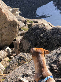 Just west of the actual summit, our group was fooled by a false summit. We realized it almost immediately but decided to stop for snacks when we noticed how fantastic the view was. As we appreciated our food and our view, a mother mountain goat investigated our presence. A curious kid followed closely as the mother kept watch of us and our dogs. As they turned to leave, we turned to make a short descent from the West Ridge and on to our final ascent. The majority of our last stretch to the top was on a well-defined path that connected to the Meyer-Womble Observatory’s parking lot. The much shorter trail, understandably, was more heavily trafficked. The short system of switchbacks induced excitement as we approached the payoff. 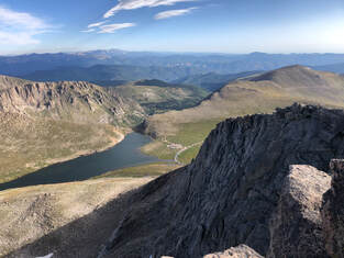 From Mount Evans's peak looking north. From Mount Evans's peak looking north. Mount Evans’s peak provides spectacular views from underfoot to the horizon. Broken boulders balance in seemingly impossible ways and large slabs of rock protrude into the air. Our best view of Summit Lake was from the peak, and Rocky Mountain National Park is even visible on a clear day. Most impressive, gazing westward grants a view of Mount Bierstadt and the vast mountain ranges beyond it. 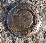 As part of the Rocky Mountains, the Mount Evans Batholith is a single rock formation estimated to span an area of more than 75 square miles. It is thought to have been created beneath the Earth’s surface and forced upward as it solidified. Bronze plaques driven into Mount Evans’s peak announce the highest point of the massive batholith. 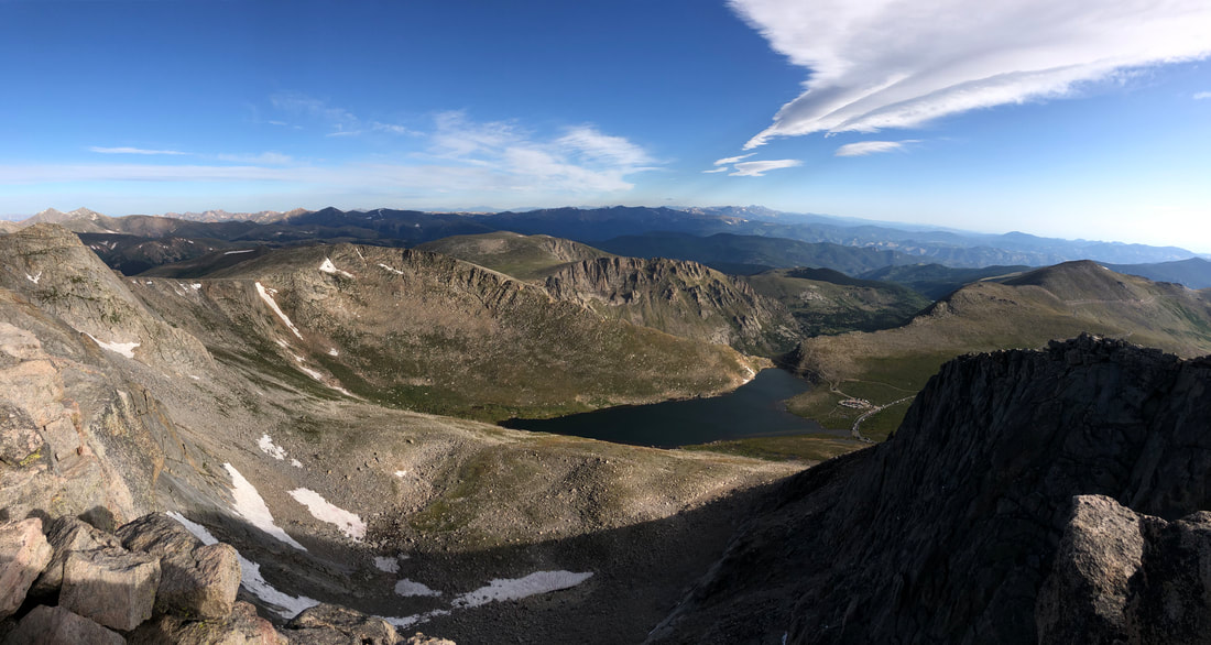 After taking in the views and exploring the peak, our group decided to seek shelter in the Crest House just below the summit and next to the parking lot. All that remains are stone walls and iron gates after a fire destroyed what used to be the world’s highest structure. More mountain goats meandered in and around the ruins as we learned about the site and prepared to hike down to our car.
 We decided to descend Mount Evans Road after learning that it is the highest paved road in North America. We eventually left it to hike north on the slopes of Mount Evans toward Bear Creek and our car. The gradual decline of the slopes was leisurely and filled with tiny flowers that dotted the vast field of grass and strewn stones. As we made our way around the mountainside we had the perfect opportunity to reflect on our morning journey. 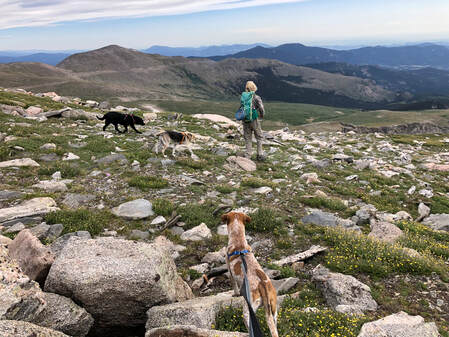 We arrived at our car at noon, and our hike of Mount Evans was officially over. Throughout the hike, the landscape was continuously stunning, but we were all glad to have witnessed the view from Mount Evans’s peak. Having a parking lot less than 200 yards from the summit undercut our sense of accomplishment at times, but we all agreed that we wouldn’t trade the full hike for any comfortable ride to the top.
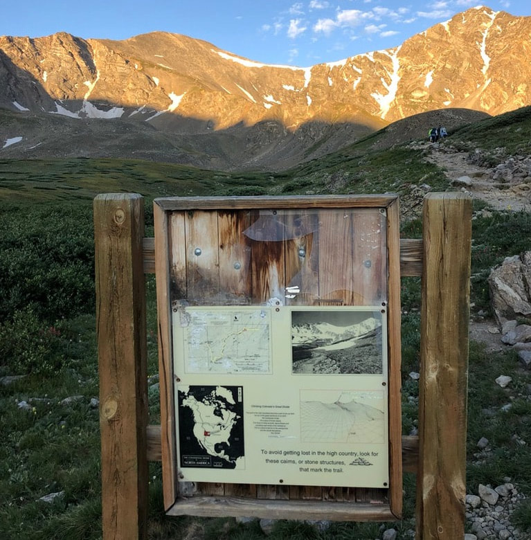
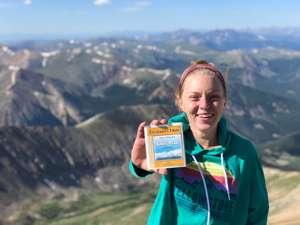
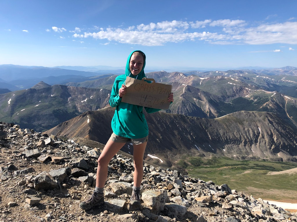
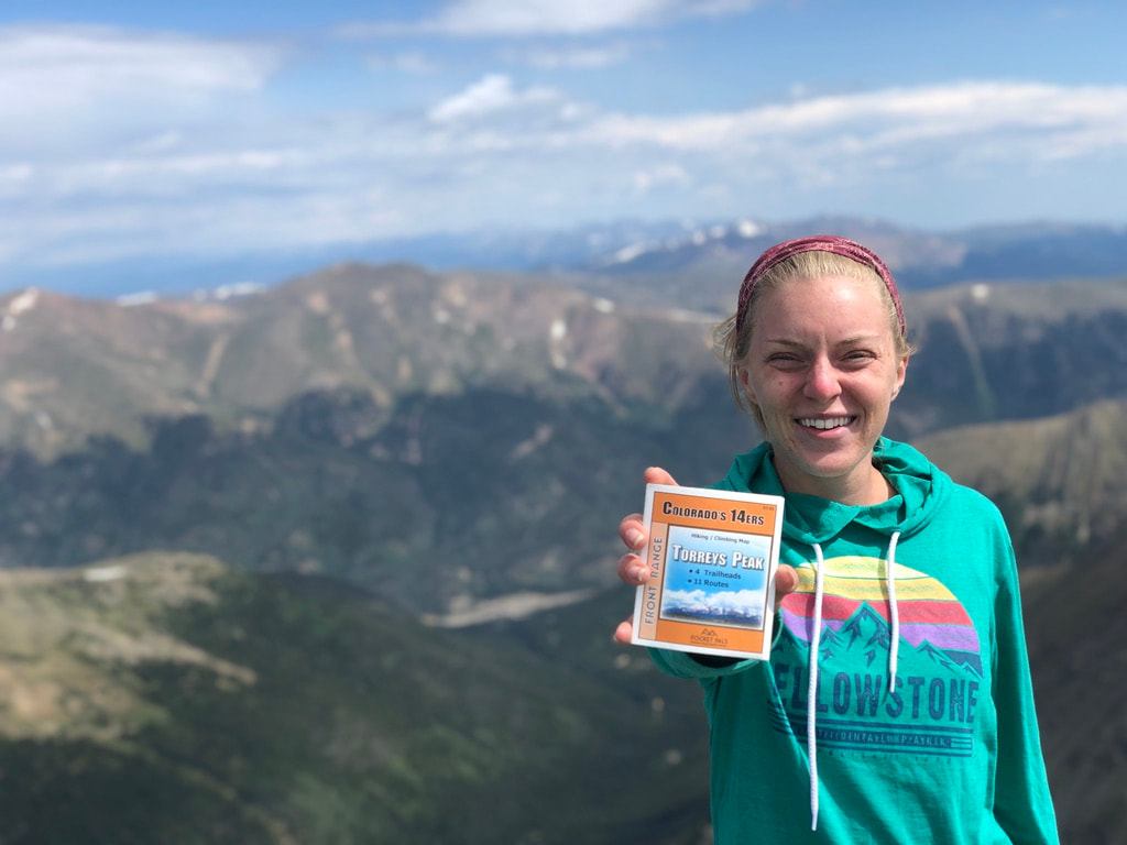
 There are 58 mountain peaks in Colorado that reach further than 14,000 feet into the air. Most are concentrated in Colorado’s western slopes, but there are towering peaks scattered along the Rocky Mountain ranges. When Taylor moved to Colorado, she decided to tackle 10 before the end of the calendar year. To start the task, she and I took a day hike to the tops of Grays and Torreys Peaks. 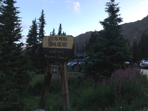 An early start helps ensure favorable weather while hiking up and back down any 14’er, so Taylor and I left Denver with our dog Maria and headed for the Grays Peak Trailhead at 4:20AM. Roughly an hour later, we exited Interstate 70 and began to climb Stephen’s Gulch Road. The two mile road is steep, rocky, and narrow at times, but we parked at the trailhead after Taylor skillfully maneuvered the dark, bumpy road. 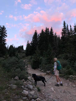 Sunrise colored the sky deep purple as we crossed the footbridge spanning Stephen’s Gulch and began our first journey to 14,000 feet. From the trailhead to the summit, Grays Peak Trail is 3.5 miles long with 3,000 feet of elevation gain. Nearly every step we took after the footbridge was a step up, but every step was filled with beautiful sights. As the sun erupted over the McClellan Mountain Ridgeline, wildflower colors burst from the grassy sides of Grays Trail. Reds, pinks, and lavenders lay among numerous white and yellow patches on a lush, green canvas for over two miles of the trail. Quayle creek cuts through the vegetation and its source marks the beginning of a different landscape.
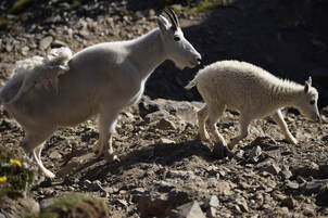
 The ascent routes to the summits were unmistakable as Taylor and I climbed into fields of broken and strewn rocks. The path was littered with hikers, but the traffic could not affect their majesty against the blue morning sky. Thankfully, the traffic didn’t affect several snow white mountain goats either. A watchful mother, several fluffy little ones, and a few distant loners made appearances as we climbed higher looking for a suitable place to have ‘lunch’ at 8:30 AM.
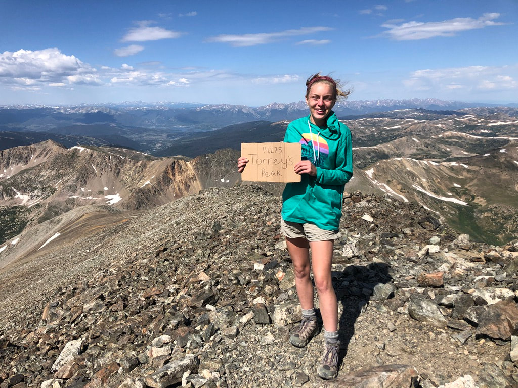
After a short break, one half mile of switchbacks through the mountain’s shed rocks led us to the payoff we’d been anticipating. The top of Grays Peak is a platform where hikers were relaxing, chatting, taking photos, and gazing over the vast range of Earth. 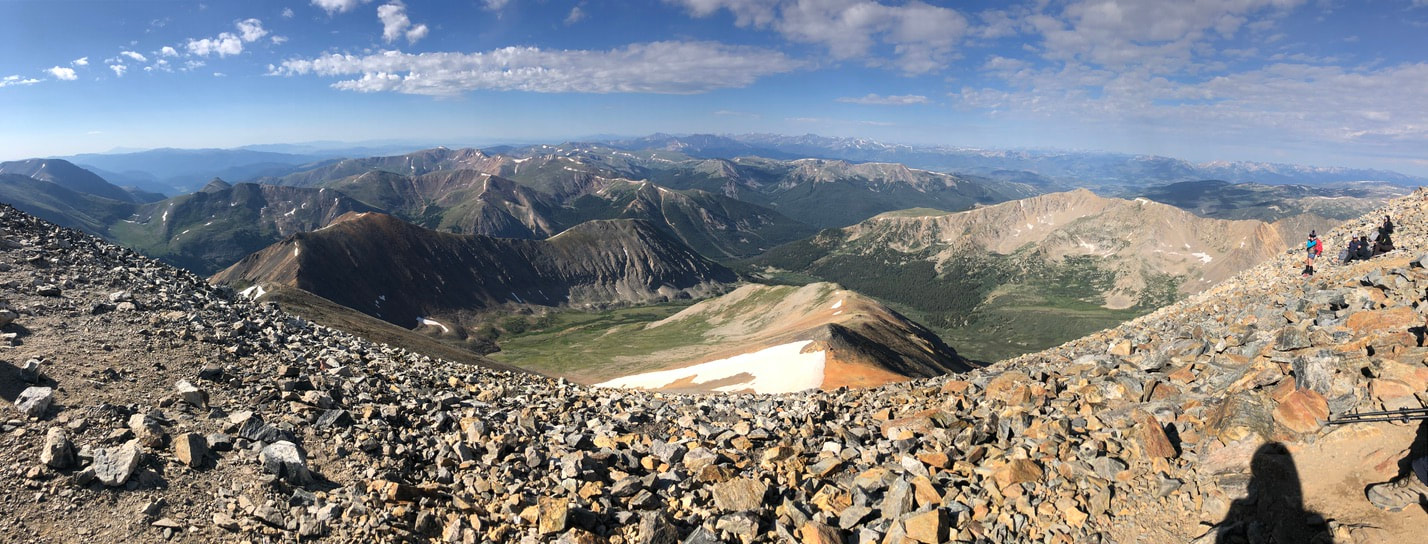 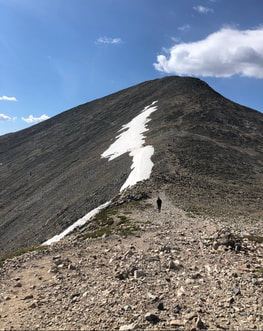 After marveling for ourselves and determining that Keystone was the visible ski area, Taylor and I began descending to the saddle between Grays and Torreys to approach our second peak of the day. A 500 foot ascent from the saddle led to the more pointed Torreys Peak. Our first experience taking the dog down steep slopes was a bit difficult, because she gets anxious around heights. A pulling dog does not mix well with a trail littered with large stones and loose gravel. We made the descent more quickly than we should have, but we made it safely. 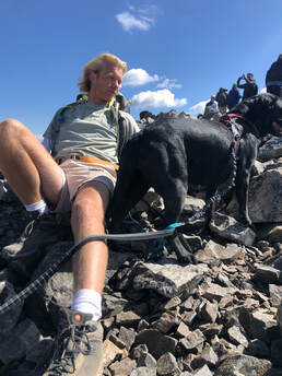 It took us roughly an hour to go from Gray's peak to the top of Torrey's. The climb to the top of Torreys was a bit more crowded and much more steep. The switchbacks were shorter and more narrow. Everyone on the trail was moving at the slowest pace of the day. When we got to the top, weary hikers crowded at the area soaking in their accomplishment and the warm sunshine. We sat and soaked in the views until the wind made Taylor chilly. We considered taking a class three trail back to Grays Peak Trail, but we quickly reconsidered while watching climbers traverse the spiny and icy path. 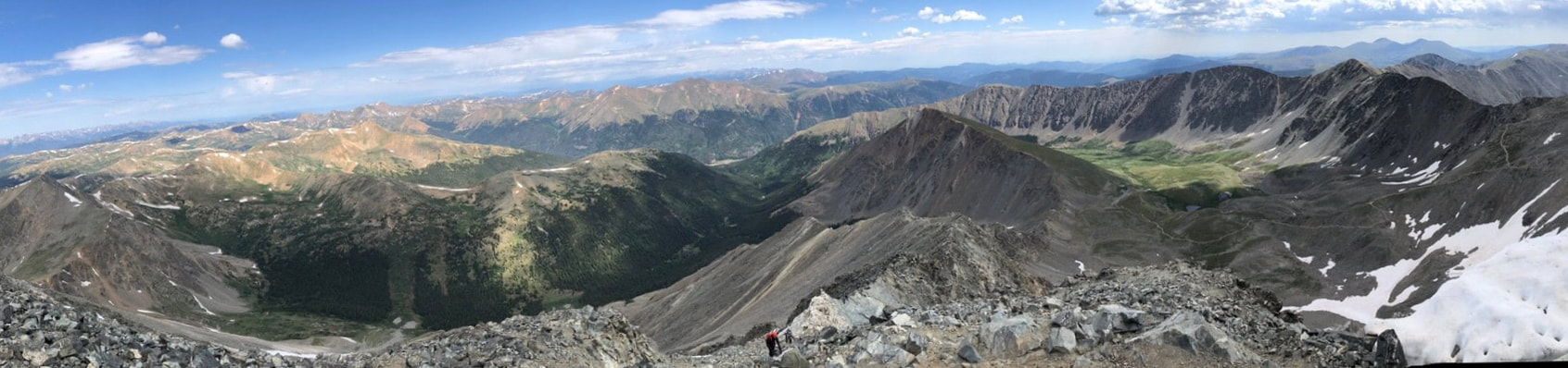 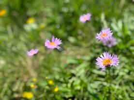 The hike down Torrey's Peak Trail leads across Grays and Torreys Saddle and across the eastern face of Grays before tying back into Grays Peak Trailhead. A small patch of slushy ice and the rocky descent into the Stephen’s Gulch were the last difficult segments of our day. In the noon sun, the fields of flowers, grasses, and shrubs of the gulch were even more vivid than they had been that morning. Taylor and I bubbled with wonderment and pride as we discussed the beauty and difficulty of our first two 14’ers.
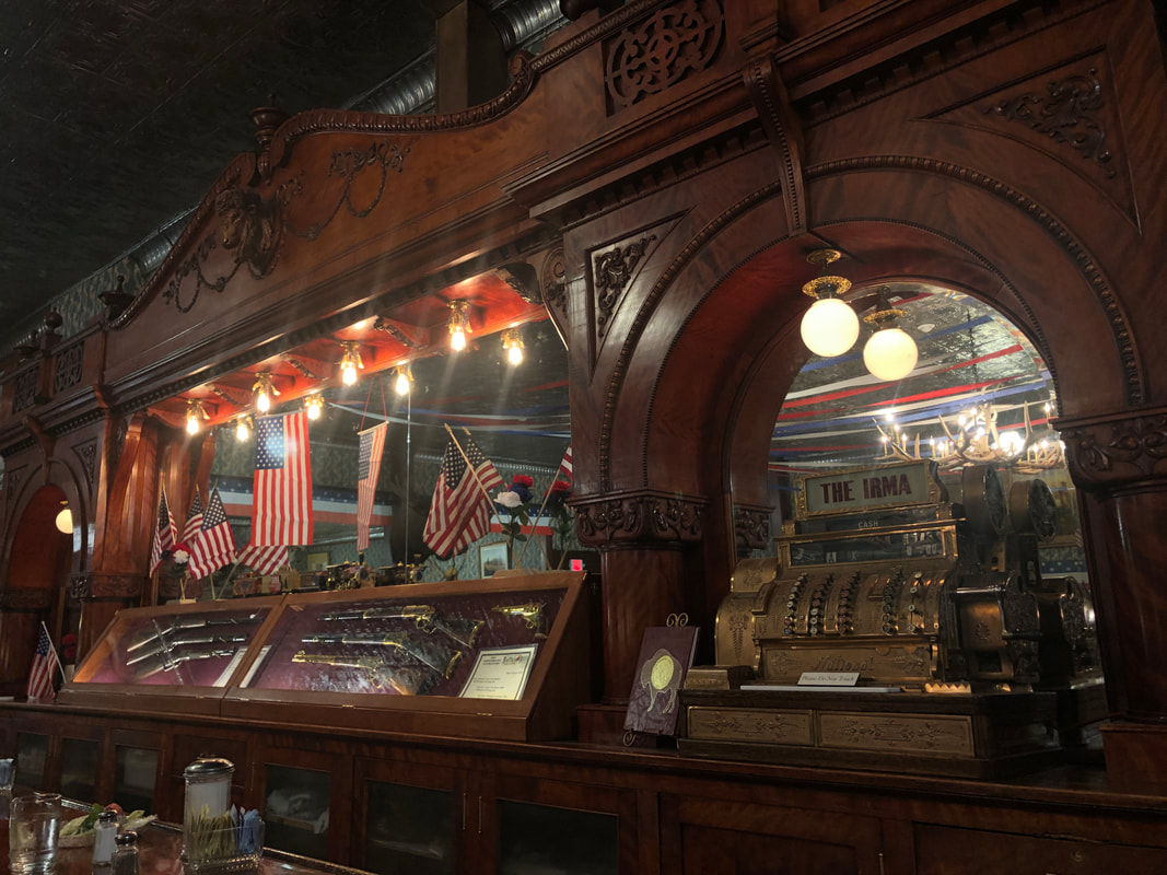
  Road tripping out to Yellowstone National Park was a last minute decision. Thanks to crazy weather, our Fourth of July plans were changed several times just a week before we left. We decided on Yellowstone National Park and it’s Thorofare Trail for our first ever backpacking trip thanks to its fishing accessibility and it being free of snow. You can read all about it in this separate blog post here! Since most of our trip was spent in the backcountry, we didn’t really plan for anything outside of that - and we did a lot of planning (you can read about it all here.) When our backpacking trip was shortened by two days, we decided to wing it and drive through as much of the park as we could. 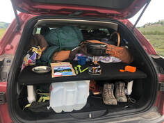 Cooking a dehydrated meal in the back of my car camper. Cooking a dehydrated meal in the back of my car camper. We quickly discovered the National Park’s campsites were all booked up for the Fourth of July holiday, so we had to find a place to stay each night, and most nights we also wanted a hot meal. Other nights, we ate our Mary Jane’s dehydrated foods, but we only had a few leftover from the trail. It wasn't easy every night, but we managed to find some pretty awesome spots along our route. This post will lay out how we found a place to lay our head every night and the awesome spots we stumbled upon to get some grub! 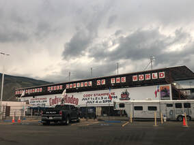 Wyoming - Our first night off the trail, we headed out the east entrance of the park to Cody, Wyoming. It was 53 miles from the park entrance to the town center. When we arrived in town, we learned that we had missed the 100th annual Cody Rodeo Fourth of July show. It was disappointing, but we were hungry anyways so we kept driving and found Buffalo Bill’s Irma Hotel and Restaurant. This site, since remodeled, was put on the national historic registry of sites due to its influence on the town and early settlers. We had no idea about this until we were inside, so it was a wonderful find, and the burgers weren’t bad either!
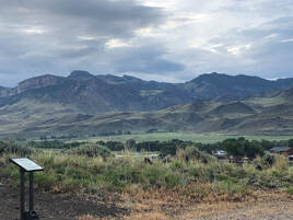 View from my car camper outside of Cody, Wyoming. View from my car camper outside of Cody, Wyoming. After we got our fill, we tried to find a hotel in town, but there were no vacancies for almost 100 miles due to the rodeo and holiday. We were slightly prepared for this by having our car camping rig in the back of my car. We didn’t know, though, was that it would be difficult to find a campsite between Cody and the park or how spotty cell phone service would be. Luckily, while we were driving down highway 14, we noticed the Four Bears Bureau of Land Management site. We quickly pulled over and parked the car for the night. When we woke up the next morning, we had stunning views of the surrounding mountains and were very happy to discover a restroom - a rare find at most sites like this! 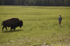 Montana - Before entering the park and before losing cell service again, we looked at the park map and decided we could make it all the way through to the Mammoth Hot Spring area and stay in Bozeman, Montana. We went to Hotels.com and quickly found a cheap room for the night at the Lewis and Clark Motel in Three Forks. After a full day inside the National Park that started with a close encounter with a bison and ended at Mammoth Hot Springs, we started the more than 85 mile drive to our hotel. We could not have made it without a stop for dinner at the Emigrant Outpost. It turns out that small town restaurants in Montana either completely shut down or stop serving food close to dark. We pulled into several different parking lots, but nearly everything was closed. We finally found Emigrant Outpost, outside of a town called Pray, and they were only serving fried foods, but beggars can’t be choosers. We enjoyed our wings and beers, and for the first time in almost a week, we were able to shower and lie down in an actual bed. 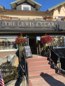 There wasn’t much to The Lewis and Clark Motel , and it actually had nothing to do with Lewis and Clark, but it served all of our needs. Including a warm shower, with a nice little heat lamp if I might add, a clean bed, and some pastries and coffee in the lobby. We woke up refreshed and ready for another full day. We got on the road hungry and decided to check out what Bozeman had to offer. We found Main Street and Stuffed Crepes and Waffles. We sat at a sidewalk table and enjoyed our crepes and coffee before continuing the drive back into the park. We were going the same way we had come the night before. 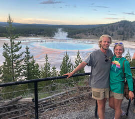 Idaho - After a full day of geysers, hot springs, and mud pots we, again, found no open campsites inside the park. We did find out that the price of a room for the night at the Old Faithful Inn was $450!! After politely declining their offer, we cooked one of our dehydrated dinners and drove out the west entrance to West Yellowstone, Idaho. 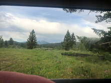 View from my car camper at our parking spot in Idaho. View from my car camper at our parking spot in Idaho. We found a campsite on freecampsites.net at the Targhee Creek Trailhead. It was quick and easy to find, but there were lots of other cars parked for the night. When we found an open spot, we sat outside the car for a while to admire the incredible amount of stars we could see. We hopped back in the car camper for some sleep after marveling at our night lights. 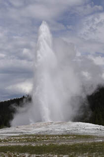 We woke up ready for our last day in Yellowstone. All we had left to see was an Old Faithful eruption, so we were in no rush. We stopped right outside the park in the town of West Yellowstone for a hearty breakfast at Old Town Cafe. After our meal, we drove through Yellowstone National Park one last time and saw the crown jewel erupt. It was the perfect ending to our trip, and even though we had found great places to eat and sleep, we were ready to be home and sleep in our own beds! If you want to see more about our trip to Yellowstone you can check out our YouTube videos! 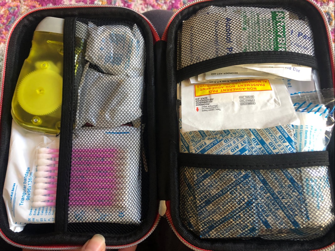 Having a complete first aid kit is critical in the backcountry. There is no way to predict what may happen in the wild, but it is possible to be prepared for common injuries. It is important to be familiar with the uses of each component of a first aid kit and know where they can be found in your kit, because quick treatment is effective treatment. Taylor and I’s trip to Yellowstone National Park was our first multi-night backpacking trip. Before we hit the trail, we did a lot of research into the different scenarios we might find ourselves dealing with in the backcountry. You can read all about our Planning and Prepping Process in this post.  We compared several backcountry first aid kits such as Andrew Skurka’s, My Open Country’s, and The Washington Trail Association’s to other kits sold in stores like this one from REI. After taking inventory of what we already carried in our day packs, we looked at these lists and decided what was important to carry and what we needed to buy. For the most part, we were able to restock and fill our kits at our local Safeway grocery store. Anything that we weren't able to get there, we picked up at the REI in Denver. We each carried our own kits in case we were ever separated. Here is the complete list of items in each first aid kit: 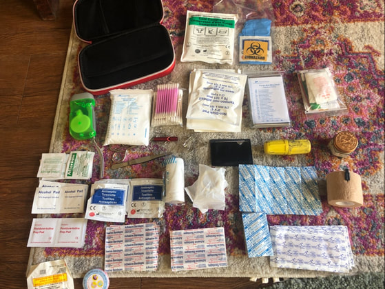   Taylor and I were well prepared with the supplies listed above. She suffered several cuts, scrapes, and bruises from being swept off her feet by a rushing creek and blisters from her new hiking boots, while I suffered a punctured palm after a careless stumble. On top of these, we were both attacked by mosquitoes leaving us covered in bites. We both used antiseptic pads for cleaning our wounds and off-brand Band-Aids to cover them up. In addition, I used elastic wrap and medical tape for securing the adhesive bandage on my palm. Taylor used moleskin to cover her blisters and insect bite relief for some of her mosquito bites. 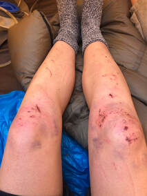 The only thing that Taylor felt we should have also carried was a cold compression pack to help relieve her bruising and swelling, but she got by just fine without it.
We discovered that Taylor’s first aid kit was not waterproof even though it was advertised to be. Luckily, we weren’t in a dire situation, but some of her moleskin and bandaids needed to be dried after her slip in the water. Overall, we were well prepared for the situations we faced in the backcountry, and we hope this guide will help you prepare for any trips you might take. 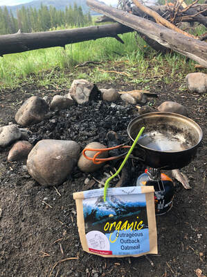 As part of our preparation for our first multi-night backpacking trip, John and I spent a lot of time researching our food options. On other trips, we had been able to keep sausage for a night or two and could carry around cans of potatoes and beans without them weighing us down. This trip to Yellowstone was much different though. We were planning for seven days in some of the most remote parts of our country, so calories, weight, and healthiness were all important factors in our choice. You can read about our entire planning and prepping process for our big trip in this post. We started our research by going into some local outdoor stores to see our options. When walking around our local REI, the first thing we noticed about meals were the cost. Upwards of $5 per meal seemed very costly. At first, the prices made us panic about our decision to try them out, but we learned about variety and bulk boxes offered when we started looking online. A quick Google search lead us to these sites that helped us start our search: Switchback Travel, Adventure Junkies, and My Open Country. Thanks to these articles, I was able to narrow our search to less than 10 brands. The companies we checked out first were Alpine Aire, Backpacker’s Pantry, Good to Go, Mary Jane’s Farm, Mountain House, Wise Company, and Wild Zora Foods. The lack of variety instantly took Wild Zora off the list. Good to Go’s variety packs were all sold out, and even though Mountain House was highly recommended and the least expensive, the sodium content was too high for us. We felt that we’d rather spend more money on healthy ingredients than carry more meals. I ended up making a spreadsheet that laid out each meal that was offered in each box I was researching. I broke down the cost, calories, and quantities of meals for Backpacker’s Pantry, Wise Company, and Mary Jane’s Farm. Backpacker’s Pantry had two options I was considering: their seven day one person kit and their seven day two person kit. The main issue I had with this company was their website! It would allow me to create a variety pack with the meals they had, but for some reason, they would never appear in my cart or they were just not available. I had a hard time pricing out their items because of these troubles, but from what I could tell, they were a bit more expensive than the ones we ended up with.  Wise Company offered a very large survivor style box on Amazon that cost $70 and included 15 packets. The downside is that there were there were no breakfasts, and their nutritional facts weren’t very impressive. Also, some of the comments sold it as more of an emergency preparedness box instead of camping meals, but it still came in a close second.   After all of our research, Mary Jane’s Farm’s “Alone At Last” was the box we chose, and we could not have been happier. In fact, we don’t really know how any dehydrated meals could be any tastier or more filling than Mary Jane’s. Every night, we were amazed by the quality of product and the consistencies of the dishes. Nothing felt gummy or uncooked. We were able to eat a meal and a soup every night, and for three nights, we had chocolate mousse for dessert! I will say that we never ate any of the meals for lunch - we each had snack bags and made tortilla roll ups with sandwich meat and cheese nearly every day for lunch. But still, at the end of the trip, we had one soup, two breakfasts, and one couscous meal left over.  Overall, we were thoroughly surprised and absolutely stuffed while on the trail. We were so glad that we chose Mary Jane’s Farm for our first backpacking trip, and honestly, I can’t wait to give the others a try to really compare the taste and quality! Check out our other posts to see what other gear we carried and the things we packed in our first aid kits! 
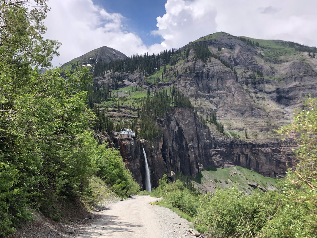
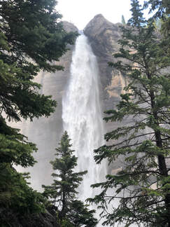
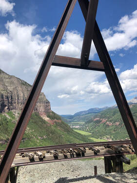
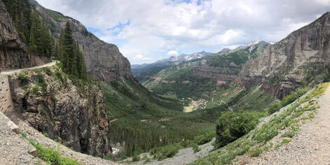
 Between shows at The Ride Festival, John and I decided to take a Saturday morning hike up to Bridal Veil Falls with the intention of making it to Blue Lake. We chose this trail because of the proximity of its trailhead to Telluride and word of mouth recommendations.  When we got to the trailhead, we were psyched to see that the trail leads up to not only Colorado’s tallest waterfall but also to the stunning Ingram Falls. Ingram Falls is visible from most of Telluride and had captured our attention since our first drive into the town. We arrived at the Valley View parking area around 9:30 am. If we had arrived any later, we might not have gotten parking spot. As we were eating breakfast and putting our boots on in the parking lot, the road filled with hikers’ and mountain bikers’ vehicles. 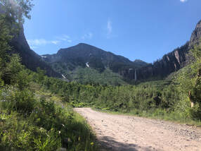 The road to the top of the falls is a steep dirt road. As the morning continued, more and more cars passed us by. They were fairly annoying, especially the ones that would shoot up dust and rocks, but we learned to face the valley and enjoy the view while they passed. The views of Telluride and the surrounding Box Canyon were unbelievable. During the entire hike, I could not stop commenting on how stunning the layered rocks were and how much better the view got as we went higher.
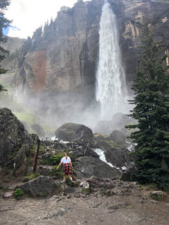
 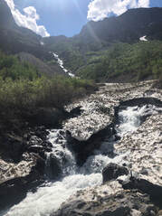 Before we made it to Bridal Veil Falls, we stopped to check out Ingram Falls at the few points where the trail crosses over or approaches its waters. This waterfall falls over one thousand feet down into the valley. Some snow atop the fall was still frozen, and it created little ice bridges where the flowing water cut through. John’s favorite part of the hike was the bottom of Bridal Veil Falls. You could feel the mist of the waterfall from a dozen yards away, and it was very refreshing after the sunny hike up. We stopped to take some pictures and helped other groups take theirs before we continued the climb to the top of the fall.
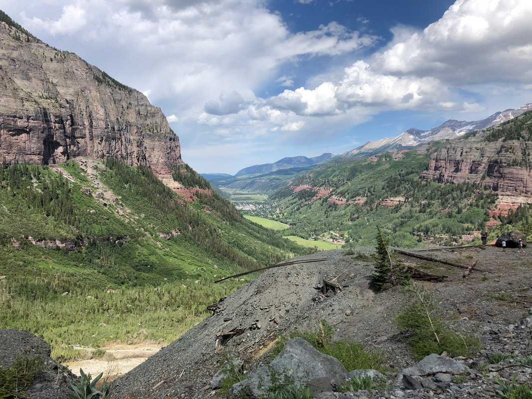
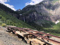
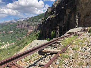 What we were not expecting to find on our way was a mine hidden inside the canyon wall. There were broken rail tracks that led straight to it. It lead our curiosity to questions like who owned it and what was the purpose of the rushing water behind the mine’s gate. A few climbers were hiking along a nearby ledge, so we followed them to a great spot where we sat and took in the view for a while. We had a snack and grabbed some water before continuing up the hill to the top of the falls.
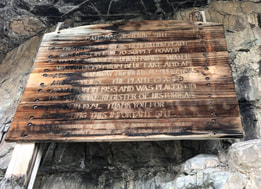 The top of the falls is home to the historic Smuggler-Union Hydroelectric Powerplant. This plant was built in 1907 and was put on the national registry of historic sites after it went out of commission in the 1950’s. Since then, it has been restored and provides power to almost a quarter of Telluride! 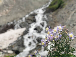 It was so incredible to see the beauty and power of Colorado’s tallest waterfall up close, and the views surrounding it made for one incredible hike. The hike is just under 5 miles round trip, and I would highly suggest it if you ever find yourself in Telluride or in the surrounding San Juan Mountains.
During our weekend at The Ride Fest, we checked out Telluride’s Floradora Saloon. It offered the expected dimly lit atmosphere of a saloon but unexpectedly high prices. Taylor and I decided to give the saloon a try and were pleased with our meals.
We sat at a booth and ordered a couple of cocktails off the top. Soon after, we placed an order for the unique combination of edamame, burgers, and fries. Taylor had the ABBB burger with avocado, bacon, blackening seasoning, blue cheese, lettuce, tomatoes and spicy pickles on a potato bun. I had the Matty’s Popper Burger with bacon wrapped jalapeño poppers, chipotle aioli, lettuce, tomatoes, and spicy pickles on a potato bun. The burgers were filling and had a good taste, and it was our very first time to have edamame at a "saloon". Taylor and I should have expected to find high prices all around Telluride, but we were caught off guard by the prices at the Saloon. Aside from the taste of spending $18 on a burger, everything at the Saloon was very appetizing. Taylor and I questioned the authenticity of a saloon that sells edamame, but our time at the saloon was delightful. 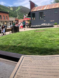 The Butcher and The Baker is a bakery and cafe on bustling Colorado avenue in Telluride. Taylor and I had a delicious breakfast while recovering from the day-before of exploring Telluride’s Bridal Veil Falls and dancing at The Ride Fest. The small shop’s doors were propped open and most of its outdoor seating faced a lush, public lawn. A glass case next to the register displays several of the bakery’s creations, but nothing looked as good as the brunch menu’s descriptions.  Taylor had gluten-free blueberry pancakes and a cappuccino, and she added whipped cream to both. I ordered the Day Maker sandwich full of two eggs, white cheddar, breakfast sausage, house-made pepper jam, and arugula on an English muffin. It paired perfectly with a hot drip coffee. Both orders were enjoyed al fresca in Telluride’s beautiful July weather.
Our best meal in Telluride was compliments of the Butcher and Baker. The atmosphere was welcoming, and the food was mouthwatering. It’ll be tempting to revisit the next time we’re in Telluride. 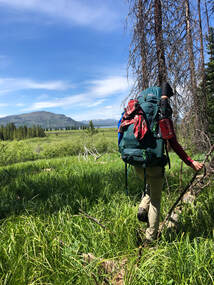 When Taylor and I determined that we’d spend 2019’s Fourth of July backpacking in Yellowstone National Park, we knew that several pieces of critical gear would ensure a successful trip. Before we started packing though, we had to find a trail and determine its safety. We spent a great deal of time researching and preparing for our trip, you can read all about it here! Once we were ready to pack, we took even more time determining what gear was important and getting it all packed in our two packs. This post lays out the gear that Taylor and I felt was the most important, why we picked it, and whether or not it performed as well as we had hoped. 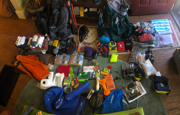
The packs that so trustily carried our remaining gear were the Ascend MS 4400 and Kelty Coyote 80. This was Taylor's first time carrying her pack and my Ascend has seen pretty good use over the three years I have had it. 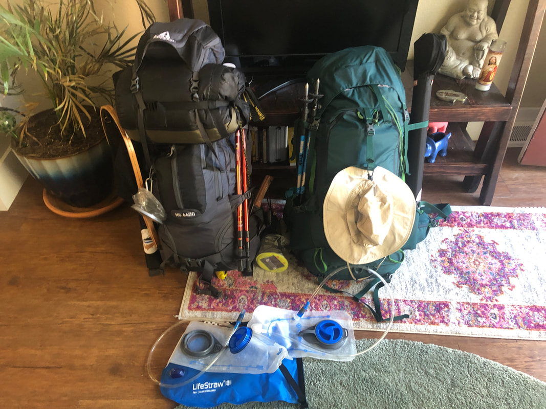  My bag has been stuffed to the brink of its capacity more than a few times. All of that use has lead to two non-major faults: The sternum strap detached from the shoulder straps and a five inch rip has opened up along the pack’s primary compartment seam. It's nothing too major, but I need to find some way to patch it soon. Taylor’s Coyote 80 is a bit big for her, she again purchased this from REI’s sale section and she picked up a men’s pack. This causes it to sit about 2-3 inches too low on her hips, but it does carry more gear than my Ascend. The weight of Taylor's bag almost caused a costly mistake later on in our trip. We learned a lot about carrying the correct weight and packing our bags properly. We wrote a "10 Things We Learned In the Backcountry" post, you can read it here to see what other useful knowledge we gained on our first trip.  The most important piece of gear inside our packs, aside from first aid - which we listed out in this separate blog post, was our tent. Taylor and I have had our Eureka Apex 2XT (2015 version) tent for almost 3 years now and it has been the most impressive piece of gear we’ve used on the trail.. We’ve used this hardy tent more than 30 times and have never had to deal with a tear, leak, or broken tent pole. The rain cover did a perfect job protecting us in Yellowstone’s backcountry and helps keep the heat in when the temperature drops. 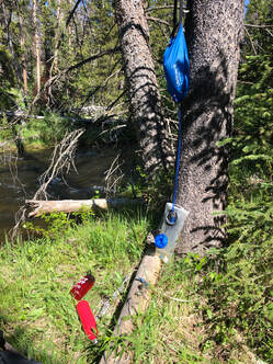 Long days of hiking require plenty of drinking water, and water filtration is critical for mitigating the risks of drinking from flowing streams. Taylor and I purchased the LifeStraw Flex with gravity bag system before our trip into the backcountry, and we could not have been happier with its performance. The system filters up to one gallon at a time at a rate of roughly one liter per minute. We were nearly able to fill our respective 32 ounce Nalgene and RTIC water bottles and each of our two liter water bladders with one gravity bag full of water. The LifeStraw water filtration system is effective and leaves spring water tasting as delicious as it should. 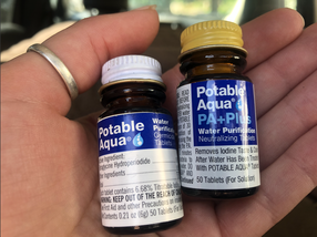 When we didn’t want to stop to filter water, Taylor and I treated collected water with Potable Aqua iodine germicidal tablets. These tablets take 35 minutes to cleanse water of harmful agents and require careful proportioning. Taylor often passed her treated water off to me due to the unpleasant taste, and we have since decided that iodine tablets are best kept for emergency use. 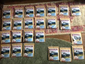 Along with our filtered or treated water, Taylor and I carried and cooked dehydrated meals for the first time. We compared several different options and were very deliberate in our choosing Mary Jane’s Farm thanks to their low sodium content and variety options offered. Were thoroughly happy with our choice and were full every night. You can read about our decision process in this post! 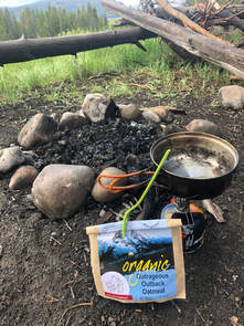 There were some days where we would not have been able to boil water for these meals if it hadn’t been for our MSR PocketRocket and our Jetboil Jetpower 8.11 ounce fuel canisters. They have been lifesavers over the years when campfires are banned or weather conditions prevent them. We also used it when we were driving around the park and car camping outside the park every night. It really helped make the dehydrated meals even more convenient.  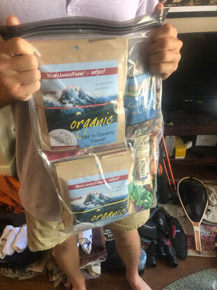 Carrying food into Yellowstone’s backcountry requires careful storage to keep from attracting bears. Taylor and I purchased four Loksac Opsac scent locking 12” by 20” bags to keep our food and other scented items. We placed those filled bags in a 20 liter Earth Pak dry bag before using 100 feet of rope and carribbeaners to hang the bags out of reach. Bears can also be encountered by chance on the trail. Taylor and I each carried large knives and 8.1 ounce cans of Counter Assault Bear Deterrent. The powerful pepper spray can reach a distance of 32 feet, and it gave us peace of mind as we ventured into bear country. Though these were the critical pieces of gear that made our time in the backcountry safe and reasonably comfortable, we had much more on our backs each day. Here is a complete list of the rest of the gear we carried on our journey. 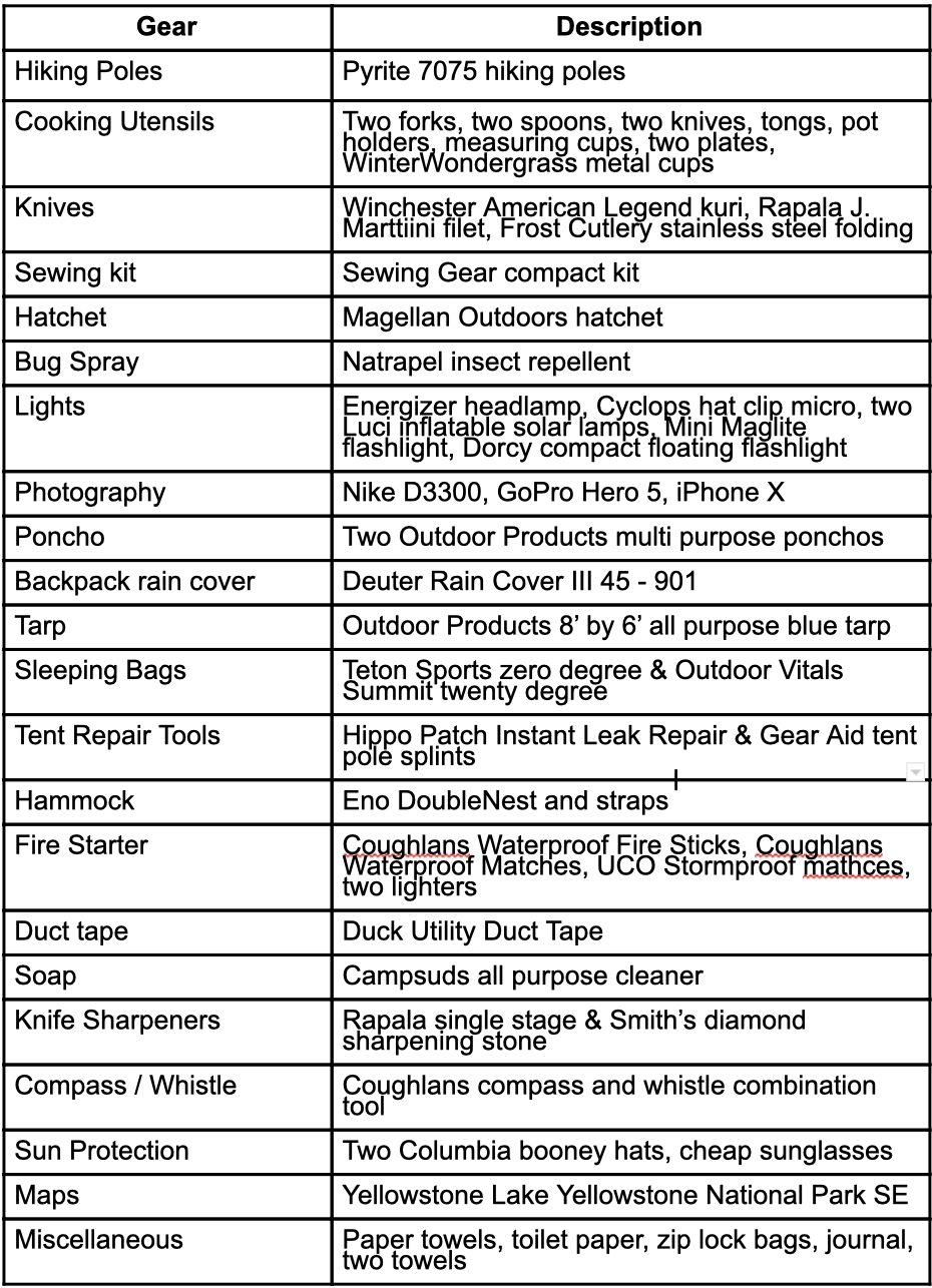 Just outside of Yellowstone National Park, restaurants and gift shops define West Yellowstone, Montana. Old Town Cafe is among those serving breakfast, and their plates of morning grub stuffed Taylor and I after we’d camped nearby in Idaho. You can read and see about where we slept outside of the park in this post here!
Old Town Cafe features a diner, a barroom, and a video lottery room. The diner is a brightly lit, beautiful wooden room with a bar and visible kitchen. Sitting underneath one of several paintings of cowboys, trains, and bears, Taylor and I ordered a delicious breakfast. I had hot cakes, sausage, hash browns, OJ, and coffee. I couldn’t have asked for a better tasting or more filling meal. Taylor nearly finished all of her six ounce sirloin, eggs, sourdough toast, and OJ. We both agreed, then and there, that the breakfast was just what we needed before a long day of exploring Yellowstone's wonders.  Three Forks, Montana, is 31 miles from Bozeman and home to The Lewis and Clark Motel. Originally the Milwaukee Railroad and Puget Sound Railroad Clubhouse, this quaint hotel is where Taylor and I stayed between days in Yellowstone National Park. Most other nights we camped, or slept in my car camper, but after several days backpacking through the backcountry we decided to splurge on good rest and showers. Since it was the Fourth of July, available rooms were few and far between near the national park, but a second floor room with a single queen bed was available  The cozy lobby and welcoming receptionist were the first signs that we’d made a good choice for the night, but the balcony and bathroom heat lamp amenities sealed the deal. We both slept comfortably and woke rested.
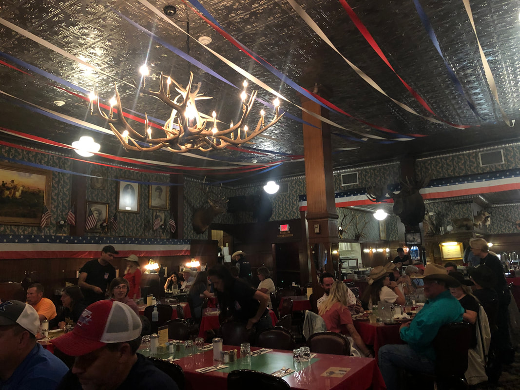
Complimentary coffee and banana bread was icing on the proverbial cake. Though it was a long way from Yellowstone, the Lewis and Clark Motel of Three Forks was a luxury that Taylor and I couldn’t have been more thankful for. 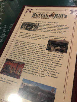 Buffalo Bill’s Irma Hotel and Restaurant in Cody, Wyoming, is a city staple and is listed on the National Register of Historic Places for its "contribution to the cultural foundations of America". Taylor and I stopped in for a burger after five days of backpacking through Yellowstone National Park’s Backcountry. Taylor and I arrived in Cody looking for a hot meal, and the Irma’s kitchen was still open late on the Fourth of July, plus the building’s rooftop railing and large sign distinguish it among its Sheridan avenue neighbors, so we walked in.  We had no idea that we were walking into a historic building. Taxidermied big game filled the walls of the downstairs restaurant and bar, and a gorgeous cherry bar gifted by Queen Victoria of England sat as a greeter when you walked in the front door. Since its opening in 1902, the establishment has since been foreclosed, sold, expanded, and reopened, but it still holds it old western sentiments.  The dining area was full of patron’s and the prime rib buffet seemed to be a popular choice. Taylor enjoyed a Buffalo Burger while I had the Irma Philly. Both of our plates were cleaned, and we were both satisfied.
The decorations and artwork inspired conversation, and the staff was busy but effective. If Buffalo Bill’s Irma Hotel is on par with the restaurant, this landmark will be around for a long time to come. Stuffed Crepes and Waffles served Taylor and I a delicious breakfast before we continues our driving exploration of Yellowstone National Park. Located on Main Street in Bozeman, Montana, near the corner of South Willson Street, this counter-service restaurant serves many savory and sweet creations.
I fawned over my ‘Georgia’ waffle with caramelized peaches, cinnamon, sugar, walnuts, bequet caramel sauce, and homemade whipped cream. Taylor substituted ham to her ‘Vermont’ crepe before devouring it. It usually consists of bacon, cracked egg, diced tomatoes, and sharp white cheddar. We both enjoyed a cup of Coldsmoke coffee and warm rays of sunshine while sitting at a streetside table. From time to time, Taylor and I discover delicious and hearty breakfasts while on the road. Bozeman’s Stuffed Crepes and Waffles is one of those fantastic locations. Tasty would be a tragic understatement, and I would go back for breakfast without hesitation. After an extremely incredible and eventful backpacking trip in Yellowstone National Park’s Backcountry, John and I took three days to drive around the park and see all the highlights. You can read and see all about it here!
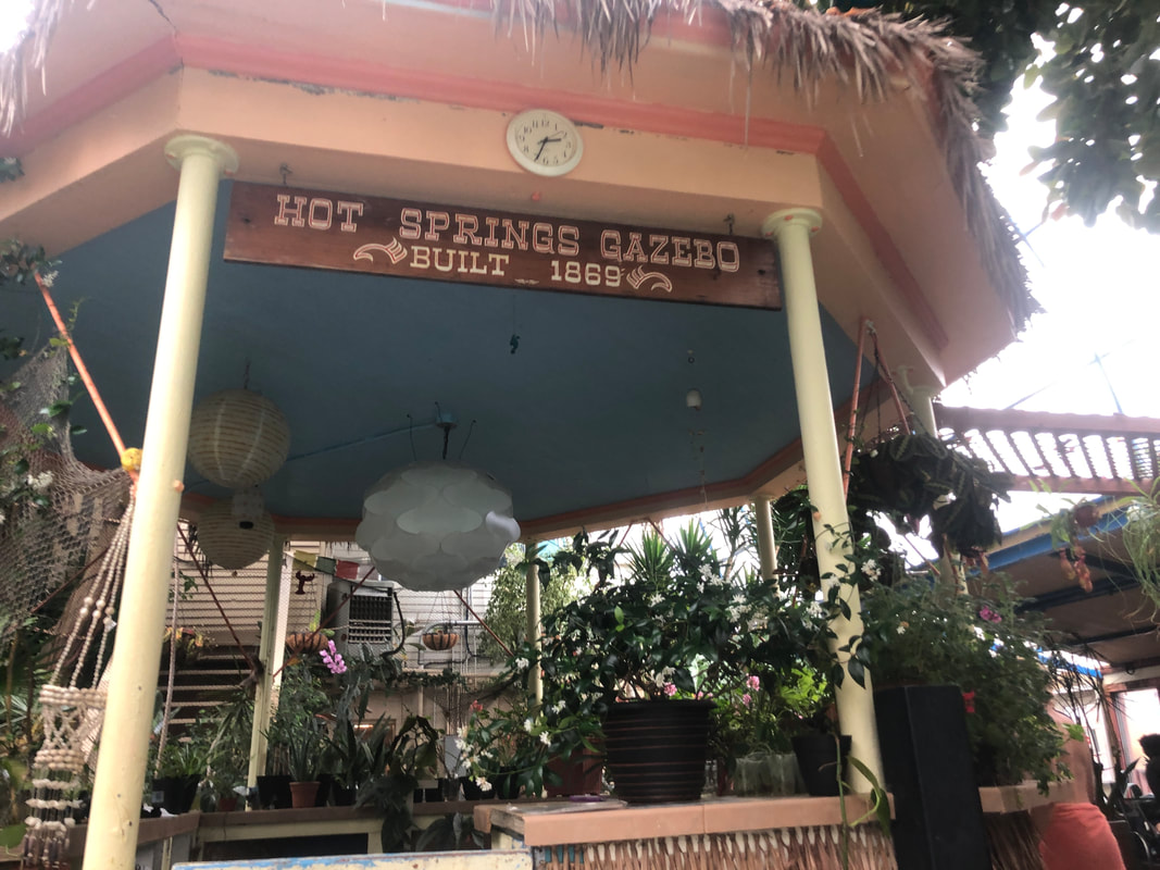
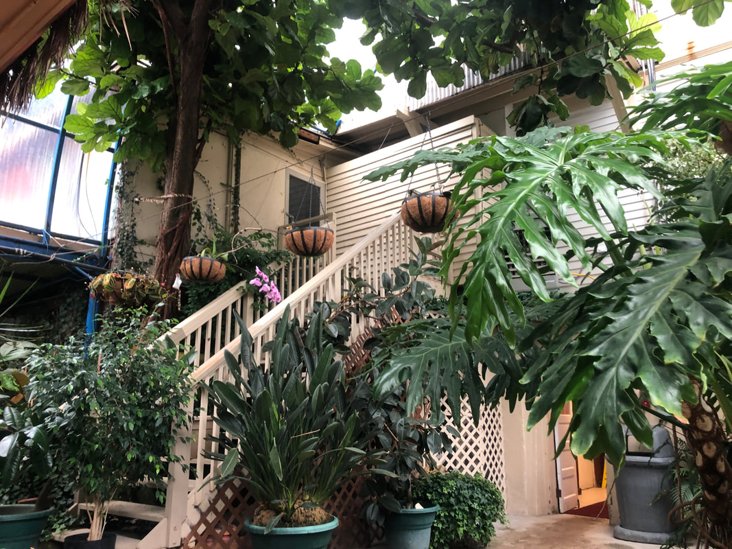
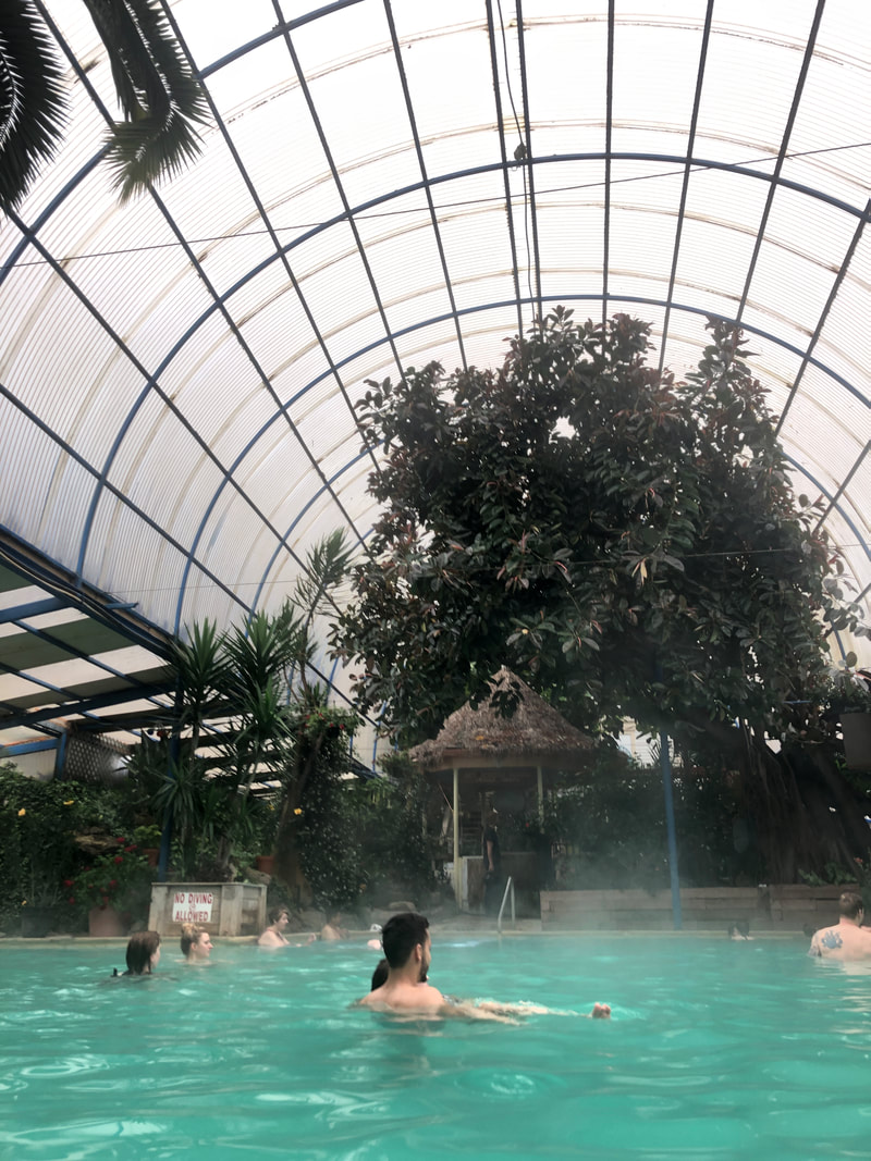
After our first day in the car, we drove through Pray, Montana, on the way to the Lewis and Clark Motel in Three Forks, Montana. The Emigrant Outpost was the only place serving food at 9pm and we couldn’t have been more thankful. Though they were only serving fried food, we were able to order two dozen buffalo wings and fries. A cold beer each complemented our meal while a crowd of locals laughed and drank at the bar. Emigrant Outpost was a life-saver for John and I. We were starving and couldn’t have been more happy sitting in front of a hot meal. It is one of the only places serving food in Pray late night, and it seemed to be the home base for a certain group of Montana natives. We weren’t in on the party, but we did get enough food to fill our bellies for the night. 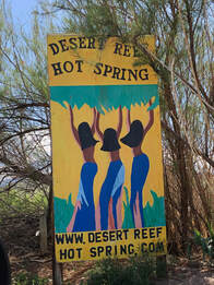 Southern Colorado is very different from the rest of the state's mountainous landscape. Near Royal Gorge, the mountains in the Pikes Peak Region fade down from behemoth heights to the red barren sand thousands of feet below. After spending a day exploring around this other-worldly area, some girlfriends and I were exhausted and looking for an escape. We found the perfect oasis at Desert Reef Hot Spring! Located in Florence, Colorado, just outside of Canon City, Desert Reef Hot Spring is a one-of-a-kind place. I say that, mainly, because it touts being a "family friendly, clothing optional pool". I can't say I've ever heard that combination before! The tag line isn't what drew us in, but it definitely made the day interesting. 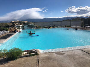 When we arrived at the small park, we had no idea what to expect. It was just one small building and a parking lot seemingly in the middle of nowhere. We went in and spoke to the lady at the front desk to gain entrance. It cost $20 for the day, and once we paid, we were given the rules including the ones about nudity. 6 p.m. is when clothing becomes optional, and it was almost 4:30 already. We knew we would be soaking during these times. Since nudity is allowed, the guide asked for no phones or cameras to be near the pool area. She lead us to our locker room and showed us where we could keep our items. After that, we were free to do as we pleased. We quickly undressed down to our suits, at first, and headed out to the pool area. 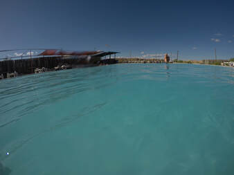 It is just one large hot spring pool kind of like a shallow swimming pool. We saw pool floats laying around, so we grabbed some and slowly walked into the nice, steaming water to start our relaxing evening. We spent right up until 6 p.m. lounging, laying, and playing in the water. When 6 o'clock hit, though, and the nudey-hours started, more and more people, seemingly locals, started to show up. 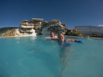 We made the decision to keep our clothes on and had a few comments made toward us about how we should strip down and join in. After politely declining a few times, we decided it was getting close to leaving time, since the sun was setting, so we packed up and headed out. The end of our evening didn't overshadow the lovely few hours we had spent there. We knew the people were joking and playfully antagonizing us, and we never truly felt uncomfortable. That being said, we wished we had been left to relax and not been bothered at all. It was definitely worth the stop after the long, hot day! 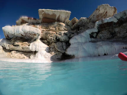 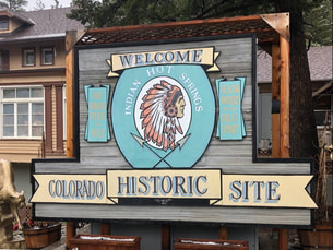 After a cold, snowy day hiking at St. Mary's Glacier, a group of friends and I hopped on down to Idaho Springs to warm up in Indian Hot Spring's geothermal pools. Even though it is less than an hour and a half away from Denver, none of us had ever stopped here before! We were all frozen from hours of trekking through snow, so Indian Mountain was the perfect stop on our way home. It was still snowing when we arrived at the front door, but the lobby was nice and warm. 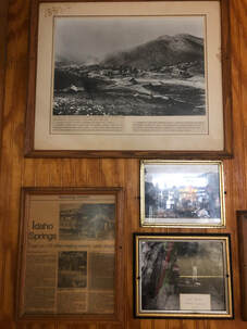 Newspaper clippings from the hotel's opening. Newspaper clippings from the hotel's opening. The entrance looked like a typical hotel or motel lobby, since that is the property's primary function. The walls were covered in newspaper articles chronicling the history of the spring, the resort, and the spa. After learning about the igneous magma heating the spring, we walked up to the desk and paid our entrance fees. We chose to do both the swimming pool and caves. The swimming pool is the main attraction, but the hanging photos of steam caves looked really inciting, and I had never been to another hot spring that offered these, so we chose to add it on! It cost $34, per person, for access to both amenities. If you would like to see a detailed breakdown of rates, you can visit their website, here. 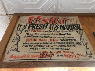 An old sign hanging in the lobby. An old sign hanging in the lobby. We were given a quick briefing of the layout: the men's and women's locker rooms and steam caves are downstairs on their respective sides of the front desk, and the swimming pool is down the hallway to the left. We all agreed to check out the swimming pool first. We all headed down to our locker rooms, and once we were changed and ready, we met up to walk down the carpeted hallway to the large, steamy swimming pool. What the end of this hallway held was an absolute surprise to us. 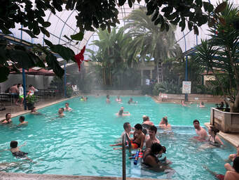 The main swimming pool area. The main swimming pool area. The swimming pool area was like a tropical paradise set inside a greenhouse with a hot pool in the center. We were blown away. There were gigantic palm trees and brightly colored flowers lining the walls surrounding the crowded, turquoise water. There was even a tiki bar complete with a thatched roof, and one side of the pool hosts picnics and chairs.
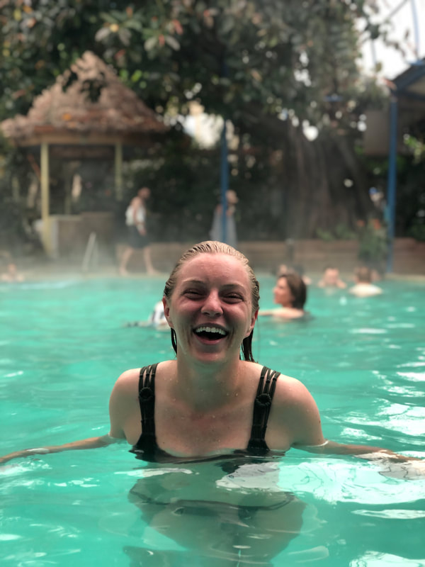
Once we got our wits about us, we found a place on a picnic table to leave our items before slipping into the tantalizing water. Even though it was the middle of the day on a Friday, it was still relatively crowded.  Found ourselves a private spot in the pool! Found ourselves a private spot in the pool! We found ourselves a nice, open corner near the hot water spring. The water flowing from the spout was super hot, but the water around it was the perfect temperature. The farther we moved from the spring the colder it got, but we knew we should share when more groups arrived. We swam and lounged in this gigantic pool for quite some time. When we were ready, the boys and girls went our separate ways to check out the geothermal caves. These caves are naturally filled with hot water from the spring underneath. There were about a dozen different small pools to soak in, and some are hotter than others. Since the cave walls are all natural, they really trap the heat, and the room itself was like a sauna. We ladies didn't stay in here for more than 30 minutes before it got too hot. The caves make for a beautiful sauna, but since it was clothing optional, I wasn't allowed take any photographs. 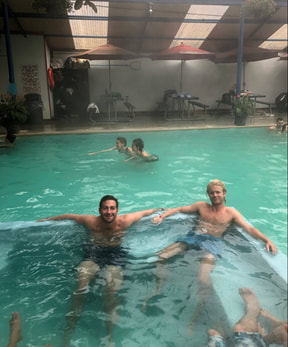 The boys sitting in the swimming pool. The boys sitting in the swimming pool. We came out and went back to the pool area to discover that the boys were already there. We joined them for a while, then both groups began to go back and fourth between the pool and caves until it was finally time to dry off and pack up. We were all sufficiently toasty and were ready to make the rest of the drive home. We were all blissful and decided to stop at Indian Springs with every opportunity we get!
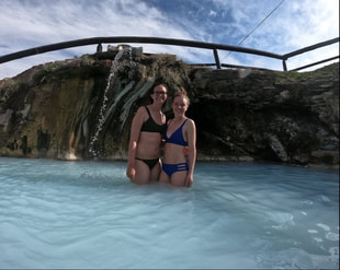 In May of 2019, my close friend came to visit me in Colorado for a week. She is just as adventurous as me, and I wanted to show her all of the best highlights in the state. I decided to plan a road trip that would take us to a bunch of different towns to ski, hike, and soak in hot springs - something we didn't have growing up in Alabama! You can watch my YouTube video HERE to see even more! 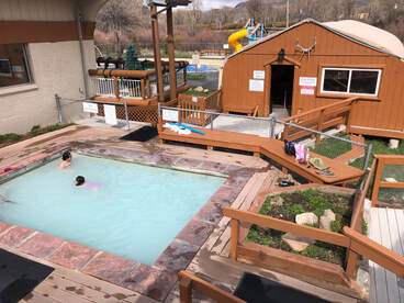 One stop along our trip was Hot Sulphur Springs. We noticed this town on the map while planning our hike to nearby Radium Hot Springs - it's name really drew us in. With a quick search, we found Hot Sulphur Springs Resort and Spa which boasts 22 pools filled with "sacred waters where the Ute Indians once bathed, healed mind, body, and spirit," so we made sure to include it on our road trip. We arrived at the spring's front office a little bit more skeptical than we expected to be. "Colorado's finest" was housed inside a teeny-tiny shack in the middle of nowhere. Regardless, we went inside and got ready to spend the afternoon enjoying the hot, steamy water. For less than $30 each, we gained access to the hot springs, swimming pools, showers, and lockers. We paid our dues, got a quick tour, and were shown to the locker room to put away our items. It wasn't long until we were briskly walking from the warm locker room through the frigid open air toward our first hot spring pool. 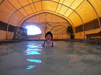 Each pool is relatively small and only holds a couple of people. Some hold more than others and a few only hold one or maybe two people! It wasn't crowded when we were there, but every now and then, we did have to skip over an already full pool. The first we checked was the larger, indoor, tented pool. It was the first empty pool we found, because it wasn't ultra hot, but it was a nice start to our exploration of the resort. We hung out in the pool for a minute until we could tell that the close-by outdoor pools were open again. We bounced around the three tiny pools just outside of the tented one before hopping over to the larger pools in the middle area. Our favorite over here was a pool tucked away in the corner with a little waterfall. It had a nice view of a small pond on the property, and it was all very calming while we had it to ourselves.
  After we spent plenty of time in this area, we decided to wrap up and walk across the property to the next area of pools. We walked up the stairs and around the other side of the building getting closer to the pond. Here, we found, by far, the most relaxed-looking pool in the entire place. It was occupied by a nice woman reading her novel, and we joined in and found some peace for a long while. We eventually said goodbye and moved back down the boardwalk toward the pools we had passed on our way up to the relaxing pool. Here, we found the spa's hottest pools including its hottest, The Lobster Pot. The Lobster Pot only holds one person and is about 110-115 degrees. This pool is definitely cooking! We took turns sitting in the pot for only a few minutes at a time before it got too hot. Once we each got hot enough, we walked over to the last pool area.   We had about 5-6 pools left to check out, and most of these were pretty packed. There were two large groups, one bachelorette party and one birthday party, sprawled out among the larger pools. We sat in some of the smaller ones waiting for them to leave and enjoying every minute of it. Finally, after checking out every other pool in the spa, we had the most picturesque, waterfall-fed spring in the place all to ourselves! We saved the best for last, and we loved the frothy, turquoise-colored water. We hung out here and made new friends as they showed up, but eventually, as all good things, our day had to come to an end. We were so relaxed and warm leaving Hot Sulphur Springs that the 3 hour drive home to Denver felt like floating on a cloud.  Similar Links
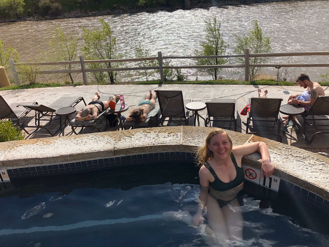
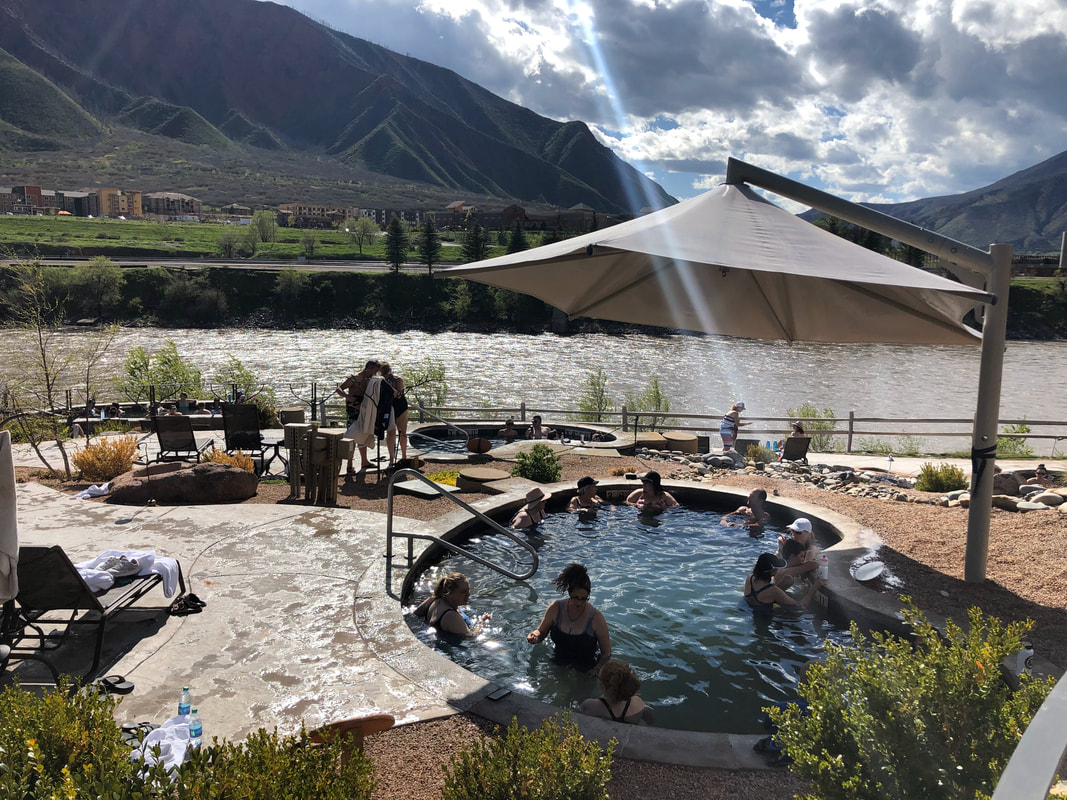
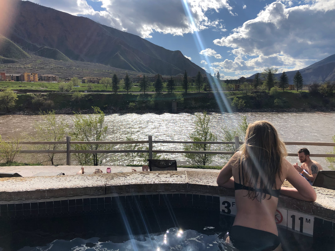
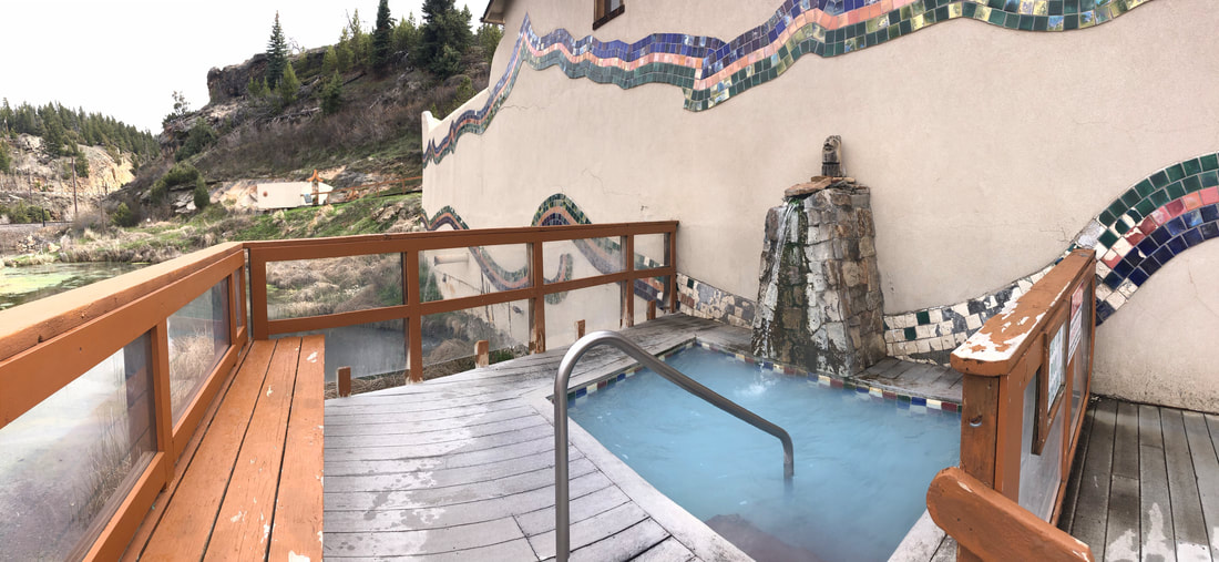
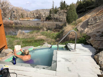
Pagosa Springs Resort and Spa - Pagosa Springs, Colorado Conundrum Hot Springs Hike - Aspen, Colorado Strawberry Hot Springs Park - Steamboat Springs, Colorado 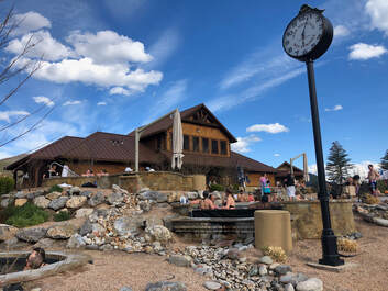 After hiking up to the beautiful Hanging Lake, John and I needed to find somewhere to relax. We found solace in the hot waters of Indian Mountain Hot Springs in downtown Glenwood Springs, Colorado. These mineral-rich waters have been a haven for centuries, and they provided John and I with exactly what we needed after our hike! It was a lovely Sunday afternoon, and we could tell that the town was bustling. We pulled up to the spa around 2 o'clock in the afternoon, and the parking lot was just about full. We fortunately found a spot and walked inside. 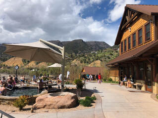 It cost $25 for access to the spa for the day, and it included showers, lockers, and access to all 16 pools. You can find all the rates and rules on their website here. We separated into our locker rooms and quickly changed into our bathing suits. We met back up at the top of the pool area and scoped out which pool we wanted to start with. Usually, we start with the coldest and work to the hottest, but many of the pools were at capacity, so we had to hop around based on what was available. The pools are all grouped together fairly closely, yet each one has its own "personality". Some are small and intimate, others are big enough for swimming, some are hotter, and some are cooler. I felt like Goldie Locks looking for the pool that was just right.
 We liked the pools that were closer to the river, because they gave us a better view of the incredible rock formations surrounding the town. The views of the bright right and orange hillsides from Iron Mountain are definitely its best selling point. The stunning mountain views and warm, spring waters were beyond relaxing especially with the sounds of the river beneath them.
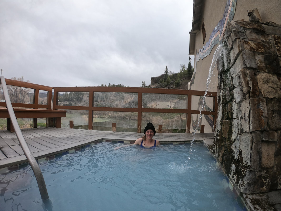
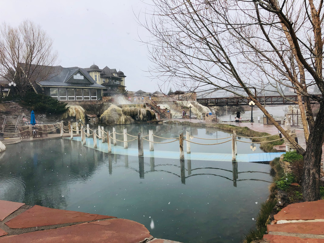
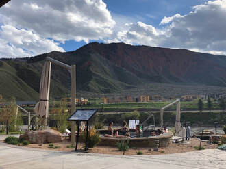
We spent the entire afternoon hopping in and out of pools, sipping on drinks, and enjoying the company of our fellow soakers. Once the sun set, we took the cue to pack up and head home. We were well beyond relaxed and were totally satisfied by the incredible day in Glenwood Canyon. 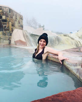 The southwest corner of Colorado is unlike the rest of the state, and it is one of my favorite places to travel to. I used to be fortunate enough to have this area in my work territory, and on one such work trip, I took some personal time to relax after a day full of meetings. I found the best place to relax at The Springs Resort and Spa in Pagosa Springs. It was the middle of April, but a snowstorm was rolling through. When I arrived in the parking lot, I could barely see the front door. The snow was no hindrance though. Soaking in the snow is possibly my favorite way to enjoy the warm, mineral waters. When I finally made it inside, I paid my entrance fee (you can see their rates here) and prepared to get in the water. 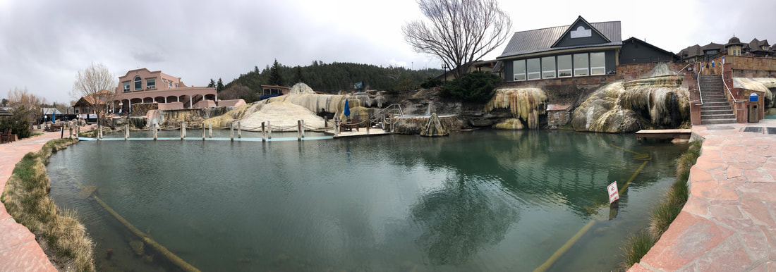 It turns out that most other people don't like soaking in a snowstorm, so I practically had the entire resort to myself. It was beyond relaxing. It was complete zen and serenity. I had access to the spa all day, and I probably spent six hours soaking it all in.
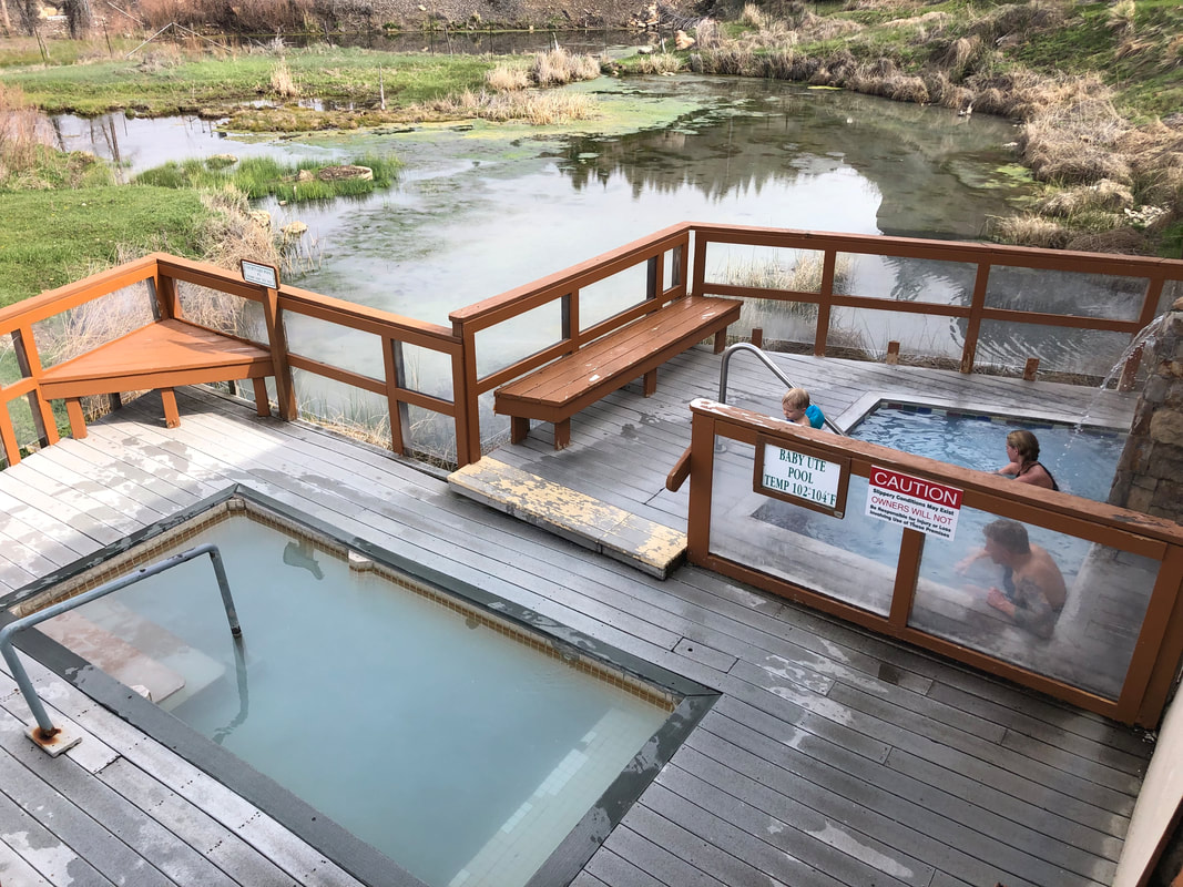
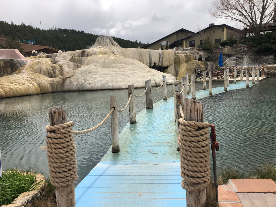
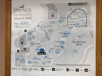 From the bathhouse, I chose the closest spring, The Overlook Pool, first. Then, I slowly moved counter clockwise across the resort's 19 pools. The pools range in temperature from 83-114 degrees and most of the smaller pools are the hottest. The Motherload Spring is the deepest hot spring in the world and feeds water into all of the man made pools. (You can read this article, here, on just how deep the deepest pool in the world is!) It is full of hundreds of healing minerals like Iron, Magnesium, and Potassium and has been sought after by healers for hundreds of years. The history of Pagosa Springs is very interesting, and you can read more on their website www.pagosahotsprings.com ! 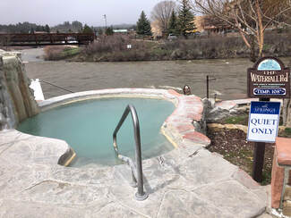 The spring is situated alongside the rushing San Juan River, and I progressively made my way down to the pools closest to it. I imagined a summertime crowd of fly fishers along the shore, people floating and swimming in the river, and a packed poolside, but during this snowstorm, it was barren and on the verge of freezing. Thanks to the hot pools, I kept warm sitting in the tiny rock bottomed pools while watching snowflakes fall. 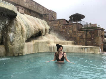 I saved the iconic-looking Golden Pond and its neighboring Cliffs and Clouds in my Coffee pools for last. These pools have small waterfalls and features the other pools didn't have including people. These were the only pools that I shared with other people, but I didn't mind. The company was actually nice, and I learned a lot about the lovely family I was sitting with. 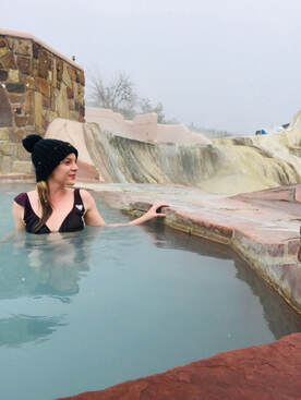 When the conversation lulled, I looked down and noticed my pruney fingers and the rumbling in my tummy. I decided it was time to shower off and head home. The hours of physical and mental relaxation had made me forget that I still had a home to get back to. I said my goodbyes and headed off into the locker room.
It was hard to leave the great waters and all the seclusion that had come with them. I wish I lived closer to make purchasing a monthly or yearly pass worthwhile, but before long, I was on the road with Pagosa Springs in the rear view mirror. |
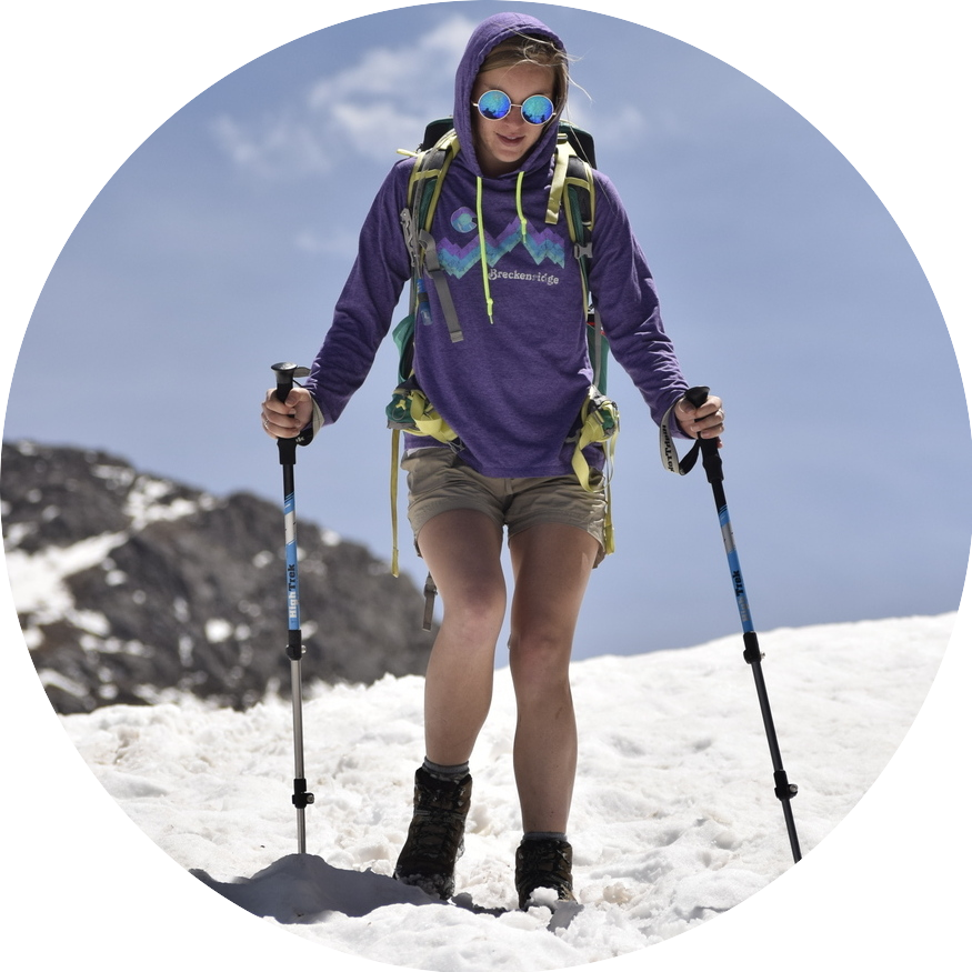
Talkin' 'bout Tacos:
I'm Taylor, aka Tacos! I am sharing my journeys and experiences from across the world, hoping to inspire travel and adventure in all who read! Archives
April 2024
|